10 CAS activities in Manaslu Nepal

CAS is a mandatory core component of the IB Diploma Programme. A programme designed to help students or who are working as volunteer develop their creativity, well-being, and commitment to serve the communities in which they live and beyond.

And Manaslu is a perfect destination for students to learn about society and nature. Manaslu is a challenging and excellent experience for students which helps them to engender teamwork. The sense of achievement after experiencing the remote villages and nature of Manaslu is a lifetime gift. 

The most special thing about Manaslu and Nepal is its people. The humbleness and giving nature of people is the wow factor that will help you to make a positive impact in your life. The culture of considering the guest as the god, people of Nepal will try their best to feel you secure and fulfilled in their homeland. You can make good friends out of Nepali People. 

Here we have tried to make a list of cas project ideas that you can consider doing in Manaslu.

CREATIVITY

Creativity is a way of living life that embraces originality and makes unique connections between seemingly disparate ideas. Creativity is about living life as a journey into seeing and communicating the extra-ordinariness of the simplest, most every day acts.

So in IB diploma program, it is considered in one of the most important factors for student’s all-round development. Here are some CAS project ideas that you can do in Nepal to enhance your creativity. 

1. Create a Short movie

Although creating movies is a highly technical discipline, you can learn to create short movies a lot quicker. And when you are in the Himalayas, the job gets easier as you get to capture magnificent beauty of snow-capped mountains and rare Himalayan animals. The culture and living style of people there will add additional charm to your movie. 

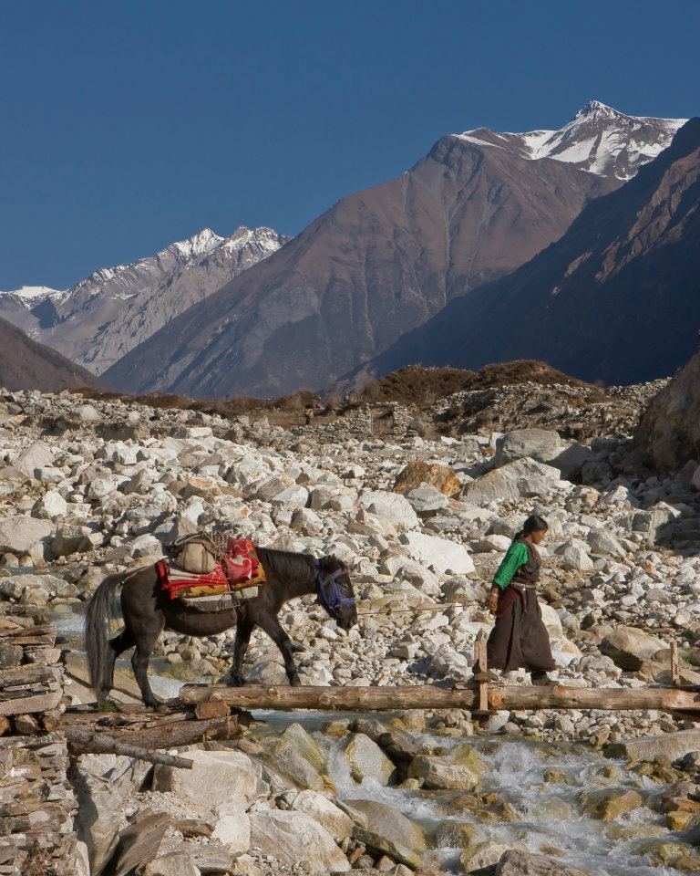
Okay, let’s say you want to create a movie, so what Manaslu has to offer? The Manaslu region has precarious bridges and stunning mountain scenery including Hindu and Buddhist culture, protected wildlife, rhododendrons and wildflowers, raging rivers. 

You will need a script, a storyboard, a good camera and a video editing software. Having a GoPro and a drone will help you to capture the most beautiful images. You can create short movies on “People of Manaslu”, “The Magnificient Himalayas”, “Unknown Species in Manaslu”, Exploring the Unexplored” etc. You can get more ideas and tips on creating movies at this link.  

If you have any queries regarding short movie creation in Nepal for your CAS project you can email our expert in this regard. 

2. Write a story about a local Women

Women in hilly areas of Nepal have to go through a lot of hardships. Their stories can be a great inspiration for people like us living in the comfort of city areas. Women in Nepal and especially hilly areas of Nepal are facing different problems like gender inequality, girl trafficking, domestic violence, physical relation assault and many more. Girls are considered as “Paraya Dhan” meaning Others property in Nepal which results in no education and special care of girls in these areas. 

So, you as a student can write their stories, interview them, and let the world know about the difficulties they are facing. Maybe you can advocate for them, which would eventually create a positive change in the society and the world would become a little happier place to live in. 

Nepal Sanctuary Treks has helped students all over the world to create outstanding stories about Nepal. You can talk to our Expert Tulsi Gyawali if you want to do CAS in Nepal. 

3. Write a song or a poem

There is no other place more peaceful and creativity uplifting than Manaslu, Nepal. You will get to see sky touching Himalayas, beautiful flora fauna and landscapes. These are the place where you can sit down and write a poem or songs. When writing environmental poems today, contemporary poets tend to write about nature more broadly than their predecessors, focusing more on the negative effects of human activity on the planet. 

Here is a poem written by Anna Voelker that can inspire you

I want to tell you 
about the sunflower I found 
on the sidewalk yesterday.
It is wilting and curled and gorgeous
and knows it.

I want to age like that, 
never forgetting my own beauty, 
never forgetting how to say bloom.

By Anna Voelker

4. Arts and craft training in school

Arts and crafts training is the interesting project among other CAS activities. In the rural area, the schools are small, mismanaged and dirty due to the lack of equipment, technology, and teaching skills. Most of the school in rural area still follow the traditional teaching style.

The extracurricular activities such as sports, educational programme, learning arts and craft are not available. After the school off everybody go home since everybody’s homes are far from the school and walk for an hour or more than that.

You can conduct a creative art session in a local school and help students learn painting, clay art, paper works etc. You can use local resources for these activities like red clay for the color red. You will get to interact with local students and a sense of contributing the society will boost your self-esteem. 

So, why wait, let’s plan your next field trip to Manaslu. Students are waiting to learn from you.

SERVICE 

In a world filled with injustices and incredibly complex, pressing challenges, we need people who are committed to making a difference in the lives of people within their communities more than ever before, and that’s precisely where social workers come in.

Here are some ways you can give back to the society. 

1. Conduct a Health Camp

Health Camp is the one of the most essential part that must have in the rural area. For the students and volunteer, it is the best platform to observe the different places and their lifestyle.

Most of the people of the rural area away from this service. As a result, people died from the small diseases because they are unaware of it. Also, the health check post and hospital are far away from there and do not have a lot of facilities too. This could be challenging for students because of the communication. The people are financial very poor and couldn’t afford the expensive treatment.

Health Camp provides both medical examinations and treatments to those people as well who are unable to afford care for themselves. This services provided at no charge to everybody, all age, gender and cultural background.

2. Awareness Programmes

Awareness plays a vital role in all sector such as education, health hygiene, and conservation area and other daily basis works. You can plan for any awareness program. 

You can conduct programs on health hygiene awareness program, children safety programs, earthquake awareness. This job of your can change the way people are living in remote villages and help them to save themselves in life. 

There are a lot of NGOs AND INGOs working already in that region with the same kind of goal, we can help you collaborate with these organizations for your CAS projects. 

3. Reforestation

With the growth of mountaineering and, trekking tourism activities, the local forest of the mountains has faced the problem of deforestation. The woods are only sources of fire available on that region.

Non Profit Organisations are working in environment sector here in Manaslu, you can help them or organize your own program with the help of local forest office. We can also manage a nice memorable project like by naming a plant with your name or your college’s name and maybe when you come to visit Nepal after years, your plant would be big enough to give you shade. 

Planting the small tree as tropical and sub-tropical in the forest will help to improve the ecosystem and wildlife.

4. Charity

Charity can be done in many areas such as educational charities, health charities, environment charities, animal charities and so on. Educational charity in remote village area for school can help poor children who are miles step away from the education. The proper and manageable schools aren’t available in the rural area. 

INGOs like Read for Nepal are already working in rural education. They have been making significant changes in the society by upgrading education system in rural Government schools. 

You can contribute educational materials such as note copy, pencils, colors, sports materials etc. Or also you can just go and teach them for some days, tell them stories of your country. 

5. Library

Library project can be included in CAS activities for those who are traveling to Manaslu Region. Books can be collected from different publishers and you can help schools there to build a small library for children. Books are the source of world knowledge which children of rural areas seem to be lagging. 

Many children are unable to buy books due to their financial condition.

6. Cleaning the trails

Cleaning the trails while trekking is something NST has taken initiate in. We encourage our guests not to litter while trekking. We have also conducted trekking where along with enjoying the charismatic view of mountains we collect plastic bottles, litter and clean the path. 

The increasing number of trekkers and mountaineers create the environment problem likes garbage of the plastic cup, plate, etc.

7. Water awareness programme

Water awareness programme is the essential trekking project of CAS activities. Water awareness combines huge strategies and activities designed to keep safe your child and your life. Consumption of unsafe drinking water causes 80% disease in rural areas.

Low awareness of hygiene in many rural areas are the evidence of drinking water and making water pollution.

As a student, you can conduct a program, road show, home to home awareness program regarding consumption of clean water. 

Activity

Life is supposed to be a series of adventures. It’s impossible to understand the meaning of life without understanding that. We’re all supposed to be explorers, pioneers, and treasure hunters of the soul.

We’re not supposed to be sleepwalking through the world, caught in a routine, heads down and eyes closed to the possibilities that lie waiting all around us. This world is a dramatic arena, and each of our lives is supposed to show that in the best possible way.

Some activities you can do in Nepal are:

1. Rafting

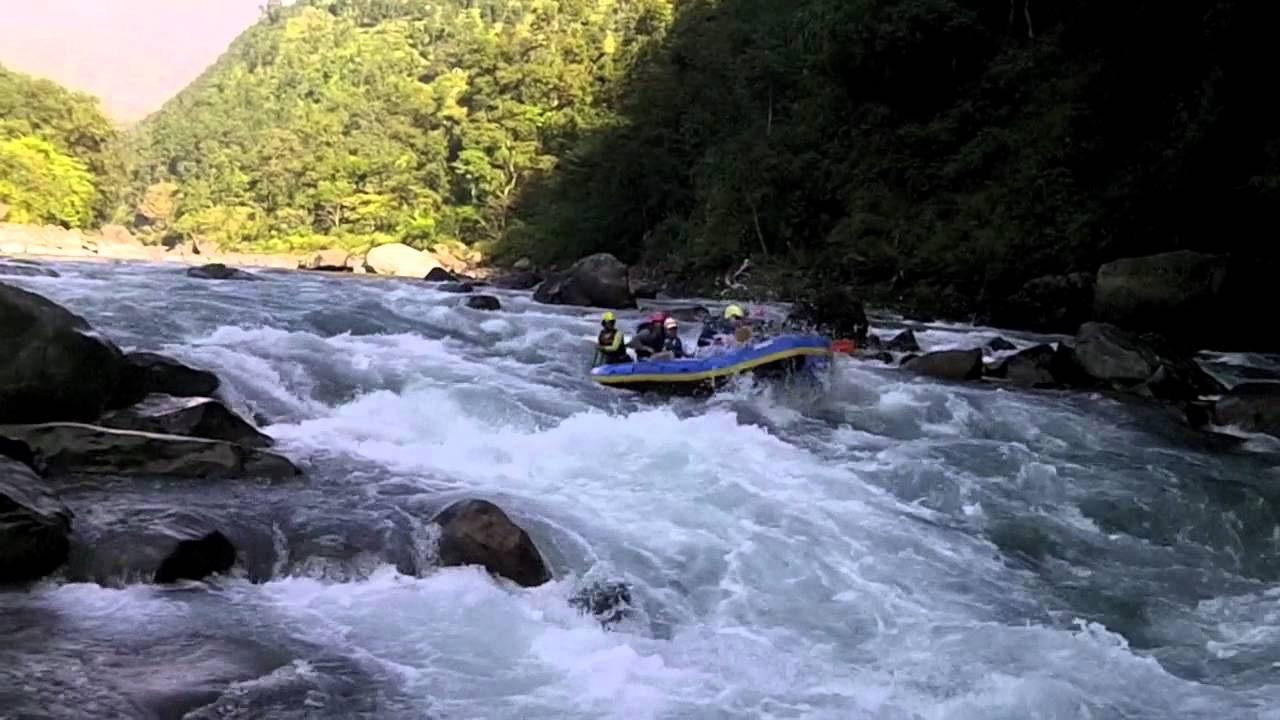
Nepal has got world class rivers which can provide you exciting and thrilling rafting adventures. Nepal’s mountains, rivers are a treasure for great opportunities for river rafting, kayaking, climbing, mountaineering, biking and many more. Nepal has got something to offer to every single person. 

You can have a day of rafting with camping beside the river and enjoy the culture and beauty that surrounds you. Rafting is one of the most popular adventurous activity, that is why Nepal is considered a paradise for river runners.

 2. Mountaineering

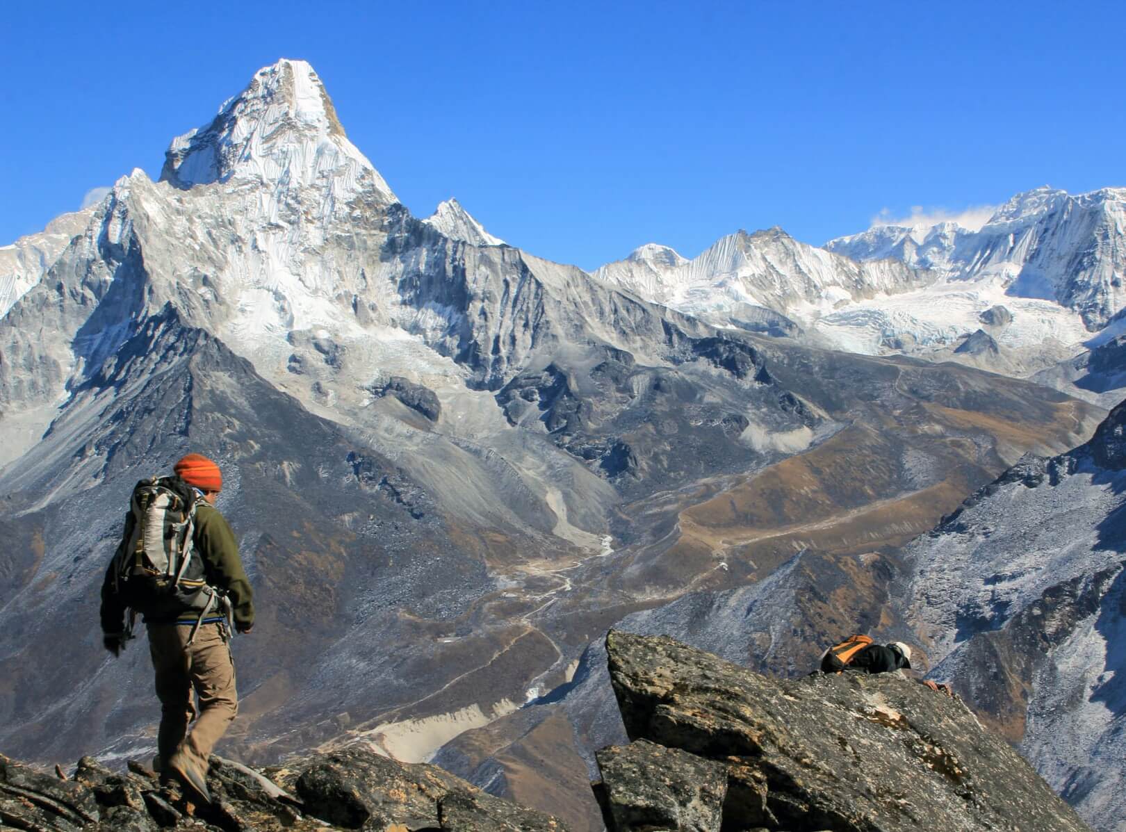
With eight of the highest mountains in the world, Nepal host numerous high mountain for you to the expedition. Being on the summit of high mountains is the result of hard work, discipline, training, and patience. 

“The mountains are calling, and I must go”

John Muir

Nepal offers a plenty of mountaineering opportunities. Autumn and spring are the best times of year for Expeditions to the high mountain summits. Those inspired to join for our Expeditions should have previous mountaineering experience, courage, and should be in good physical fitness in order to have the safest and enjoyable adventure.

3. Bungee Jumping

A bridge above 160 meters above a river, and now you jump. If that is not breathtaking what is. And in Nepal it’s possible. Bungee jumping was banned in some part of Europe but now it has got a home in Nepal. Nepal first Bungy Jumping site is over wild Bhote Koshi river located close to Nepal-Tibet border. It takes 3 hours in a bus to get there. This jump at the height of 160 meters was designed by New Zealand’s leading bungee consultants and is opr=erated by most experienced people. 

So this can one of the best activities you wanna do in Nepal. 

So how do I know more about these CAS Activities?

NST is an expert trekking company in Nepal providing quality services to its clients all over the world. We are eager to provide safe and enjoyable experiences to our guests. Moreover we emphasis on quality, safety, and desires of the guests. We have highly trained trekking guides who understand your needs and help you accordingly. 

And we have been organizing School Treks for 10 years now. you can contact us via Email at info@nepalsanctuarytreks.com or you can directly call us at +977 1 4426721

Khopra Ridge Trek | Khayer lake Trekking | Khopra Ridge trek itinerary

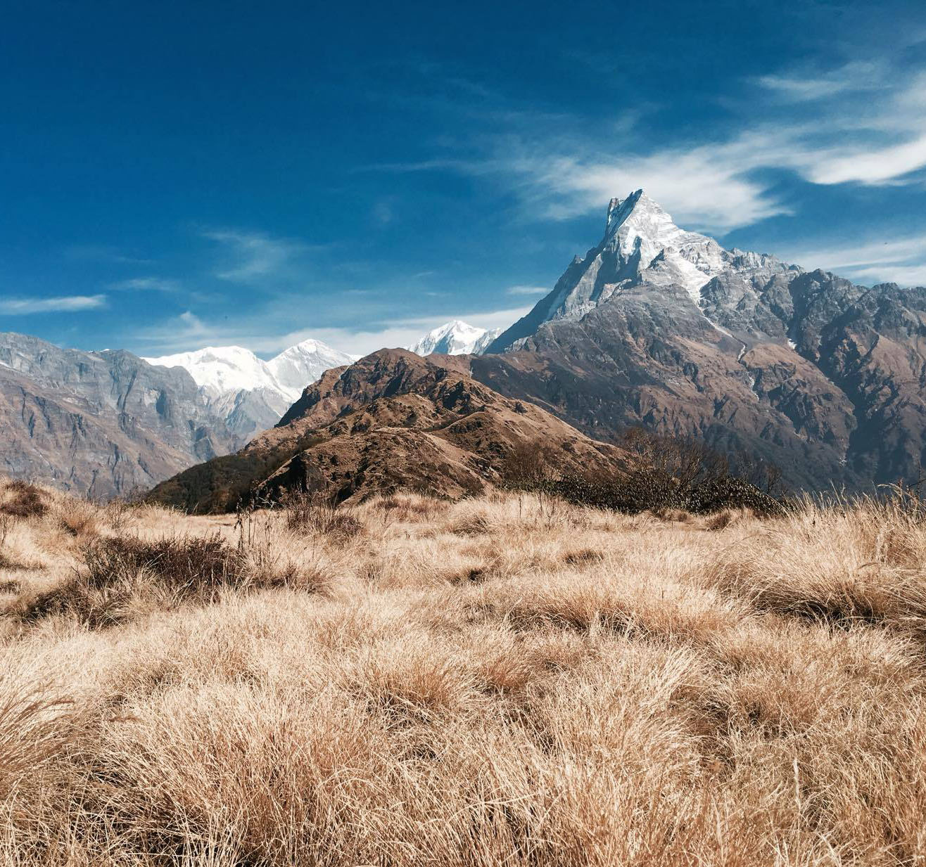
Khopra Ridge trek is one of least explored and incredible trekking destinations in Nepal. It is located to the south of Annapurna ranges. Khopra danda trek is often compared to its neighboring destination Ghorepani Poon Hill trek. However, regarding altitude, Kopra danda rises to an elevation of 3,640 meters whereas Poon hill is located at 3,210 meters.

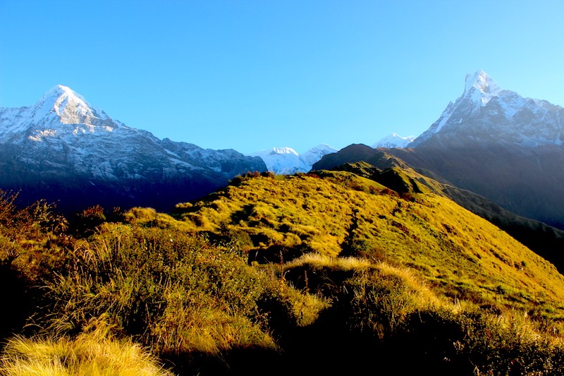
Hence, Khopra danda naturally offers better Himalayan vistas. It is arguably the best place to observe Mt. Dhaulagiri (8,167 meters), Annapurna I (8,091 meters), Nilgiri (7,061 meters), Bahrashikhar (7,647 meters), Annapurna South (7,219 meters), Annapurna II (7,937 meters) and many other mountains from a close distance. It has a concise history of being a trekking destination.

Kopra Ridge

Though it is in the heart of Annapurna region trekkers, have often underrated this destination because it is hidden from the main trail of Annapurna circuit. Kopra ridge is one of the shortest trekking destinations, but it can be lengthened by adding Khayer lake to your itinerary.

This lake is located at the altitude of 4,660 meters. You can either spend a week-long period, or more depend on your final destination. One thing is sure that it is a beautiful destination for both nature lovers and adventure seekers. If you think out of the box and do what most people have been negligent of, the joy and adventure you gain will be worth the effort you put in.

The trail of Khopra ridge trek is partially moderate and partially strenuous. With enough preparations, any new trekker can accomplish the journey, though. The path to Kopra goes through dense and lush green forests of pine, oak, and rhododendron. In the meantime, you can observe the high Himalayan panoramas from various angles.

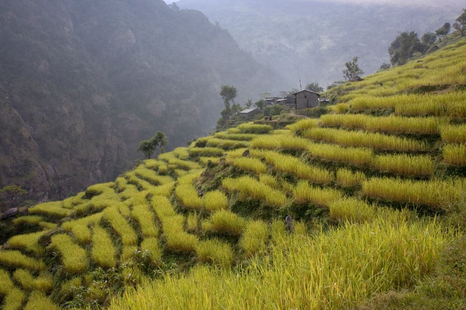
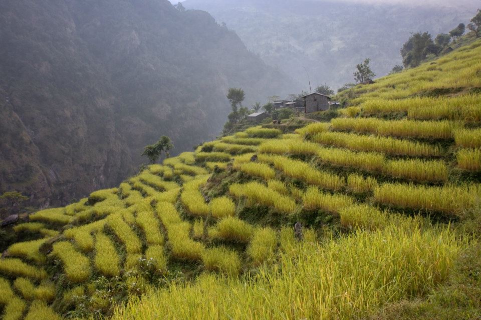
Moreover, the green terraced farming lands of the lower valleys play a significant role in decorating the trail. On the route, you will see especially the Magar and the Gurung communities who have developed for themselves the identity of successful hospitality providers.

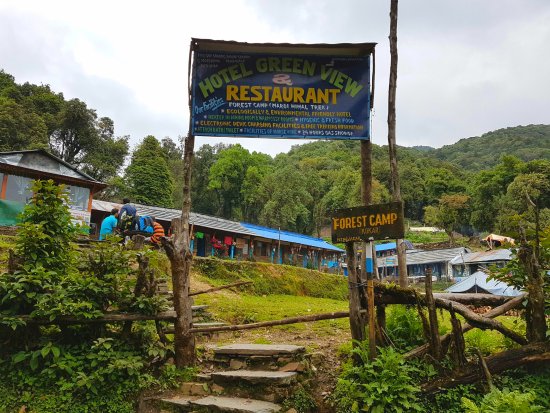
You can find tea houses for some initial days, and after that, you have to spend remaining few days in community lodges. Staying especially at community lodges on Kopra ridge trek trail is a splendid opportunity to explore the exotic lifestyle and culture of local communities.

Kopra Ridge Trekking

You can become a participant observer and feel what it means to live in secluded, high mountainous zones. You can exchange life experiences and gain life-changing motivations from them. Information mentioned above proves that you will not experience heavy traffic in this part of the world.

Hence, you will have a quiet, peaceful and fresh trekking experience. If you wish to add more challenging adventure, you can extend your destination further to Khayer lake. It is more challenging because once you leave Khopra danda, there is no lodging facility ahead.

Therefore, you have to manage full board camping trek. In addition to the lake, you will get to visit the Khayer Barah temple.

A general Khopra Ridge trek Schedule

Day 1: Kathmandu – Pokhara – Kimche – Ghandruk (1,940 meters)

Take a short flight from Kathmandu to Pokhara as early as possible in the morning. It will take between 25 minutes to half an hour. Approximately 3 hours of further driving will take you to Kimche from where the Kopra ridge trek officially begins.

The vehicle will take you through some of the famous villages like Lumle and Nayapul. You can have lunch either in Pokhara or Kimche, depending upon the time. Once you disembark from the vehicle at Kimche, you will get to observe the rural life.

After one hour’s hike, a warm welcome awaits you at Ghandruk, arguably the most famous Gurung village in Nepal. From Ghandruk, located at the elevation of 1,940 meters, you can see the panorama of vast mountains like Annapurna South (7,219 meters), Hiunchuli (6,441 meters), Machhapuchhre (6,993 meters), etc.

Day 2: Trek from Ghandruk to Tadapani (2,630 meters)

You can stroll around the village for some time in the morning and observe the lifestyle of Gurung community. Watching the mountain ranges is an unavoidable part.

You can leave for your next destination, Tadapani, either after the breakfast or after the lunch because you will have an easy trekking day. After 3 hours’ hike through oak and rhododendron woods, you will reach Tadapani (2,630 meters).

The sound of waterfalls and chirping of birds will endlessly give you the pleasure of nature. There is no particular village on the route, but there is a huge buffalo pasture where you can stop and have some dairy snacks.

Tadapani is an excellent place to view the panoramic vistas of snow-capped mountains like Annapurna II (7,937 meters), Annapurna III (7,555 meters), Annapurna IV (7,525 meters), Lamjung Himal (6,931 meters), etc. Moreover, it is also an excellent place to have sunrise and sunset views over the top of those mountains.

Day 3: Trek from Tadapani to Dobato (3,420 meters)

You should take breakfast before leaving Tadapani. On this day, you will divert from the Annapurna Base Camp Trekking trail to a less used path. Walking through rhododendron forests, you will come across buffalo pastures and small clearings.

Though you have to ascend hills, it will not be a tiring day. It takes approximately three hours to reach Isharu where you can have lunch. After that, you have to go through rhododendron forests again for about two and half hours to reach Dobato.

If you have spare time, you can visit Muldai View Point which is half an hour’s ascent away from Dobato. It is an excellent place to observe the panorama of Himalayan ranges like Machhapuchhre, Dhaulagiri, Annapurna, etc. Morning is the excellent time for sunrise view over those giant mountains.

Day 4: Trek from Dobato to Chistibung (3,026 meters)

It will be a fascinating thing to hike for 30 minutes uphill to Muldai View Point early in the morning for sunrise view. You have come back to your lodge in Dobato for breakfast before setting out for yet another incredible journey.

The trail will be now uphill and downhill in a moment through rhododendron forests again. It requires an hour’s walk to reach Bayli Kharka, a beautiful pasture, from where you can see the Dhaulagiri range at close distance.

From this day onward, you will start experiencing a real rustic Nepal. It takes approximately three more hours to reach Chistibung from Bayli Kharka.

There are a small community and private lodges in Chistibung which will provide you with a reasonably satisfactory accommodation.

Day 5: Trek from Chistibung to Khopra Ridge (3,640 meters)

On this day you will have a reasonably easy time trekking to the Khopra ridge, for it takes only 3 hours at most. It is advisable to take sufficient breakfast and to carry some in order not to lose your energy before reaching the destination.

Because it is an uphill trek, you might need to take rest very frequently. You can expect to see the Himalayan tahr (the wild goat) and the national bird of Nepal, Danfe. You will undoubtedly feel elated upon reaching the Kopra ridge for lunch. You cannot even describe how good a place it is to view the panoramic vistas.

Almost all members of Annapurna range, Dhaulagiri range, Nilgiri, Bahrasikhar, along with their foothills, are visible at a close distance from here.

Khopra community lodges have distinguished identities for the warm love they shower to their guests and their attempts to provide as much facility as possible.

Day 6: Trek from Khopra Ridge to Khayer Lake (4,660 meters)

It might be an exhausting journey from Khopra danda to Khayer lake. But the beauty of this high altitude lake and Brahma temple is worth more than your effort.

The problem, however, is that you will not find lodges there. Hence you have to manage staffs who will set up tents and do the kitchen works for you. It takes approximately five hours to reach this holy place.

Day 7: Trek from Khayer Lake to hRidge

You have to come back the same route that you had used while going up. Walking down through a highly remote area for more than four hours, you will reach Kopra danda where you can spend yet another night.

Day 8: Trek from Khopra Ridge to Swanta Village (2,214 meters)

After observing a 360 degree of panoramic vistas and having taken breakfast, you can descend the hill to Chistibung. Even a relaxed walk will take only two hours at most. You should take lunch at Kharka in an hour’s journey down from Chistibung.

Then the route goes instantly up and down again which continues till you reach Swanta, a beautiful but less known Magar habitation.

Altogether, you will have walked for five hours by the end of your trek on this day. You have the right to choose a lodge at a suitable location.

Day 9: Trek from Swanta to Ulleri (2,050 meters)

This day’s trail does not require much going up and down. It is mostly level which meanders at times. The joy of walking amidst the aroma of rhododendron is beyond explanation. You will not have any difficulty finding lodges there.

Day 10: Trek from Ulleri to Nayapul and drive to Pokhara

It is the last day of your trek. After trekking for 2 hours partially downhill, you will reach Nayapul from where you can catch a bus to Pokhara.

After one and half hours driving you will find yourself in Pokhara, the beautiful lake city. You will most probably have some spare hours during which you can visit different places of tourist attractions.

Or else if you wish to stay a whole day, you can think of spending two nights there so that you can visit most of the tourist destinations.

Day 11: Either Drive or Flight to Kathmandu

You can choose the means of transportation as per your preference. If you are in a hurry, it is better for you to choose a flight because it takes a whole day of driving to reach Kathmandu. But if you have sufficient time, it will be a pleasant experience riding a bus to Kathmandu for around eight hours.

Gosaikunda: Best time to Visit, Cost and Weather.

Manaslu Trek: An ultimate guide to most popular tea-house trek

Ghorepani Poon Hill Trek – The Ultimate Guide and Itinerary

Ghorepani Poon Hill is one of the shortest and most sought-after trekking destinations in Nepal. Poon hill is located at an elevation of 3,210 meters in Ghorepani village (2,874 meters) of Myagdi district in north-central Nepal. Ghorepani offers accommodation to the visitors who are Poon hill-bound.

Due to its rustic setting and being one of the best places to have the sunrise view, this hill is one of the major attractions inside the Annapurna Conservation Area. The primary purpose of reaching the top of Poon hill is to have a glimpse of and capture the sunrise view of Mount Annapurna.

Hence, a throng of tourists gather there at dawn and they could be seen extending their cameras to the Mt. Annapurna, hoping to capture the best possible sunrise glimpse. For this reason, the journey to Poon hill is often called the Annapurna sunrise trekking.

Poonhill Trekking

In order to secure the best seat for capturing the sunrise view, you are recommended to get up early and leave Ghorepani at dawn. By the time rays of the sun appear at the top of Mt. Annapurna and Mt. Dhaulagiri ranges, a crowd of people will be ready with their gadgets to take photographs.

When the sun finally appears in yellowish-red attire, it will attract more cameras than any leader of the world. Ghorepani has been a stopover since the ancient period when traders used to take a rest to feed their horses with water.

Hence, the place is christened Ghorepani which can be roughly translated as ‘water for horse.’

The serpentine trail to this destination takes you through villages of ethnic Magar and Gurung communities. Therefore, in addition to the inevitable adventure, it is a massive opportunity for any visitor to explore the conventional ethnic culture.

Another glorious aspect about this trail is that you will be passing through dense rhododendron forests which blossom between the late March and throughout the April, making the entire view more charming than a beautifully decorated bride.

Moreover, Ghorepani Poon Hill trekking will also let you walk along terraced slopes and beautiful paddy fields and observe the excellent culture and lifestyle of Magar and Gurung communities. Likewise, the route involves steep stone steps, suspension bridges and farms as well.

Due to its moderate elevation, people seldom suffer from high altitude sickness while trekking to Ghorepani Poon hill. However, the partial steepness en route demands of you a specific physical fitness.

Throughout the trekking duration, you will remain awestruck by the exquisite views of Mount Machhapuchhre (6,993 meters), Mt. Annapurna (8,091 meters) and Mt. Dhaulagiri (8,167 meters). Poon hill discloses the panoramic views of mountains like Mt. Dhaulagiri ranges, Mt. Annapurna ranges, Gangapurna, Lamjung Himal, Barasikhar, Nilgiri, Hiunchuli, to name a few.

For some trekkers, the steep ascent might turn out to be a hard-fought victory, but the pain of the ascent is nothing compared to the joy of ultimately inhaling the fresh air at the hill and grasping what nature has to offer.

A general overview of Ghorepani Poon Hill Trekking

Depending on the amount of time and your physical fitness, you can customize the itinerary for trekking to Ghorepani Poon Hill.

First of all, you have to make sure how many days you can invest. Based upon that, you can choose the route and prepare an itinerary accordingly.

According to your wish, you can either catch a flight or go by bus from Kathmandu to Pokhara. After one and half hour’s drive from Pokhara, you will reach Nayapul from where the trek begins. Followings are the options of itinerary you can choose from.


4 Days Ghorepani Poon Hill Trek from Kathmandu

Day 01: Kathmandu – Pokhara – Nayapul – Ulleri

To make it to Ulleri on the first day of your trek, you have to catch the first-hour flight from Kathmandu to Pokhara. It takes only 35 minutes to reach there. Because you have a tight schedule, you have to embark a bus that goes to Nayapul immediately. It does not take more than one and half hour to reach Nayapul which is also the bus terminus of Poon Hill trekking route. From Nayapul begins the Ghorepani Poon Hill trek. Approximately four hours’ hike will take you to Ulleri (1,960 meters), the first day’s destination.

Day 02: Ulleri – Ghorepani

Trek from Ulleri to Ghorepani gives you a pleasant experience of walking through rhododendron forests. Ghorepani is situated at an elevation of 2,874 meters which indicates that the journey from Ulleri to Ghorepani demands your perseverance in making an uphill ascent. The trip, however, is eased by the many stone stairs, mostly covered by dry leaves of rhododendron. All visitors, willing to observe the sunrise from Poon Hill, gather at Ghorepani.

Day 03: Ghorepani – Poon Hill – Tadapani – Ghandruk

The third day of the trek to Poon hill is the most joyous day for anyone. To record the best possible sunrise view of Mt. Annapurna and Mt. Dhaulagiri ranges, you should leave Ghorepani at dawn and choose the best possible seat. You have to consult your trekking guide to make sure that you won’t miss the chance to see the sunrise. Moreover, you should not forget that it takes an hour to reach the top of the hill from Ghorepani. You have to wear warm clothes to survive in the climate of 3,210 meters altitude. After that, you will come down to Ghorepani for breakfast and leave for Ghandruk. At first, you will be hiking up to Deurali pass at a similar elevation to Poon Hill. Then your downhill journey begins via Tadapani to Ghandruk. Ghandruk is one of the largest and most popular Gurung villages which operates world-famous home-stay hospitality. By the time you reach the third day’s destination, you will have walked approximately six to seven hours from early morning till late afternoon.

Day 04: Ghandruk – Nayapul – Pokhara – Kathmandu

On the fourth and final day of Ghorepani Poon Hill trek, you have to walk for about two hours from Ghorepani to Kimche and an additional two hours’ drive will take you to Pokhara. From Pokhara, you can take a Kathmandu-bound flight on the same day.

3 Days Trek from Pokhara to Ghorepani Poon Hill

Poonhill Trekking

If you are on an even tighter schedule, you can go according to the following itinerary with which you can complete your trek in just three days.

For that, instead of going to Ghandruk you will come down the same route that you took while hiking up. If you have spare time, you will have a fantastic option to spend a day or two in the beautiful city of Pokhara.

You can add more to the package of your joy by exploring the beauty of Phewa Lake, Begnas Lake, Mahendra cave, Chameri (bat) cave, Gupteshwori cave, Davi’s falls, Sarangkot hill, World Peace Pagoda, etc. while in Pokhara.

Day 01: Drive from Pokhara to Nayapul and trek to Ulleri

Day 02: Trek from Ulleri to Ghorepani

Day 03: Hike to Poon Hill – back to Nayapul – drive to Pokhara

Places to visit in Nepal: 26 places you must visit

5 Days Ghorepani Poon Hill Trek either from Kathmandu or Pokhara

You can make your trek even lengthier by following a slightly different and more luxurious itinerary. If you count the beginning of your trek from Kathmandu, you will have to take a flight to Pokhara and back to Kathmandu as well. It means you will not be spending any night in Pokhara.

Day 01: Pokhara – Tikhedhunga

Tikhdhunga is 42 kilometers away from Pokhara. On the first day, you have to ride a bus for about two hours from Pokhara to Nayapul, from where the Ghorepani Poon Hill trek begins. It will be an easy day because the route does not involve many ascents. You will somewhat follow the Modi river and go along rhododendron forests. Approximately two hours’ easy trek will take you to Tikhedunga.

Day 02: Tikhedhunga – Ghorepani

The second day of your trek will mostly consist in ascending steep uphill. You might be pushing yourself to the limit on this day because it is the most challenging day of the entire trekking duration.

Throughout the trail, you be stepping upon beautifully crafted artificial stone stairs. Moreover, the rhododendron forests cover a vast section of the trail.

Apart from that, you will get to observe the spectacular views of Mt. Macchapuchhre (6,997 meters), Mt. Hiunchuli (6,441 meters) and Mt. Annapurna South (7,219 meters).

Day 03: Ghorepani – Poon Hill – Tadapani

After observing the sunrise view of Annapurna and Dhaulagiri ranges, you have to come back to Ghorepani for breakfast. You have to make yet another ascent of Deurali hill before descending to Tadapani. This day, however, will be relatively more relaxed due to less ascent and less distance coverage.

Day 04: Tadapani – Ghandruk

Day 4 is the most comfortable day of the entire trek. Walking for just two to three hours will take you to the beautiful Gurung village of Ghandruk.

Day 05: Ghandruk – Pokhara

On the final day of your trek, you have a trek to Nayapul from where you can catch a bus and come to Pokhara.

 Ghorepani Poon Hill Trek Difficulty

Trekkers in Poonhill Trekking route

Ghorepani Poon Hill is a relatively easy trekking destination in Nepal. In spite of being low at elevation, i.e., 3,210 meters, the difficulty of this trail is graded as moderate.

It is because on the second day you will be making an ascent of around nine hundred meters on a single day without acclimatization. Otherwise, other days are counted among most comfortable trekking days of Nepal.

Poon Hill trail requires you to have a certain level of physical fitness so that you can persevere through the quite strenuous uphill ascent. The path has been made far more accessible by the stone stairs. Trekking to Poon hill does not require you to practice exercises for months.

If you have a regular habit of hiking, bicycling and or swimming, that will be enough preparation for this adventure. Nonetheless, you need to have a functional health status because you will be walking uphill for five to seven hours.

If you go trekking during the winter, you might face difficulty finding a suitable teahouse for accommodation because most of them remain close.

In the Poon Hill section of Annapurna Conservation Area, trekkers rarely suffer the altitude sickness, but still, you cannot be utterly negligent.

Also Read:

Gosaikunda: Best time to Visit, Cost and Weather.

Manaslu Trek: An ultimate guide to most popular tea-house trek

Manaslu Trek is least visited trekking region compared to other trekking regions and is in a very remote area, but Manaslu offers an ultimate adventure trek.

It is famous for small teahouses where trekkers can take rest and have a cup of tea with an amazing scenic view of snow-capped Himalayan ranges.

Manaslu: Eighth highest mountain in the world

Manaslu is the eighth highest mountain on the earth at 8,163 meters (26,781 ft) above from the sea level. Manaslu is located in the Mansiri Himal in the west-central part of Nepal.

The mountain name is first known as Kutan I. ‘tang’ being the Tibetan words used for the flat place, thereby describes the mountain’s general summit. Later the name of the mountain was changed to Manaslu.

Himalayas manaslu trek
Manaslu trek: Himalayas

‘Manaslu’ means ‘mountain of the spirit.’ Manaslu word comes from Sanskrit word Manasa; it means intellect or soul.

Manaslu is one of the adventurous trekking among other trekking in the Himalaya region. It is the highest peak of Gorkha district and is located about 40 miles east of Annapurna.

The Manaslu region was opened for trekking only in 1992.

The mountain’s long ridge and valley glaciers offer feasible approaches from all directions, and it culminates in a peak that towers steeply above its surrounding landscape and is a dominant feature when seen from far.

Beauty of Manaslu

Manaslu trek offers a jaw-dropping view of snow-capped mountain range and the ancient trail along with mix culture, heritage and hospitality of authentic Hindu and Tibetan-style Buddhist village.

The beauty of Manaslu is unbeatable. The trekking trail follows an ancient salt-trading route along the spectacular Burhi Gandaki River. The highest point in this trek is the ‘Larkya La Pass’ at an elevation of 5,106 meters (16,752 ft).

Manaslu Trek is famous for the beauty of the high Himalayas as well as local ethnic culture, traditional lifestyle, old monasteries and local people with unique houses.

Manaslu Trekking
Manaslu Trekking:

Manaslu is mainly inhabitant with two regions: Nubri and Tsum. Most people visited the Nubri valley after tourism board announced it as a touristic place in 1950.

And Tsum still out of touch with modernity. You will see traditional lifestyle, art, and culture. The local people are mostly of Tibet and speak their language. Different people with different cast live in a different place.

In the central part of the region, the large number of Gurung people are the main ethnic who have joined Brigade of Gurkha and closer to Tibet, the Bhutias, akin to Sherpa people who follow Buddhist.

Earlier climbers to Manaslu region

In 1956, 9 May, Toshio Imanishi and Gyalzen Norbu first climbed the Mount Manaslu. The Japanese team was lead by Maki Yuko, also known as Aritsune Maki. Next successful climb on 19 May 1971 by Kazuharu Kohara and Motoki, group of 11 Japanese teams.

 While climbing Mt. Manaslu only a few make it happen, but most people fail to climb the highest peak. Many foreigners were failed to reach at 8000 meters. On November 9, 1986, Jerzy Kukuczka, Artur Hajzer climbed the eighth highest peak.

Manaslu Trek: River

Carlos Carsolio, the youngest and being the fourth person of eight-wonderland in history reach the summit of Manaslu. During the climb, most people died due to the high altitude.

Manaslu trek forms section of the Great Himalaya Trek. Tourists are the important part of GHT which connects to the rural life, provides the essential commodities and school for children.

The trekking trail to Mount Manaslu has only one route which starts from the Gorkha district of Arughat Bazaar and ends in Syange.

The Manaslu trek is a challenging and strenuous trek. The trail can be shorter or longer depending upon your walking hour per day. Along the trek; there are many tea houses and the breath-taking scenery that will make your heart melt in each step. 

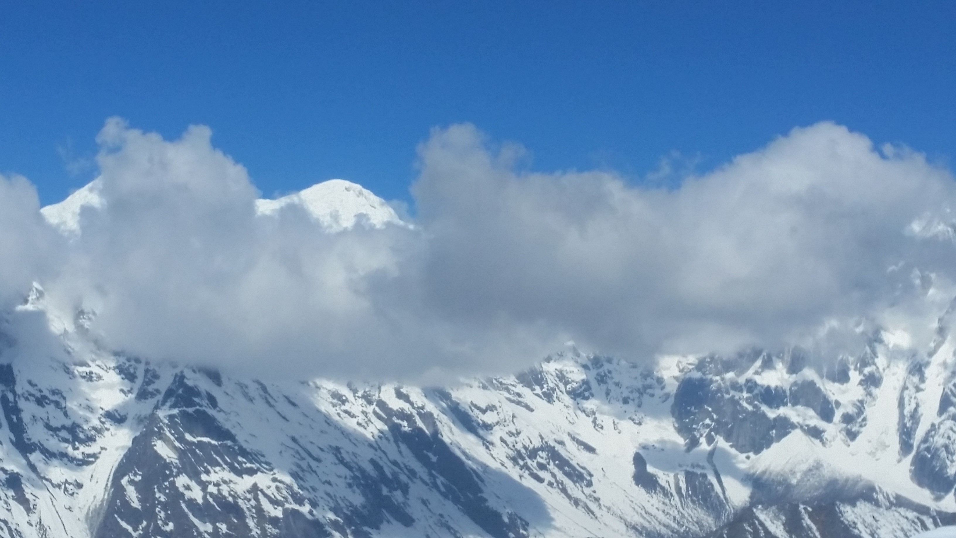
Manaslu Trekking: Himalaya with cloud

Manaslu Trekking: An amazing tea-house experience

 Manaslu is now popular for the tea houses trek. There are many teahouses available on the trail where you could stay overnight or take rest and have some tea during the trek.

Now, these tea houses developed into mountain lodges offering foods and accommodation in nominal price.

Local people manage most of the teahouses, and tourists love to stay in the tea-houses because they get chance to know the local people’s daily lifestyle, tradition, culture which are rarely seen in the rural area.

Trekking Permit

A trekking permit is required to trek any part of Nepal. But before you go there, you need trekking permits, cost, and other information.

There are two types of cost of permits according to the season. You should pay US$ 70 per week and after seven days US$ 10 per day per person. This applies only from September to November month.

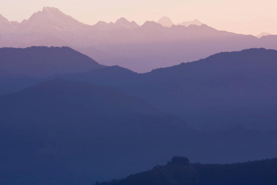
Manaslu trek: Blue Mountains

Similarly, from December to August, the cost is US$ 50 per week and after seven days US$ 7 per day. If you want to trek more than one places, then you need more than one permits. Each permit requires details for the route and region.

The trekkers should pay entry fees including 13%  Vat to trek Conservation Areas and Trekkers Information Management System (TIMS). Entry fees to trek Conservation Areas are following:

  1. For SAARC countries: Nepali Rupees 200
  2. For other countries: Nepali Rupees 2,000

Nepal Tourism Board which is located in the Kathmandu issues entry permits. 

Choosing a trekking agency

There are many trekking agencies in Nepal. If you are looking for the best trekking agency, then Nepal Sanctuary Treks is the best agency in Kathmandu Valley.

Nepal Sanctuary Treks carefully plan and pay attention to detail and design trek itinerary just the way you want and deliver all information required for client’s safety, comfort, and pleasure.With the support and guidance of our trek specialist, you can co-create a trekking itinerary to suit your style, taste and physical fitness. 

https://www.nepalsanctuarytreks.com/about-us/why-nepal-sanctuary/

Manaslu Trek: Blue Sky and Himalaya


Manaslu Circuit Trekking

Manaslu Trek has one route to reach the peak and another route to return. The Manaslu Trekking is restricted area trek, so consequently, before organizing Manaslu trek, we must take permission for Manaslu region.

It is considered to be one of the challenging and finest trekking adventures of Nepal. The trek could make shorter or longer on the length of your walking days from the starting point to ending point.

Arughat

The trek for Arughat starts from Kathmandu and takes about 6-7 hours by jeep. You can also travel by local bus. However, it takes a long time.

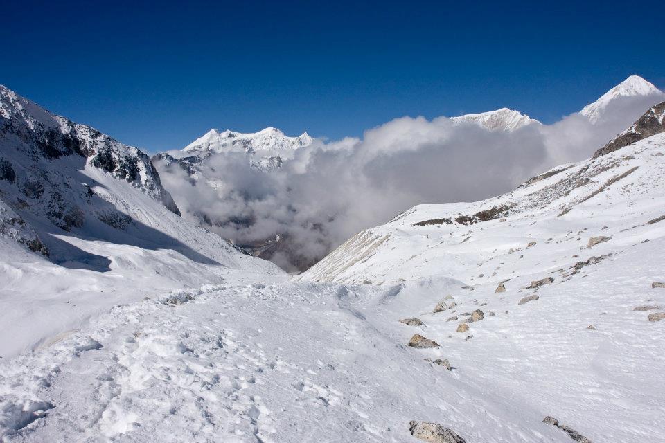
Manaslu Trek: manaslu Region withh cloud and snow

Arughat is the small local bazaar, lies in the bank of the river and has some lodges to spend the night there. The necessary things that you need for the trip are; instant foods and others items can be bought there.

Soti Khola

Manaslu Trek begins from the Soti Khola. From Arughat to Soti Khola you can go by bus or private vehicle, but the road is not properly managed. Most people go there by local bus.

The road ends in Soti Khola, and then the walk continues to Manaslu from there. You need more effort to climb up the hills starting at a minimum elevation of 730 m. You can get a pretty nice view of beautiful green hills from the Soti Khola.

Lapubesi

From Soti Khola to Lapubesi after about 6-7hours of the walk, through the Sal forest and some villages, green field you will reach villages of Lapubesi which is an inhabitant of Gurung people.

Manaslu Trek: Mountains and Himalayas

The Gurung people live in the central part of Nepal, of areas such as Gorkha, Baglung and the high slopes of Annapurna. They are Tibetan-Gurung people, farmers who grow rice, millet, maize which are daily works.

They follow both Hindu and Buddhist religions, although they have their religion, with certain rituals and ceremonies. The Gurungs still combine with the belief of the two dominant religions of Nepal.

Khorlabesi

The trail continues to Khorlabesi for around 7-8 hours of walk from Lapubesi. Crossing the path of the jungle, sometimes up and sometimes steep downside of hills and reach Khorlabesi villages.

You can see pretty scenes of hills and villages then towards to Jagat.

Jagat

Around 6-7 hours of walk from Khorlabesi, you will reach your next point Jagat. To reach Jagat, you have to go through lots of ups and downs, hills and rock but it makes your mood much better than before.

Manaslu Trek: Trees Silhouette

Deng

Jagat to Deng takes about 5-6 hours of trekking which passes through the pine forest, Philim villages, and Ekle Bhatti. Ekle Bhatti is a small teahouse where you can take rest and have a cup of tea.

After some hours later you will reach to Deng, a silent valley with small hotels settlement.

Namrung

Trek to Namrung, after leaving Deng you walk continuously to Ghap to Namrung villages. Namrung is a small village inhabited by Bhote, Lama peoples.

Their main occupation is agriculture and animal husbandry. They raise maize, barely, potato as crop and oats, nut, as fruits. They have their own culture and religion.

The local people want to preserve their historical culture and religion, so they have open Historical Cultural Lakpa Dhundup Museum at Namrung prok VDC.

Manaslu Trek: White small houses in the mountain

You will walk through villages, beautiful waters, rhododendron forest with white Langur monkey and also you can see beautiful views of Himalayas peak including Ganesh Himal and Himchuli.

Samagaon

The next trek to Samagaon takes 6-7 hours to arrive there. While walking towards Samagaon following Lihi, Sho, Lo, Shyale villages, hilly terrains and bushy forests.

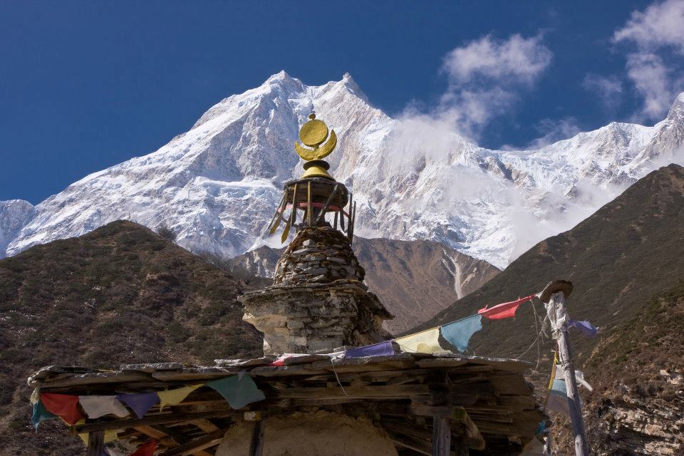
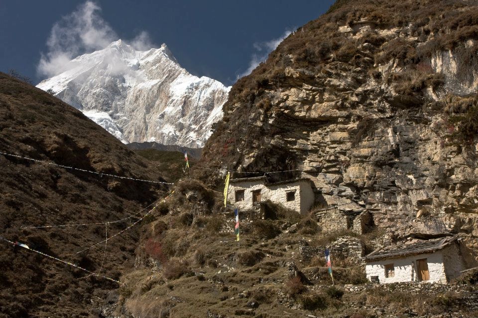
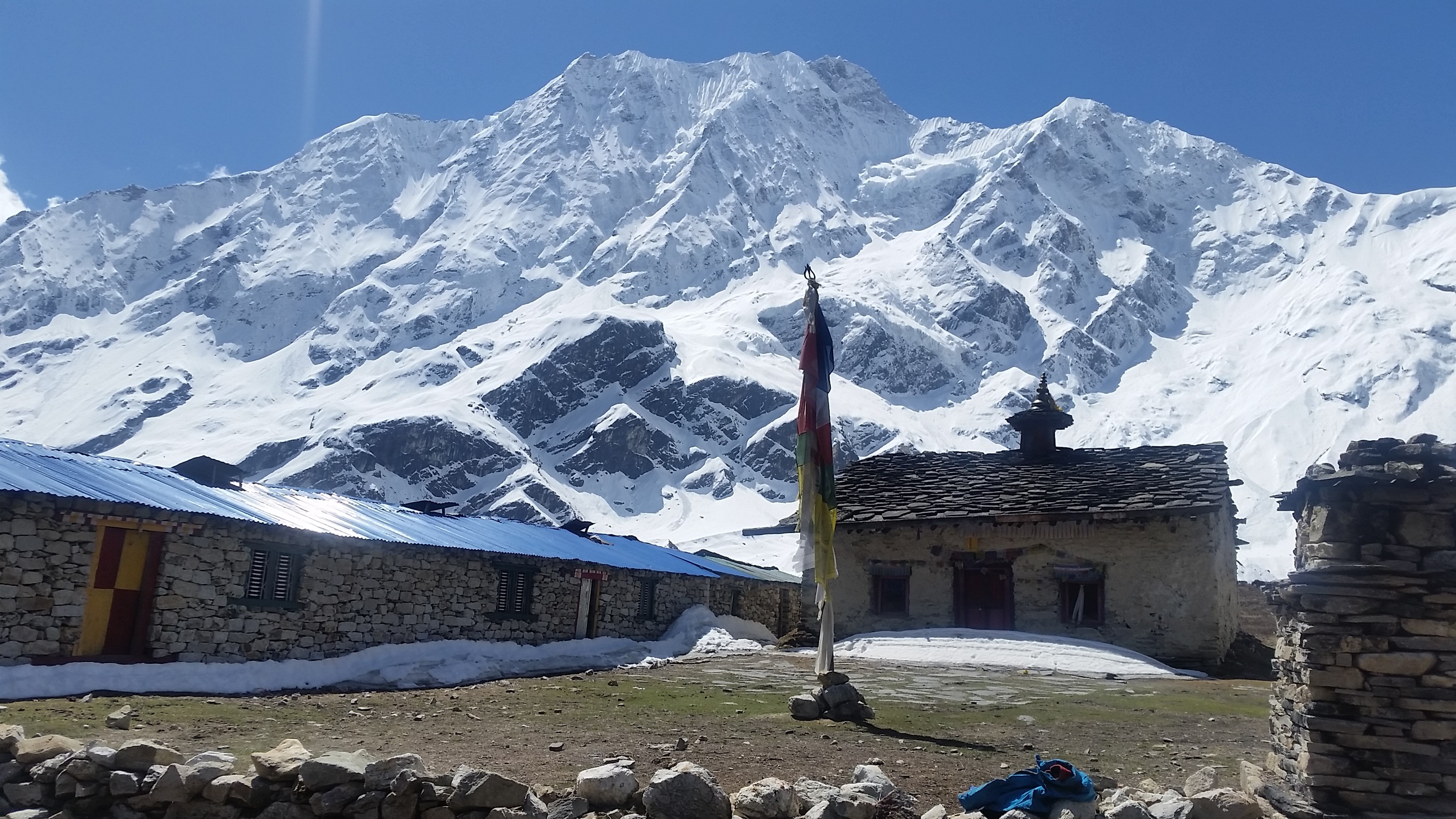
Samagaon is a beautiful village surrounded by prayers flag, and they follow Buddhist Religion. Also, it offers amazing views of Himalayas peaks including Manaslu, Himchuli and peak 29.

During the walk to Samagaon, you can also visit Birendra Tal, Phungen Gompa.

Samdo

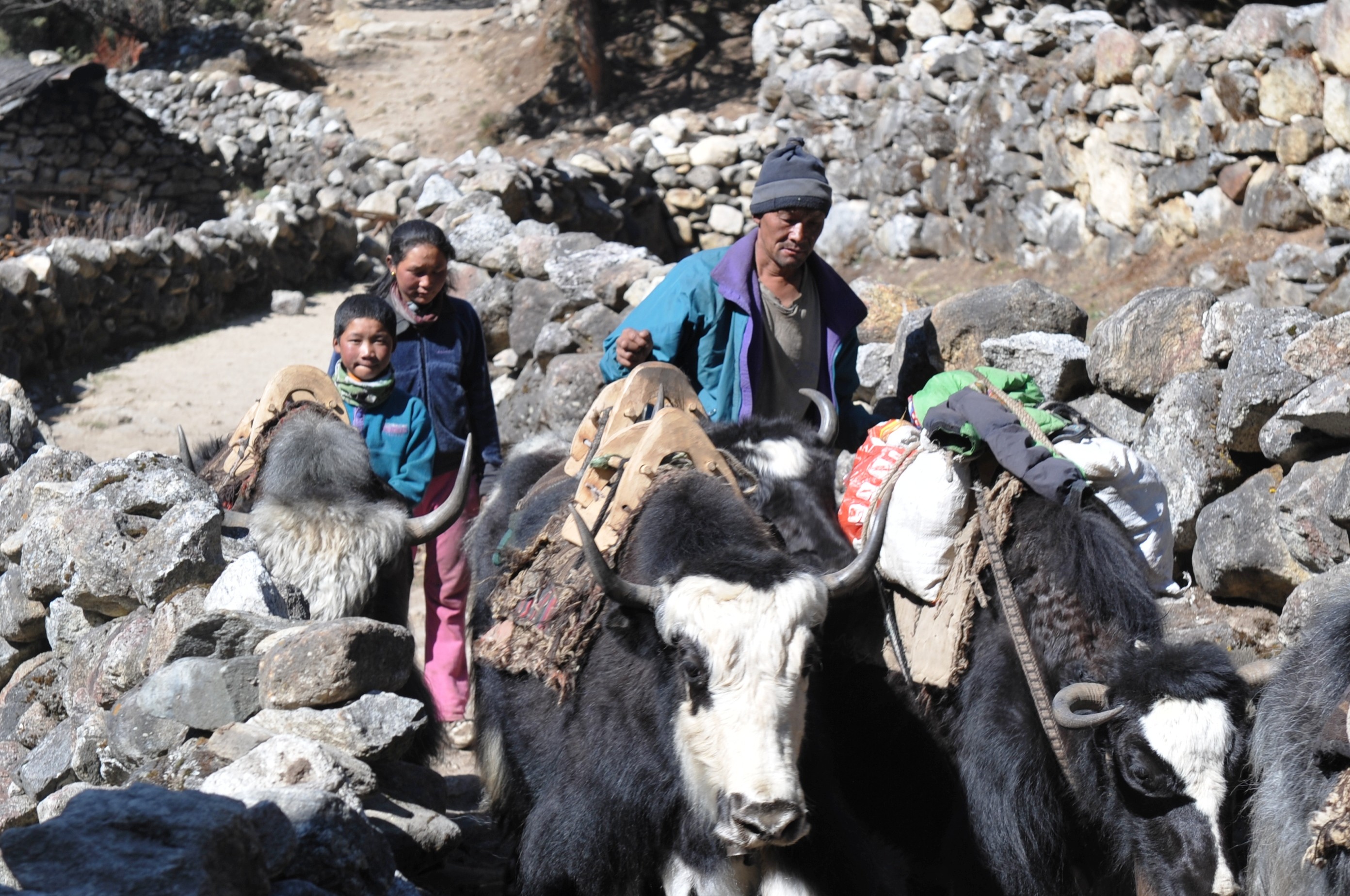
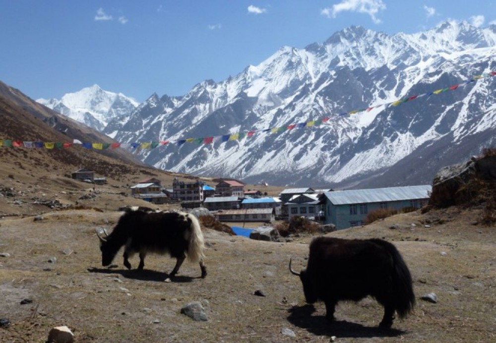
It is a short walk of around 3-4 hours to Samdo after leaving Samagoan. Samdo, the most beautiful place of Manaslu. The places are especially known for yak herding.

This village has more animals and fodder shelter than human settlement. This place offers excellent views of Simrang Himal, Hiunchuli himal, Ngadi Himal, Larkhye Peak, Cheo and Kang Guru Himal.

Dharamsala

Next trek to Dharamsala, a hut made by the stone of three rooms and a roof but doesn’t have doors and windows. Everyone can go into Dharamsala, but there’s nothing inside.

Manaslu Trek: Crops
Manaslu Trek: Crops

To reach Dharamsala from Samdo; it takes around 4-5 hours of walk passing through Larke Bazaar “a seasonal Tibetan Market.” Dharamsala is also known as Larkya Phedi which is a final part of Manaslu Circuit before Larke Pass.

Larkya Pass

Larkya Pass is the maximum altitude of 5,106 meters.

From Dharamsala, you will climb steadily up to reach the top of Pass. Finally, you will see breath-taking panoramic views of snow-capped Himalayas peak of Mount Manaslu, Annapurna II, Himlun Himal and other mountains.

You can snap the pictures of the beautiful Himalayas and videos too before descending to Bhitmag. Many trekkers become sick due to its maximum altitude.

Bimtang-Tilje-Dharapani

Leaving the beautiful Mount Manaslu behind and start descending to Bimtang takes 3-4 hours and trek to Tilje around 6-7 hours of walk. Passing the rhododendron forest take you to Karachi; one of the highest cultivated village of Nepal.

Then continue to walk to Gho villages where few lodges are available. After few hours of walk, you will reach Tilje village which has better lodges then Gho villages.

After a short walk from Tilje, crossing Marsyangdi Khola through on a long suspension bridge finally, you will reach Dharapani. Dharapani is a small village where small hotel and lodge are available.

Chamche-Besisahar

Chamche is the final trail of Manaslu Trek from Dharapani following Tal villages. Chamche is the most popular place for Annapurna Circuit Trek route with several lodges and accommodation facilities.

Then walk down to Besisahar, which is the headquarters of Lamjung district. Here different cast and religion of people live in one community and have a different culture.

From here, you can get vehicles such as a jeep or local bus and drive to Kathmandu about 7-9 hours.

Manaslu Trek Map

Manaslu Trek: Map 


Manaslu Trek Itinerary

Manaslu trek is one of the challenging and demanding trek. Before Manaslu trek, you need to manage itinerary on your daily basis traveling routine.

The well- planned and managed itinerary ensure the best itinerary that makes you trek enjoyable.


You can follow the link below for best itinerary:

https://www.nepalsanctuarytreks.com/package/manaslu-circuit-trek/

Ten facts  About Trekking in Manaslu Region

1. Mount Manaslu is an eighth highest peak in the world which opened in 1992. It is still under restricted trekking area of Nepal. It offers stunning views of Manaslu Peak including Ngadi Chuli, Himalchuli, and Boudha Himal.

2. Manaslu is an inhabitant of different ethnics groups such as Gurung, Lama, Bhotias, and Tibetan. They have different cultures. There many ancient monasteries, ethnic heritage and culture and unique houses made of stone.

3. Manaslu Trek is famous for small teahouses. The teahouses are built and managed by the local peoples. Tourist loves to stay there and get opportunities to know closely about local lifestyle.

4. Manaslu Trekking has countable visitor than Annapurna Base Camp Trek, Everest Base Camp Trek, and other trekking which makes entire Manaslu region unspoiled and more exclusive.

Manaslu Trek: Mountain surrounded by cloud

5. Manaslu is mainly inhabitant with two regions: Nubri and Tsum. Most people visited the Nubri valley after tourism board announced it as a touristic place in 1950. And Tsum is still out of touch with You will see traditional lifestyle, art, and culture.

6. Crossing the higher pass of Larkya Park at elevation 5,106 meters. Descending to Bimtang is more difficult than climbing. Descending towards Bimtang must use some technical trick. From Bimtang, the back view of Mt. Manaslu is amazing.

7. Toshio Imanishi and Gyalzen Norbu were the first to climb Mount Manaslu on 9 May 1956.

After them, many Japanese teams have climbed the summit of Manaslu but got failed. Mount Manaslu called Japanese Mountain and also known as Killer Mountain because of its frequent icefall, and high altitude trekker gets sick or kill.

8. Mount Manaslu which is in Gorkha district has lots of offers historically as well geographically such as Manakamana Temple, Lower Manaslu Trek, Tsum Valley Trek, Nubri Valley Trek. Manaslu Trekking route starts from Arughat and ends in Besisahar.

9. The spectacular scenario of rhododendron forest, perfect views of mountain ranges, a combination of rich culture, natural beauty and biological diversity.

10. The Tsum Valley Trek in the region has beautiful views of surrounding mountains peak, but extra trekking permit is compulsory need to travel there.


Precautions to take in Manaslu Region

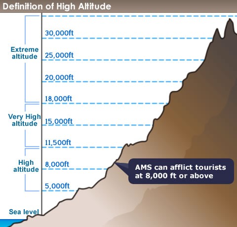
Before you travel there, you need to know all things about Manaslu region such as about high altitude, weather, hygiene and daily health care. Firstly, you can easily become dehydrated at high altitude.

The lower air pressure will force you to breath more quickly and deeply. So, you will have a drink a lot of water than you normally would have. The most common symptoms include thirst, dry lips, nose or mouth, headache and feeling fatigued.

Manaslu Trek: Village

You should drink at least 3 liters everyday trekking. Also, it is important to maintain your daily hygiene in a remote area which might affect your health and brings hand sanitary with you.

Due to cold weather, you might get sick, so warm clothes such as down jacket, electrical socks, hat, etc. are most necessary things that must have with you.

Tsum and Ganesh Himal Trek and Nubri Valley

Tsum valley and Nubri valley is one of the famous and hidden treasures of Manaslu region. Tusm words come from the Tibetan word ‘Tsombo’ which means vivid. Tsum valley is mostly the origin of Tibetan and people in that valley speak unique dialect.

Tsum valley offers the beautiful forests covered with rhododendron tree and a stunning view of Ganesh Himal.

Tsum valley always combines with Manaslu Circuit. The trail starts from the Arughat and continues the low, high passing through the forest and small villages.

Manaslu Trek passes through the Tsum Valley. The place is famous for the ancient Buddhist monastery.  Geographically the valley called ‘Tsum Tso Chuksum’ which means thirteen provinces ruled as a single territory.

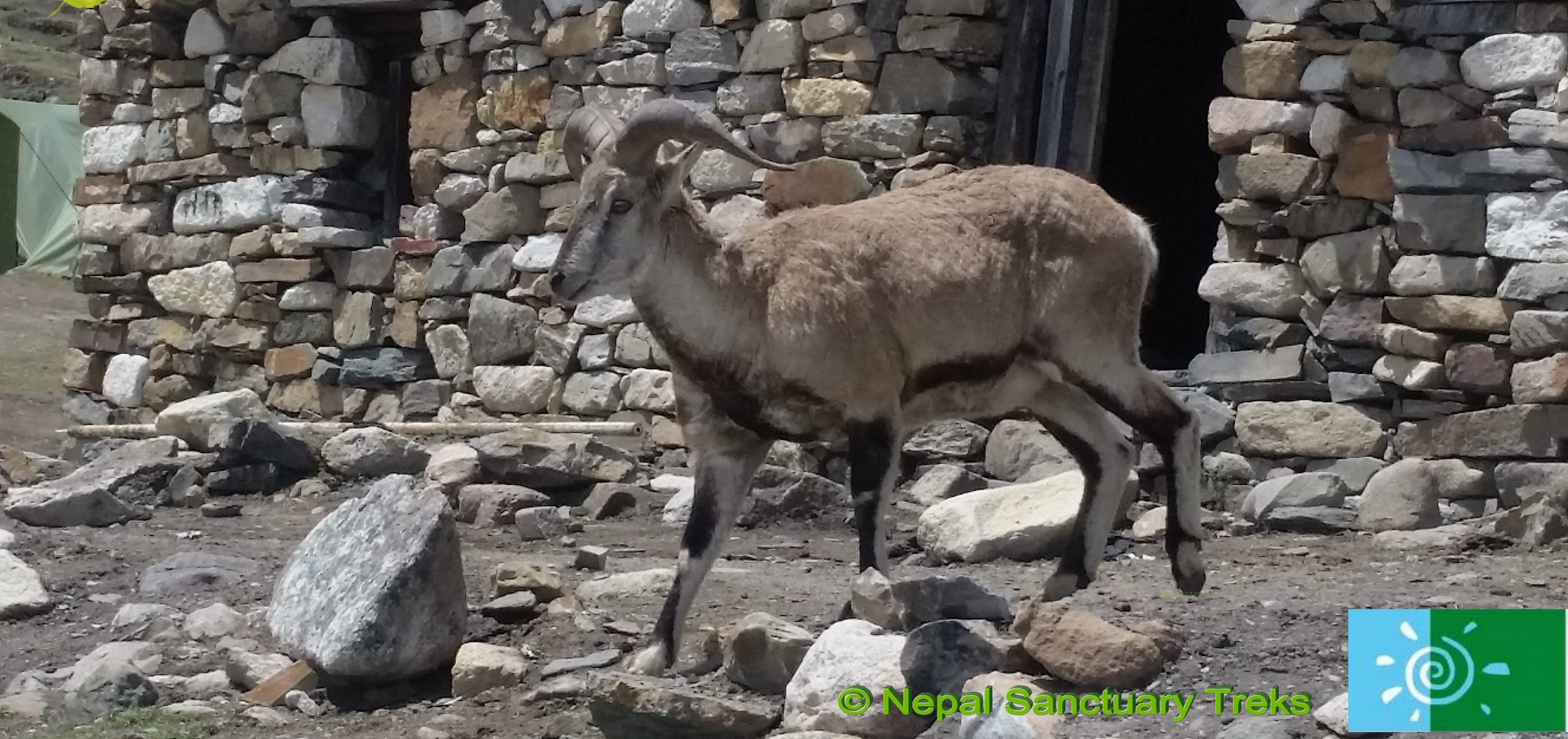
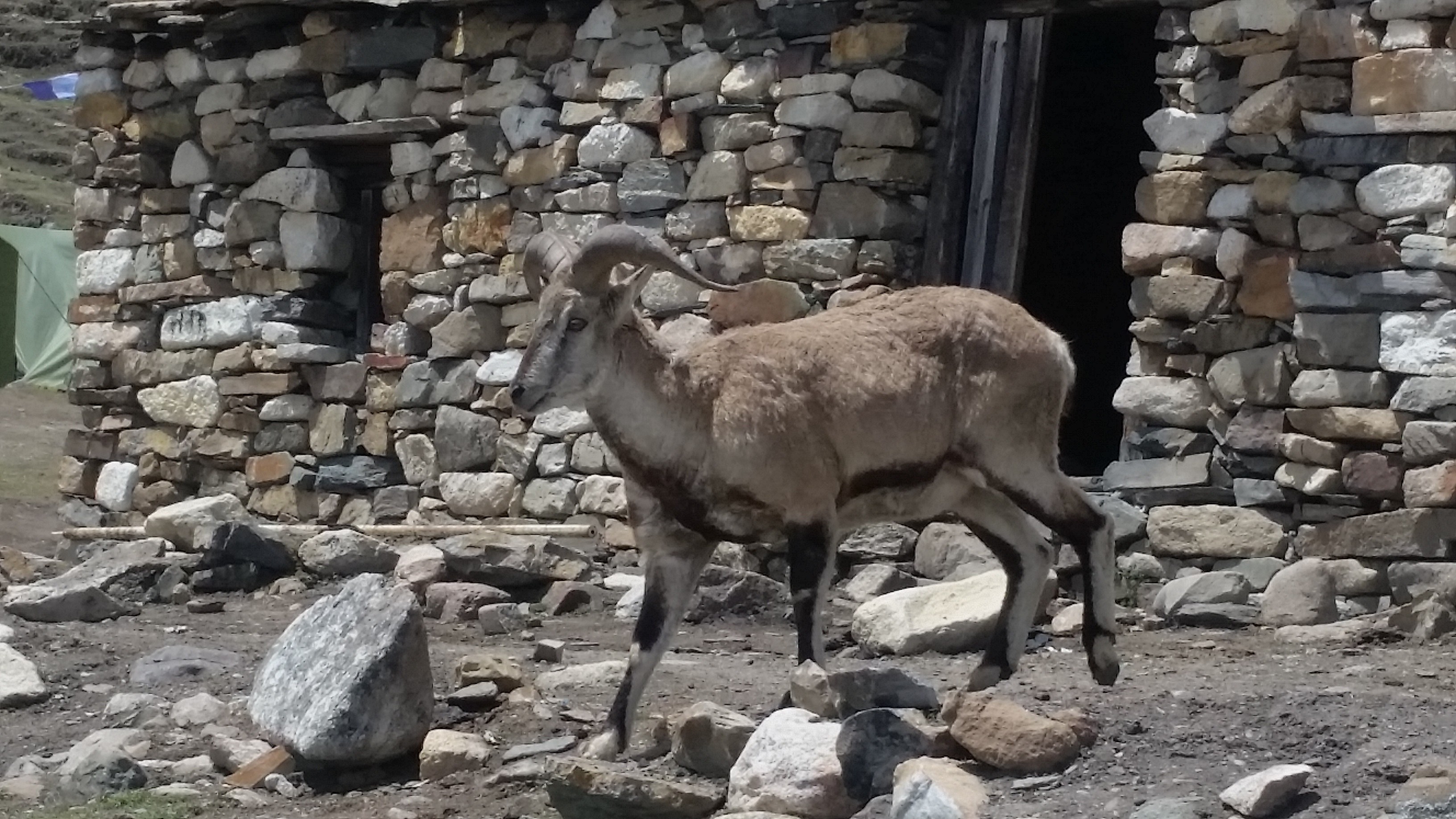
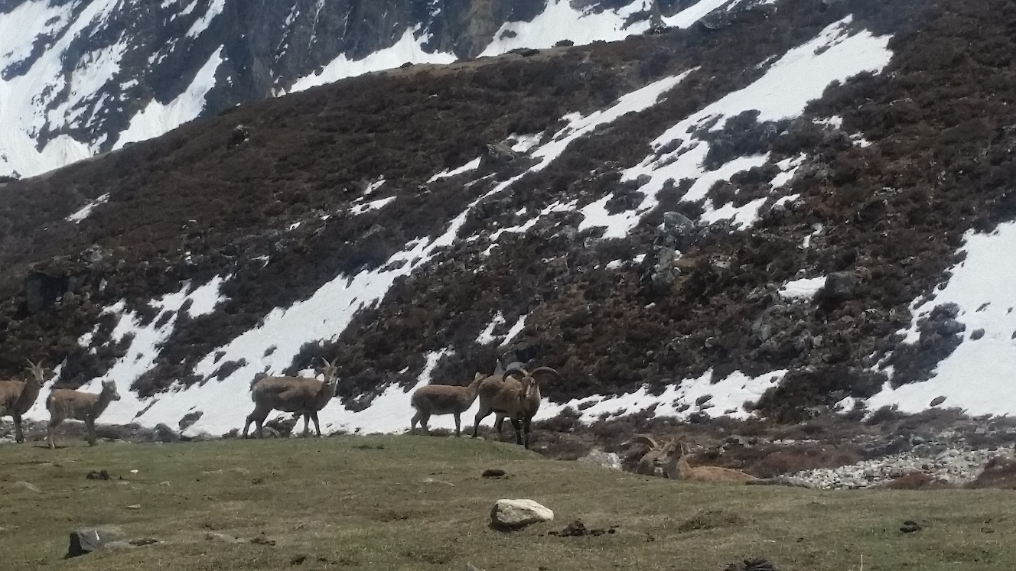
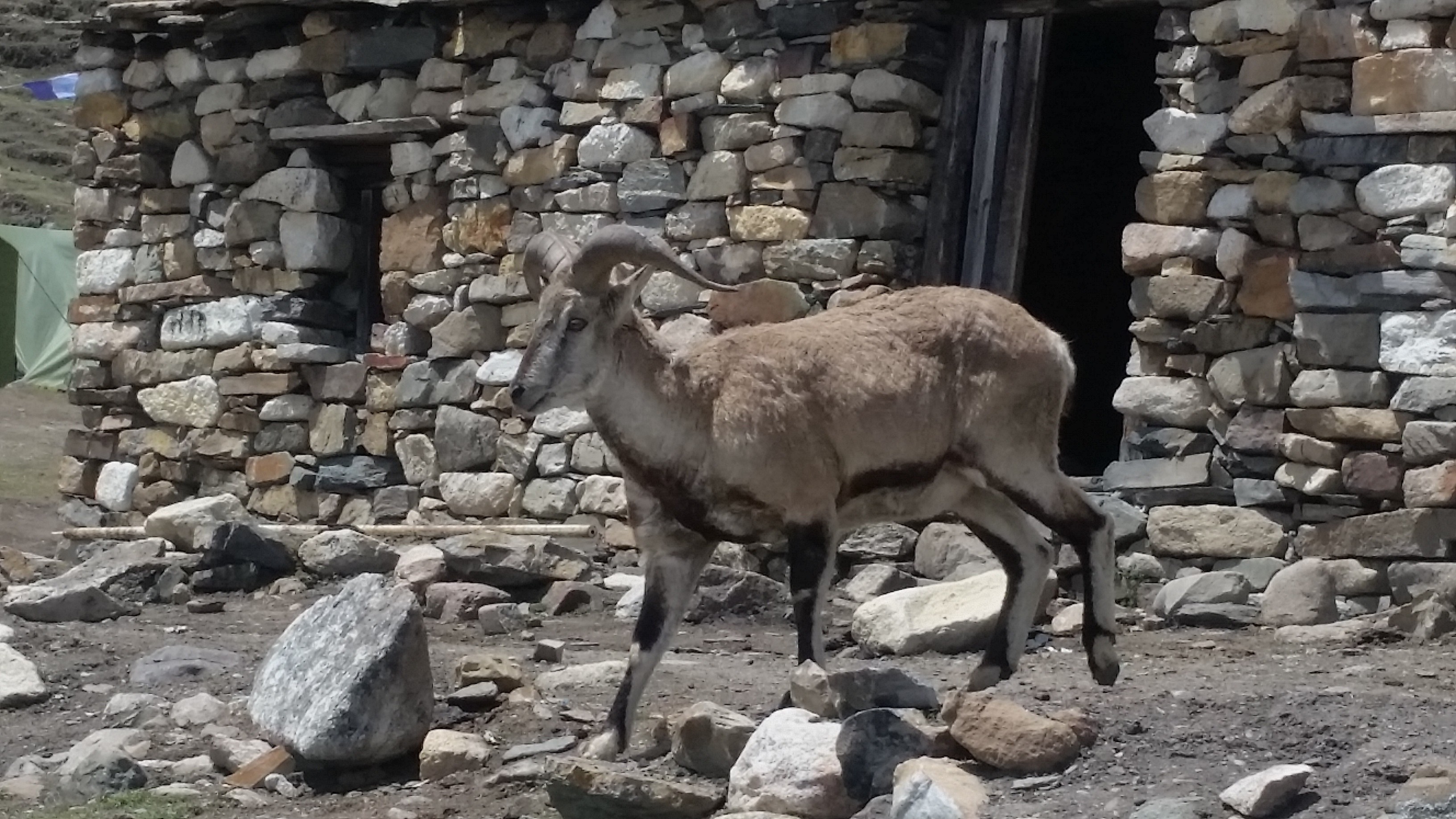
Manaslu Trek: Blue Sheep in Manaslu Dharmashala

Nubri Valley also connects with Manaslu trek. Nubri valley still follows the traditional culture, art and it is untouched by the modernization.

Weather and Difficulty in Manaslu Region

Manaslu trekking is one of tough trekking compared to other mountain treks. The best time to visit Manaslu is Autumn and Spring season. Autumn months starts from October to November and March to May.

The weather on this season is pretty much fine than other seasons. In Monsoon and Winter seasons it hard to trek in Manaslu due to the rainfall and high coldness. 

So How to start your Trip?

Firstly, the question might strike in your mind about How to start your Trip? It’s not that difficult; you can contact Nepal Sanctuary Treks.

Nepal Sanctuary Treks is the best trekking agency of Nepal. We would be glad to consult you via phone, Whatsapp or email if you feel further discussion. Our trekking professional will assist you to provide proper guidelines, process and more information on Manaslu trek.

Nepal Sanctuary Trek contact details:

Nepal Sanctuary Treks

G.P.O Box 5493

House No. 1246, Lamtangeen Marg, Chundevi-4, Kathmandu

Tel: +977-1-4426721, 4431610, 4434542

Email: info@nepalsanctuarytreks.com, gtulsi@wlink.com.np

Manaslu | A wonderland | 10 facts that will amaze you.

Manaslu trek offers an off-beaten trail experience in the Himalayan Region. Manaslu is famous for small teahouses along the Manaslu trek.
The Manaslu trek exists 40 miles away from Kathmandu to the east of the Annapurna region. The name ‘Manaslu’ means ‘the mountains of spirit.’
The word ‘Manaslu’ came from the Sanskrit word ‘Manasa’ which means intellectual or soul.
Manaslu trek offers the spectacular beauty of a perfect blend of nature, the lifestyle of local people, and stunning views of breathtaking mountain ranges in Manaslu region.
Every year, many foreigners accomplish Manaslu Circuit trek. Manaslu trek leads you to Nubri and Tsum valley, which is the hidden treasure of Manaslu.
Blue sheep in Manasulu dharmasala

Eighth-Highest Mountain in the World

Manaslu is the eighth-highest mountain on the earth at 8,163 meters (26,781 ft) and opened in 1992 A.D. It is located in Mansiri Himal, part of the Nepalese Himalaya region, in the west-central of Nepal.
Now, Manaslu Trek is controlled by the tourism board and under the restricted trekking trail of Nepal. Before planning to Manaslu trek, trekkers need to take permission from the Manaslu region.
It has the eye-catching views of the long ridge mountain range near Manaslu including Nagdi Himal, Himalchuli, and Boudha Himal.
Manaslu is the highest peak in the Gurkha district. Manaslu offers much trekking in the Annapurna region. The trekking follows the trail, an ancient salt-trading route along with Buri Gandaki river.
The trail starts from Arughat, the small town bazaar, and ends in Besisahar.

Manaslu is Famous for small tea houses

Manaslu is also known for tea houses. The tea houses are built and managed by the local people. Local people make money by selling food and providing a night’s stay for trekkers with charges or fees.
The small tea houses make this trekking more famous.
Trekkers can take a rest and have a cup of tea there. Also, tourists love to stay there and get opportunities to know closely about their lifestyle. Dal Bhat is the most famous food all around Nepal as well as in the Himalayan region.

First climbed Mount Manaslu

Toshio Imanishi and Gyalzen Norbu were the first to climb Mount Manaslu on 9 May 1956.
Before them in 1950, H.W. Tilman was the first European who made his attempt after he unsuccessfully trekked to Annapurna IV.  
In 1952, a Japanese reconnaissance party reached around 5275 meters after the monsoon season on the east side of the mountains.
In 1953, the Japanese team of 15 climbers led by Y. Mita via the northeast face K. Kato, J. Yamada and  S Ishizaka made a summit around 7750 meters before turning back.
After them; many Japanese teams climbed the summit of Manaslu but got failed. Mount Manaslu is called Japanese Mountain and is also known as Killer Mountain because of its frequent icefall, and high altitude trekker gets sick or killed.
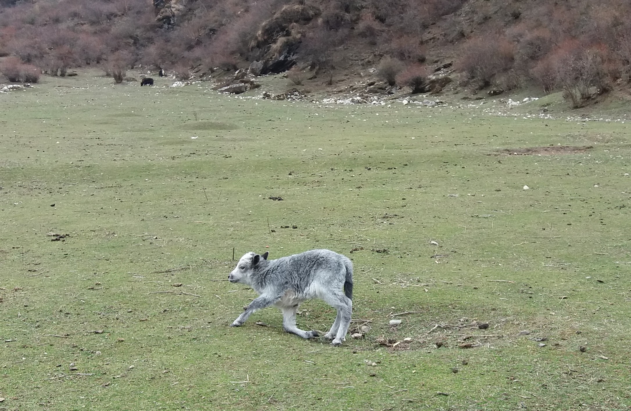
Yak Calf Samagaun

 Historical places

Mount Manaslu, which is located in the Gurkha district, has lots of historical places including the Manakamana Temple and Gurkha Durbar.
It is a beautiful and adventurous trek with stunning views of Manaslu and passing through many Hindu and Tibetan villages.
The trek also passes through the beautiful green forest, ancient architecture, and Buddhist Monastery where many children studied to be a monk.

Ethnicity and religion

Manaslu shares much of the culture and history with its neighboring territory, Tibet. Manaslu has two ethnicities mainly inhabitant this region: Tsum and Nubri.
Gurung is the main ethnic group that has joined the Brigade of Gurkhas in huge numbers. Close to Tibet, The Bhutias and akin to the Sherpa groups follow the Tibetan ethnicity.
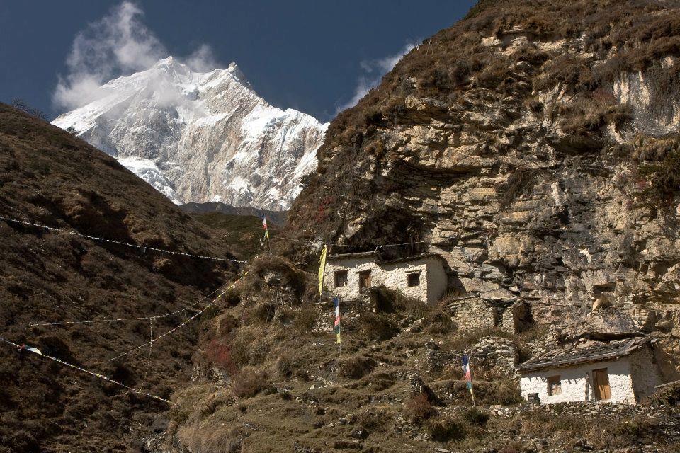
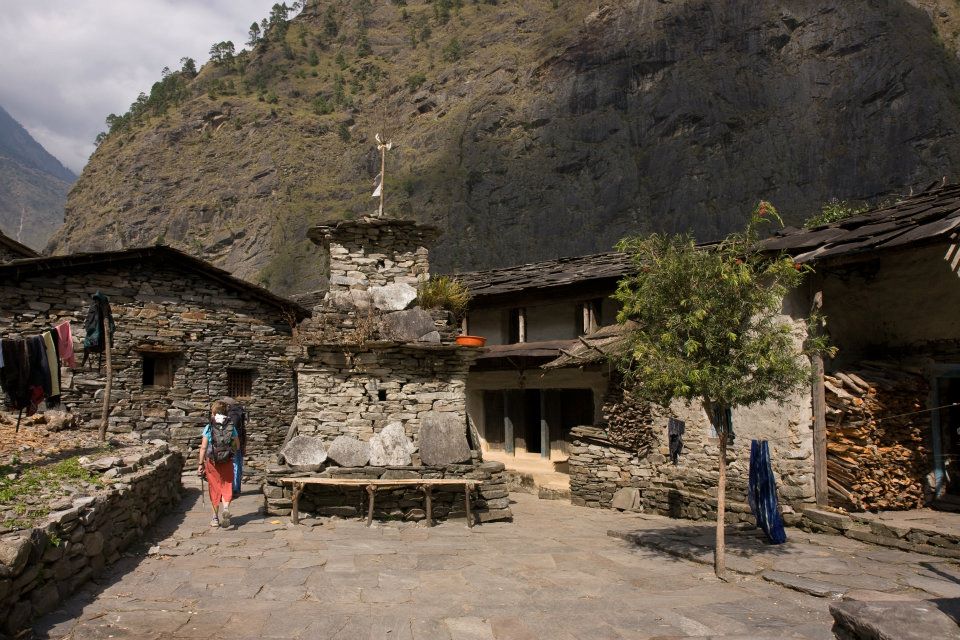
Rich in tradition and culture. The local people live a traditional lifestyle and with unique houses, that have walls built with stones and roofs with stone slabs. Due to the earthquake, many houses have been destroyed and are still under construction.
Their main occupation is agriculture and animal husbandry such as barley, maize as crops, and oats and nuts as fruits. Local people also make income from the lodge and small tea houses. Local people are mostly from Tibet and speak their own languages.
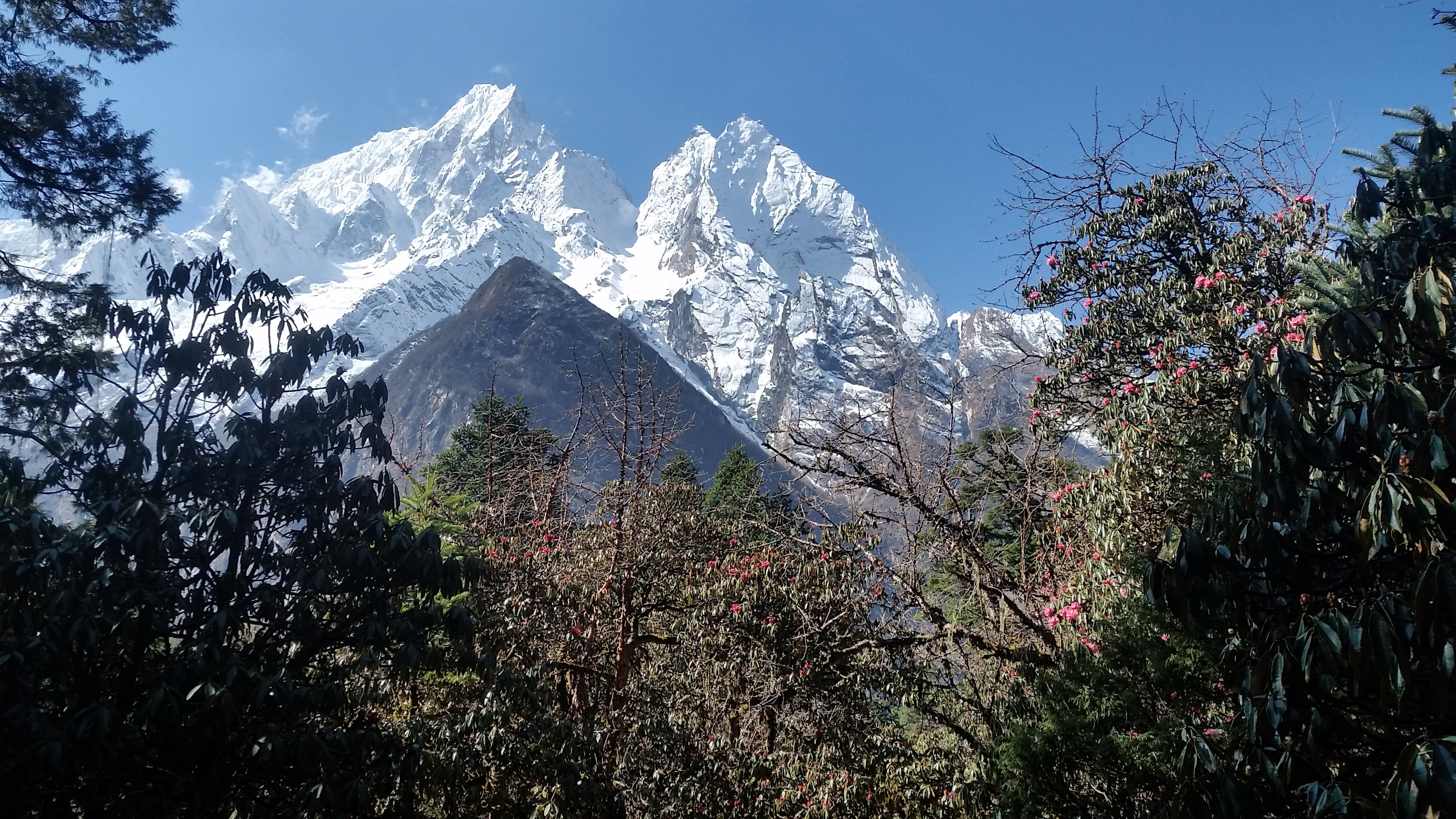
Manaslu Rhododendron

Geographically amazing

Manaslu trekking is geographically spectacular and fabulous. Manaslu region which is also termed the Manaslu Conservation Area comprises subtropical Himalaya foothills to arid trans-Himalaya high pastures border in Tibet. Starting from Arughat and extending into Larkya La Pass.
The area covers six climate zones; the tropical and subtropical zone varies in elevation with different altitudes. Elevation varies starting from 1000-2000 meters, the temperature zone(2000-3000 meters), the sub-alpine zone (3000-4000 meters), the alpine zone(4000-5000 meters) meadows, and the arctic zone of ranges lying above 4,500 meters.
The temperature of Manaslu also varies widely according to the climatic zones. The snow always covers above 5000 meters of elevation, and as the level increase, the air pressure becomes low.
The trekking route is through mountains prone to the consequences of monsoon rainfall, landslides, and landfalls.

Rich in Bio-diversity

Manaslu region is highly habitat with various flora and fauna, including endangered animals such as snow leopard and Red Pandas.
Other animals such as gray wolf, Himalayan musk deer, blue sheep, Asian Black Bear, Langur monkey, and over 110 species of birds, 33 mammals, and some reptiles are also found.
These species make the region more beautiful and melt human hearts too.
Conservation of wildlife in the area has been done by monks of the monasteries in that area by banning hunting.
The elevation categorizes the hills. For example, Low Hill, Medium mountain, and High Mountain with exclusive forests and a variety of species.
There is not much vegetation of variety. The valley basin has a rich ecotone diversity including nineteen types of forest and mostly rhododendron and Himalayan blue pine which is flanked by Ganesh Himal and Sringi ranges.
Himalayas manaslu trek

Tsum Valley and Nubri Valley

Manaslu region has mainly two inhabitants valley: Tsum Valley and Nubri Valley.

Tsum Valley is one of the remote areas of Nepal. Tsum has a long history of Buddhism. Tsum is also known as ‘Tsum Tso Chuksum’ which means thirteen provinces ruled as a single territory. Still, the ancient Tsum Kingdom remains, and the village has a unique traditional culture.
Tsum Valley Trek in the Manaslu region has beautiful views of four 7,000 meters peaks of the Ganesh massif, and also visitors can experience the distinct Tibetan culture of Tsumba people.
Nubri Valley is the next remote place in the region. Nubri valley has virgin beauty and is still untouched by modernization.
The local people follow their traditions, culture, and art. The local people wear traditional clothes and speak their language. The ancient trail along with mixed cultures, especially the Tibetan, and great hospitality.
Small tea houses and lodges are available in this area. The ancient old Buddhist monastery is established which gives a glimpse of Buddhist culture.

Larkya La Pass

Larkya La pass, also known as Larke Pass is at the maximum altitude of 5,106 meters where trekkers get jaw-dropping views of Mount Manaslu, Ganesh Himal, and other mountain ranges.
Although Larke Pass is at a lower elevation than other Passes like Thorong La Pass, Chola Pass, it is more difficult because of its long walk and the higher elevation.
Besides, descending from Bimtang is more technical and climbing.
Manaslu trek 2

A difficult but adventurous trek

Manaslu is the most difficult trek in comparison to Annapurna Circuit Trek. Manaslu region has few trekkers that make the visit more exclusive and unspoiled and presents the virgin beauty of Manaslu.
But the difficult trail to Manaslu is paid off as trekkers see the spectacular view of snow-capped Himalayas ranges, the traditional villages, local people with unique customs and cultures, and yaks in the upper hills.

Manaslu Circuit Trek: Itinerary

The Manaslu Circuit Trek is one of the unexplored trails that encompass a peaceful, natural and beautiful experience that is ideal for those seeking a getaway from bustling life.

Manaslu Circuit is getting popular as a new trekking destination. Mt. Manaslu is the eighth highest mountain in the world; it is in the very center of the Nepalese Himalaya and to trek around the base of this giant mountain along with its isolated trail is probably one of the best treks.

Manaslu Trek-1

The trail traverses through pristine areas where you will witness the beauty of nature and picturesque village of Tamang and Sherpa settlements with their unique culture.

The Manaslu region is well-known for its high altitude glacier lakes, a diverse range of flora and fauna and charming cultural region.

This trek suits best for those who are looking for challenging trekking in a remote area of the Nepal Himalaya. 

The highest point of this trek is Larkya La pass (5,135m/16,847ft), and trekking around Manaslu offers a unique opportunity to experience an untouched region of Nepal.

Manaslu trek 2

Trek can be 14 days that begins at Arughat and ends at Besishar.  The best season to visit the region is from March to May in spring and September to December during the winter.


Trip Highlights:

The maximum altitude is 5160m/16929 feet.

 The fascinating backdrop of Manaslu & surrounding Himalayan range.

Cross many suspension bridges over the different rivers, including the Budhi Gandaki River and several Mani walls on the way.

Manaslu Trek 3

Observe the traditional village lifestyle and culture.

 Tibetan culture and high pass crossing Larke La (5210m).

Experience walking through pine, rhododendron and bamboo forest and enjoy the nice view of the waterfall


Itinerary:

Day 1:  Kathmandu-Arughat (550 m/ 1804 ft) 7 hrs drive and further 1 ½ more to Soti Khola (597 m/1958 ft)

Our destination start for today is Arughat, which is about a 7-8 hour drive from Kathmandu. During the drive, we enjoy scenery landscape along with the Mountain View.

We will be driving on a paved highway from Kathmandu to Dhading Bensi, and then drive from Dhanding Bensi to Arughat on a bumpy road passing through bamboo forests and Gurung villages.

Upon reaching Arughat, we drive further towards Sotikhola. Overnight at Sotikhola

Day 2   Trek to Macha Khola  [900m/2952 ft]: 6 – 7 hours

In the early morning, we continue our trek by traversing the bridge, and we trek through the Sal forests and ascend onto a ridge above huge torrents on the Budhi Gandaki and continue to Korsani.

Manaslu Trek 4

The trail now gets a bit more difficult as we ascend over a huge rock and pass a brook on a single log bridge then weaves its way up and down again to the banks of the Buri Gandaki.

It continues up a steep rocky track to the Gurung village of Labishe. From Dobhan, we climb following a rocky ridge to old school from where the valley widens.

Then the trail descends to a tropical waterfall with a wooden bridge. The trail climbs over another ridge and dropping to the sandy river bed.

We walk along with rounded stones before ascending over a side ridge. We move down again to the river and traverse one more suspension bridge to reach Machha Khola village.

We stay overnight at ManchaKhola

Day 3   Walk to Jagat [1410m/ 4625 ft]: 6 – 7 hrs

From Korlabesi there is a sharp climb to a ridge and after a few additional ups and downs from here will take us to Tatopani hot spring.  

From hot spring, we climb over another ridge and cross a suspension bridge over the Buri Gandaki. At this point, we climb the wide stone stairway to Dobhan.

Manaslu Trek 5

The trail gets quite rough and starts by ascending to two teashops at Duman, then we cross the landslide area, and after some ups and downs through the narrow valley, it reaches a large field.

There is some jumble over gravel slope until we decline to the wide river valley. After crossing a suspension bridge, the trail ascends a set of stone stairs, drops to the river and ascends once again to Thado Bharyang.

Crossing the west bank of the Budhi Gandaki, we climb over a ridge, trek along the river and then climb towards the village of Jagat.   We stay overnight in Jagat.

Day 4:  Trek to Deng (1,860m/6,102ft) 6-7hrs

There are good views of Shringi Himal as you walk along the side of a cliff. Today we will set off our journey to Salleri by climbing over a rocky ridge to Salleri and move down to Sirdibas.

The trail descends to Setibas where the Mani walls (prayers engraved into wayside rocks) show that we are entering a region with increasing Tibetan influence.

Manaslu Trek 6

The valley widens a little and continues past the stone houses of Ghattu Khola, We continue to Ghatta Khola and then walk upstream through a long suspension bridge to reach a Gurung village in Phillim.

And then turns north just above the lowest houses in the village and stays fairly level until Serson. Further Serson the trails enter a steep gorge and descend through grassy slopes, to cross the wooden bridge at the river’s narrowest point; below you will see the convergence of the Shar Khola and Buri Gandaki rivers.

The village of Nyak is located close to here. As the trail widens, we pass through bamboo forests to reach the Deng Khola. After crossing the river, we reach the Deng village where we overnight here.

Day 5: Trek to Namrung (2,540m/8,333ft) 7-8hrs trek

We take a short walk from Deng and the trail traverse back over the Budhi Gandaki and climb Rana at 1910m. After a short climb from the bridge before heading west on level ground and we pass the large waterfall.

 Once we cross the wooden bridge, the trail curve up and out of the canyon and ascends over the river before dropping into the Shringi Khola Valley.

After crossing the suspension bridge over the Shringi Khola, there is a sharp climb, and the trail passes along the Buri Gandaki.

Manaslu Trek 7

The trail passes through forests and painted Mani stones and a corner from where we reach Ghap. You pass more Mani walls on the southern part of the river.

The trail climbs along the river, passes a waterfall and continues all the way through dense rhododendron forests with a wooden bridge in the middle which crosses the Buri Gandaki.

The trail continues along the north side to a big cave and then crosses the river at a narrow gorge where you can see grey Langur monkeys.

The forest becomes less dense, and the trail is leveled once we cross the river at a gorge. After an enjoyable walk, we then continue a final steep climb that will take you to our destination to Namrung through a stone archway where we stay overnight.

Namrung is the greatest viewpoint for Siring and Ganesh Himal as well as Mt. Himal Chuli.

Day 6: Trek to Samagaon [3530m/11,578 ft]: 6-7 hours

Manaslu Trek 8

The trail traverses the ridge onto the Buri Gandaki Valley side and followed by descending to a rock scattered moraine.

We further pass through extensive meadow and fields near Sama gompa after crossing some rocky trails. You will get the opportunity to explore a small part of Tibet with numerous Gompas and an authentic Tibetan village.

The village is settled perfectly against a wooded moraine at the end of the valley. We will rest overnight here in the village.

Day 7:  Acclimatizing day at Samagaun

We will take a break to rest and acclimatize to the increasing altitudes. We stay in Samagaon and explore the surrounding areas and traditional Tibetan community from where we will be able to see beautiful views of Manaslu.

  For the people who don’t want to hike can rest and explore the village. We will come back to the village and spend overnight at Samagaun.

Day 8: Trek to Samdo [3860m/12,660 ft]: 4 – 5 hours

On the eighth day, we follow to the Budhi Gandaki River, which turns north and crosses the suspension bridge over a side stream. The trail to the left takes us to the Manaslu Base camp.

Manaslu Trek 9

We then trek all the way through Larkya La trail we come across through numerous Mani walls. The valley broadens along an easy trail on a ridge above the river passing the juniper and birch forests to the stone huts at Kermo Kharka.

We then descend a ridge to cross a wooden bridge and ascend between diverging in the river to a headland. From this viewpoint, one can see the white stone Kani marking the way into Samdo.

Day 9: Rest and acclimatization day at Samdo (3,860m/12,660 ft)

This is another day to take a break for proper acclimatization. You can either take a rest or walk towards Gya La (‘large pass’) to the north of Samdo, which is the frequently used trading route to Tibet.

However, it takes an entire day to walk to Gyala and hence could be a bit exhausting. We overnight at Samdo.

Day10: Trek to Larkya Rest House (4,470m/14,665ft)

Today we begin the climb to the pass along the traditional trade way to Tibet. The broad trail descends you to fields to a huge old Mani wall and stone huts, dropping to the river and traverse it on a wooden bridge at 3850m.

This place shows up on maps as the legendary Larka Bazaar, which used to be a prosperous market.

Manaslu Trek 10

A Mani wall marks the beginning of the climb to the pass where the trail starts climbing through tundra and juniper; you can see the huge Larkya Glacier coming from Manaslu.

Continue on the ridge to the right to find a trail that traverses over the top of two gorges. As you climb up the side of a gorge to a viewpoint at the edge of a huge gorge at 4000m, the trail grows steeper.

Climb in and out of the gorge and contour to the only shelter on the way to the pass which is a rest house at 4460m. 

Day 11: Cross the Larkya La (5,135m/16847ft), trek to Bimtang (3,590m/11778 ft)

On this day we make a long gentle ascend across the moraine, and climb down to a lake and then trails become rough as it traverses to the south of steep, and lush slopes.

The trailhead towards the moraine to a ridge marked by two cairns, from here the prayer flags marking the pass can be seen. We then descend to the four frozen lakes then take a final steep climb to the pass.

Manaslu Ttrek 11

When you go down from the pass, the trail continues the top of the moraine to the west and passes through many sharp ascents and descents. As we cross the moraine then descends more lightly on wobbly gravel to another grassy moraine at 4,450m.

The trail now becomes easier to continue and reaches a small pasture at 4,080m. As the trails head down to a large meadow, the valley becomes broader where we pass Mani wall and a small rest house that marks Bimthang at 3,590m.

We stay overnight at Bimthang, a huge valley surrounded by high peak


Day 12: Trek to Tilje [2300m/7544ft]: 5 – 6 hours

From a ridge at Bimthang, we can view vistas of magnificent Mt. Manaslu, Lamjung Himal, Himlung Himal, and Cheo Himal.

The trails descend further and pass high pasture (Sangure Kharka) followed by a bridge over Dudh Khola.

Manaslu Trek 12

We then cross a wooden bridge and descends into pine and rhododendron forest to Hompuk at 3,430m and follow a trail through a narrow valley until we reach the highest cultivated land of the valley at Karche, 2785 meters.

 From there we pass a landslide before a steep climb over a ridge decorated with prayer flags. It makes a drop to the river bank at Gho. The trail follows through fields and takes to you at Tilje, a large Gurung village.  

We overnight in Tilje village.

Day 13: Trek to Chamje (1,430m/4691 feet)

Today we leave the village behind through a stone arch, traverse the Dudh Khola and follow along its embankment downward through the forest.

As we walk along, we see the Marsynagdi valley with its terraced fields and villages, and finally, the houses of Dharapani become visible in the distance.

Manaslu Trek 13

We cross Thonje by passing through a wooden bridge and a chorten-shaped arch, and we make our way to Dharapani by crossing a long suspension bridge over the Marsyangdi.

This is a trail where we enter the Annapurna Circuit route in reverse as you lead through the steepest part of the Marsyangdi gorge.

Day 14: Transfer to Besisahar and private transfer back to Kathmandu

 From Dharapani we take the vehicle to Beishar which takes 4-5 hours. 

Manaslu Trek 14

We pass all the way through the banks of Marsyangdi and Trishuli River, enjoying the scenery and refreshing views of the hilly areas and mountains on the way back to Kathmandu.


10 Best treks in Nepal: Read to know what you need Exactly

Nepal is the most beautiful country nestled by several Himalayas ranges. Nepal is a popular country for trekking all over the world. It is home to world’s highest peak and also largest lake, glaciers, lush hills and dwindling white river.

It is a  perfect choice who love to trek and explore. More than 200,000 tourists visit Nepal every year. Nepal has always been on the top list for mountain trekking. It is also popular for the ancient heritage, old culture, traditional lifestyle and natural beauty.

During the traveling, you can experience the views of the breath-taking mountains, beautiful green forests, wildlife and thrilling rough and tough terrains and heights of the hills. Also, you will get chance to know the different culture and life at different places.

Nepal is small in geographically, but it has huge, diverse land terrains. It’s a one time opportunity to explore yourself trekking in Nepal.

If you had lots of experience in trekking and want to trek in next level, then you can trek to Himalaya region such as Everest Base Camp, Annapurna Circuit Trek, Upper Mustang and others mountain region. Or if you are looking for both combination of cultural and adventure trek; you can treks like Poonhills, Gandruk, lower Mustang, Shivapuri and several others.

Before going to the trekking, there is something you need to consider. You need to be physically fit and have enough knowledge about the trekking. The difficulty of trek depends upon a traveler’s physical condition. Short treks are considered to be easier while longer treks require some mental and physical fitness. The trekking usually requires 5-6 hours of walking per day and some days traveler even needs to walk up to 8-10 hours at high altitude. So sometimes training is necessary for few of the difficult trekking.

The things before the trek you need to consider and they are:

  1. Firstly, state your physical ability and mental wellbeing.
  2. The total duration of the trekking.
  3. Level of trekking difficulty that you are seeking.
  4. The trekking route; Tourists route or Non-tourist route.
  5. The complete budget of the trek.
  6. Season for trekking.
  7. Size of the group to trek.
  8. Trekking permits and necessary documents.

Here we have compiled 10 best treks in Nepal with their pros and cons. We have also tried to write some of the details of these treks. If you need additional information on these treks you can directly contact us from our Contact Us page or you can chat with us with icon below.  Hopefully, that will assist you to select the favorite trekking destination.

Everest Base Camp


View images here.

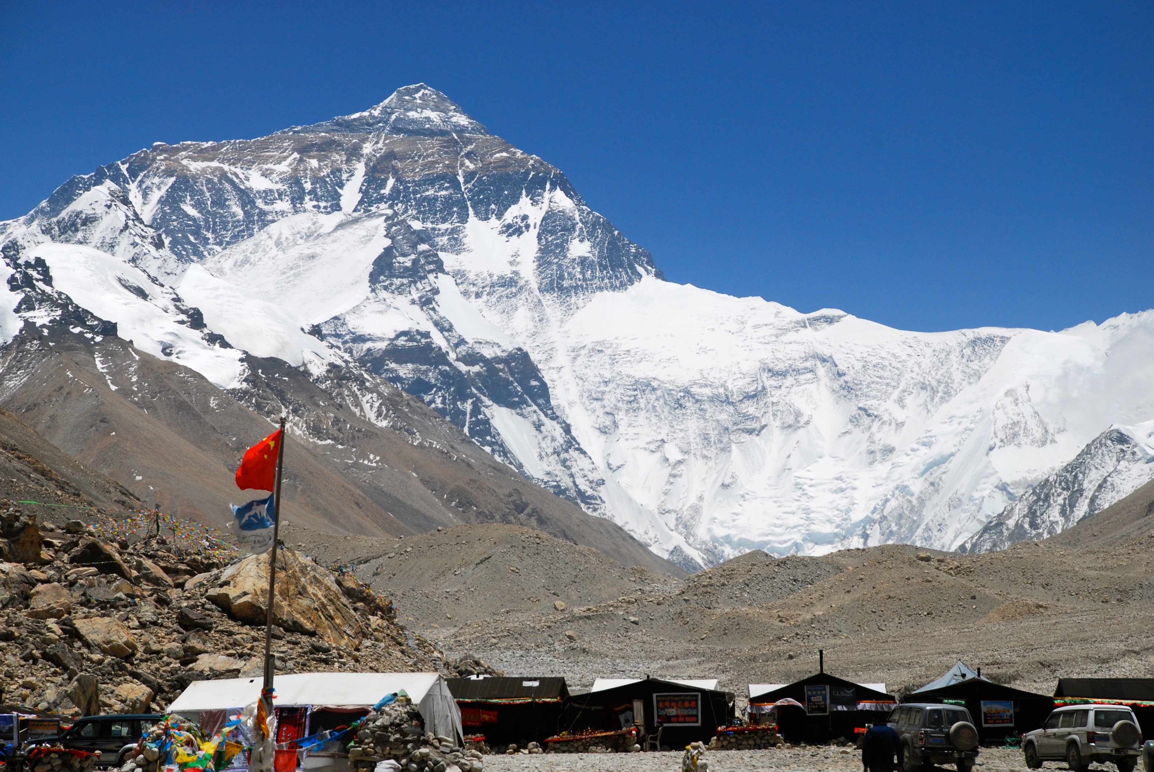
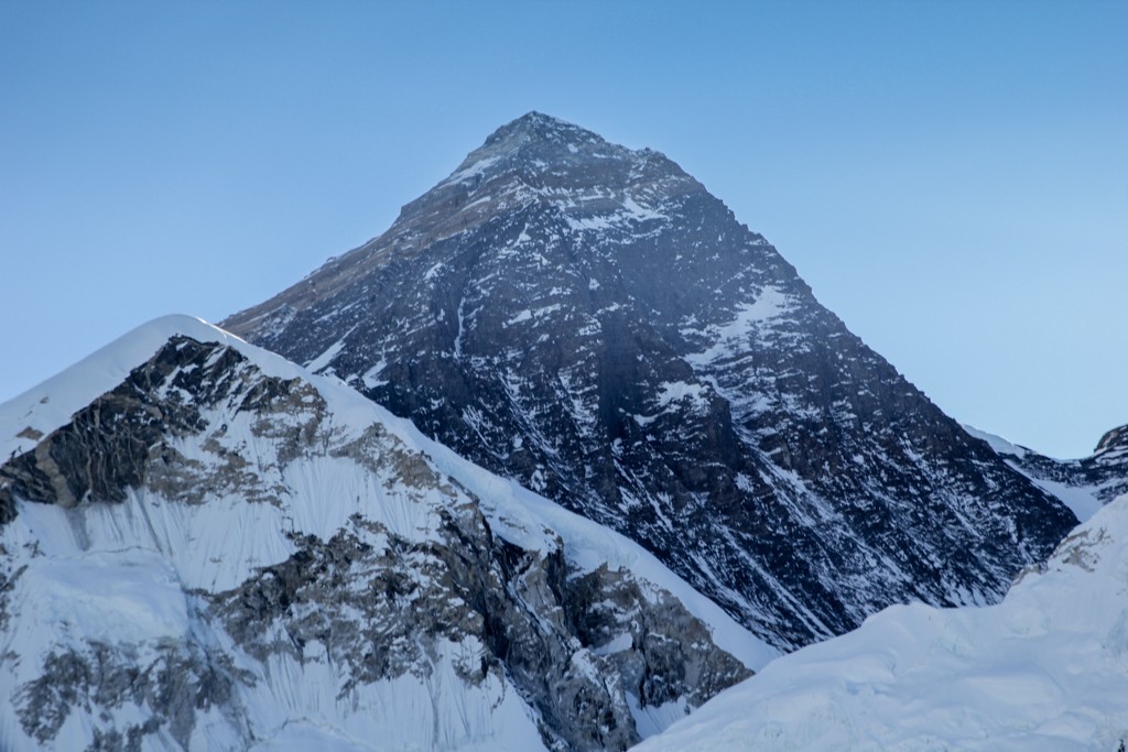
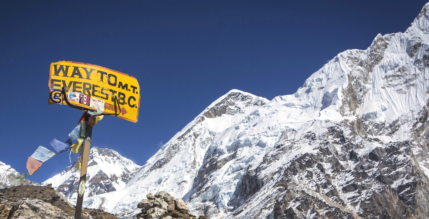
The world highest summit lies in Nepal at height of 8,848 meters tall. Everest Base camp is one of the best trekking destinations in Nepal. More than 25,000 trekkers trek to Everest Base Camp yearly. Due to its popularity, the base camp is a bit crowded during the peaks climbing season. No doubt Everest base camp is onf the best treks in Nepal.

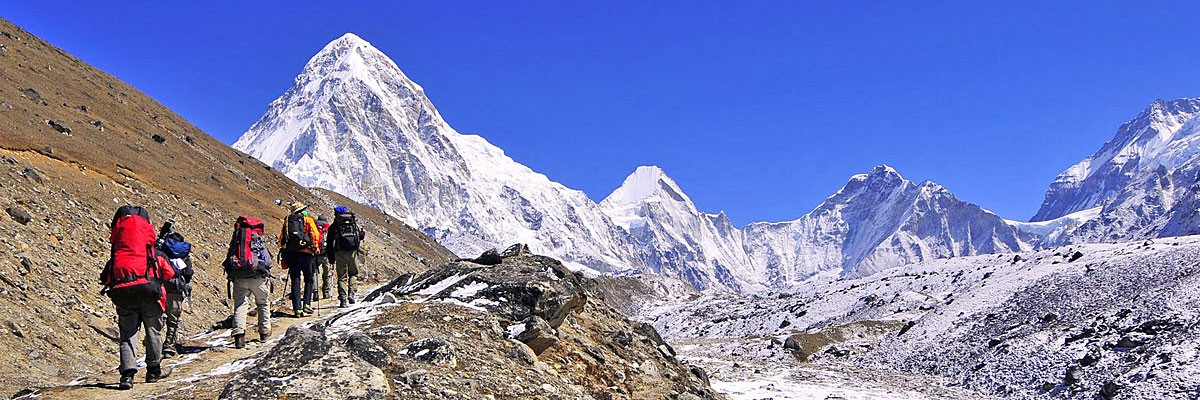
While trekking, you get an opportunity to look closely at the lifestyle of the Sherpa people living in that region. During the trek, you will see many Buddhist Monastery, prayer flags, suspension bridge, traditional houses and magnificent jaw-dropping view of mountain ranges.

Everest Base Camp Highlights:

  • Close view of Mount Everest(8,848m)
  • Amazing view of Mt. Kanchenjunga, Mt.Lhotse, and Mt. Makalu.
  • Visit old Buddist monastery of the region.
  • A close look at Sherpa Village and their traditional lifestyle.

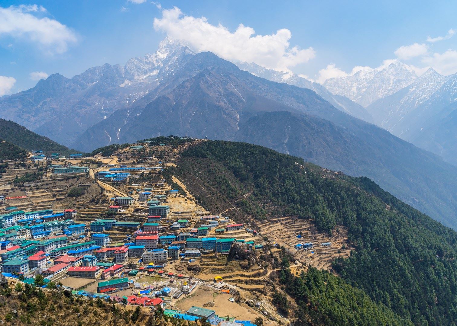
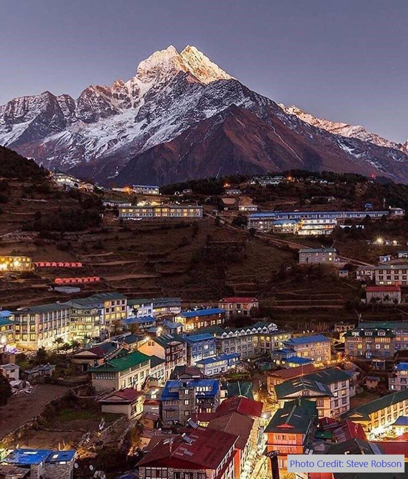
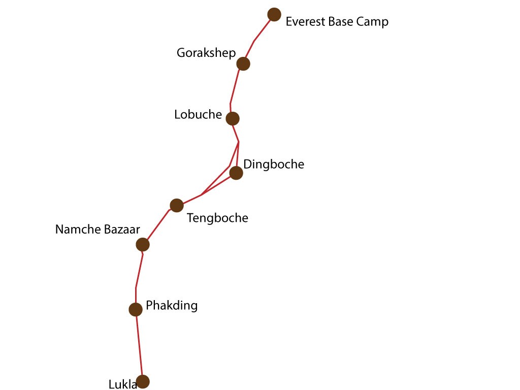
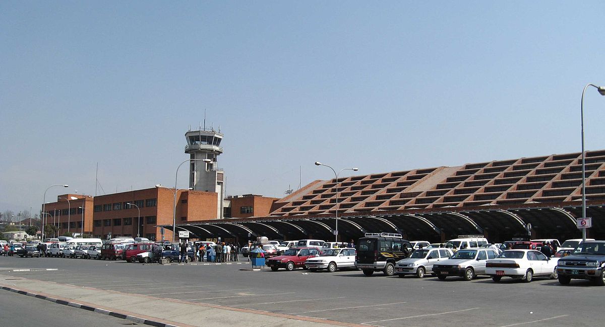
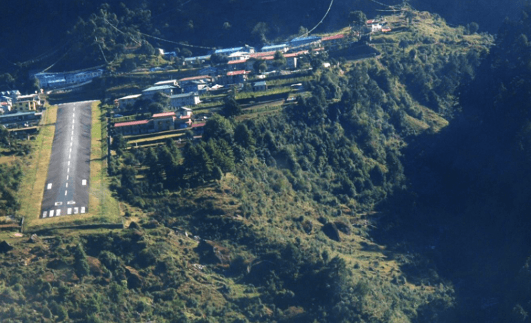
To get in the Everest Base Camp fly to Lukla from the Kathmandu airport and trek from Lukla to Namche Bazaar to Everest Base Camp. Namche Bazaar is the gateway to Everest Base Camp.

Trekking Details:

  • Maximum Height of Kalapathar at 5,600 m.
  • Best time to trek: Autumn(October to November) and Spring(May to June)
  • Trekking days: 14 days to 16 days
  • Trekking Difficulty: Medium
  • Trek permits.
  • High-Price

Annapurna Circuit Trek

Trekking in Annapurna Base Camp

This image was clicked by our One of our Trekking Guide Gopal Lama. You can view more images of ABC here

Annapurna is the second best trekking route of Nepal. Annapurna is the tenth highest mountain on the earth at the altitude of 8,091 meters. Annapurna Trek cross two different valleys and encircle the massif Annapurna.

Trekking to the Annapurna, you will see the beautiful Annapurna mountain ranges like Dhaulagiri, Machhapuchre, Manaslu, Gangapurna, Tilicho Peak, Pisang Peak, Paganda Peak and spectacular sunrise view. Also discovery the Hindu holy sites and Buddist along the way;  Gurung villages with lush green forest, the lifestyle of the local people and their unique cultural heritage. Annapurna Trek crossing through the point at Thorong La pass (5,416 m).

There are four regions that passed through on the trek; Lamjung, Manang, Mustang, and Myagdi. Annapurna treks begins from the Besisahar or Bhulbhule in Marsyangdi river valley and concludes in the Kali Gandaki rivers. The trails pass through the various villages, Subtropical forest, several waterfalls and gigantic cliff along with paddy fields. That is why Annapurna Base Camp is considered is one the best treks in Nepal.

Annapurna Circuit Trek highlights:

  • Breath-taking mountain views of Annapurna I, Annapurna II, Annapurna III, Annapurna IV, Himchuli, Machhapuchre, Dhaulagiri and others mountain peaks.
  • Walk through the subtropical forest including oak, bamboo and rhododendron trees, Buddhist villages and Hindu holy sites.
  • Crossing the widest pass in the world, Thorong La Pass (5,416m).

Trekking Details:

  • Highest elevation- 5,416 meters
  • Duration – 15 to 17 days
  • Very Commercial and busy route.
  • Best seasons- Autumn (October to November) and Spring( March to May)
  • High price
  • Trekking Difficulty- Moderate
  • There are many teahouses through the trek.

Poon Hill Trek

Poon Hill sunset view

This image of Poon Hill Sunset Gopal Lama. You can additional information here.

Poon Hill Trek is popular for short and easy trekking that you will explore major attraction during the trekking in just 5-7 days in Annapurna region. It is very exciting tours and takes you through the stunning panoramic views of mountains such as Annapurna, Dhaulagiri as well as others Himalayan ranges. The short trail continue through the forest of rhododendron and bamboo and takes through Gurung and Magar villages. You can not miss Poon Hill when talking about best treks in Nepal.

25 minutes of flight from Kathmandu to Pokhara. The trek begins from Nayapul heading towards Tikhedhunga. Then Tikhedung to Ghorepani to Poonhill and head back to Tadapani to Gandruk to Pokhara.

Poon Hill Trek Highlights:

  • Best Sunrise and Himalayas view.
  • One of the biggest settlements of Gurung and Magar
  • Stunning view of Dhaulagiri, Annapurna ranges, Manaslu and other mountains.
  • Easy and short trekking in Annapurna region.

Trekking Details

  • Maximum height altitude of 3210 meters.
  • Trekking Duration- 5 to 7 days
  • Trekking Difficulty- easy
  • Best Season- September to November and March to May.
  • Price depends upon travel agency.

Langtang Valley Trek

Himalayas while in the Langtang trekking

View more images of Langtang and Gosaikunda Trek

Langtang valley trek is situated at a distance just 19 miles to the north of Nepal. It is popular as the valley of glacier treks. Langtang is a beautiful and one of the mesmerizing place to see snow-capped mountains. Langtang valley offers pine woodland forests, lush green slopes, stunning views of the Himalayas and rugged rock.

Langtang trek takes around 8-9 hours of drive from Kathmandu. The trekking starts point is Syavrubesi where you follow the Langtang river to Kyanjin Gompa and stay overnight then continue to Langtang Valley. Trek back to Kyanjin Gompa to Syabrubesi to Kathmandu. During the trek, you can visit ancient Buddhist monastery, the local villages where you can have a small talk to Tamang people who are very frank to tourist.

Langtang Trek Highlights

  • Langtang Valley Trek is also known as The Glacier of Trek.
  • Climbing the Tersko Ri Peak.(5,000 m)
  • Nice view of the Sunrise and Himalayas.
  • Ancient Buddhist Monastery and typical life of Tamang people.

Trekking Details:

  • Duration- 7 to13 days
  • Best Season- Autumn (October to November) and Spring (March to May)
  • Trekking Difficulty- Moderate
  • Price- reasonable
  • Accommodations- Hotel and lodge are available.

Manaslu Trek

Picture taken in Manaslu region

You can view more images like this in this link.

Manaslu is the eighth highest mountain in the world at 8,163 meters (26,781 ft) above the sea level, located in the Mansiri Himal in the west-central part of  Nepal. The name ‘Manaslu’ means ‘mountain of the spirit.’ Manaslu comes from Sanskrit word Manasa; it means intellect or soul. The Manaslu region was opened for trekking only in 1992 AD.

The Manaslu Circuit trek offers the stunning view of snowcapped mountain range and the ancient trail along with mix culture, heritage and hospitality of authentic Hindu and Tibetan-style Buddhist village. The trail follows the spectacular Burhi Gandaki River towards its sources.The highest point in this trek is the ‘Larkya La Pass’ at an elevation of 5,106 meters (16,752 ft).

The Manaslu Himalayan region is a adventures trek in Nepal. The beauty of Manaslu is unpredictable. The trekking to Manaslu area is considered one of the finest destination of Nepal. The area is highlighted by two culture; Gorkha which is the ancestral seat of the reigning Shah dynasty and the temple of Manakamana.

The Manaslu Trek starts from Kathmandu to Arughat about 5-6 hours drive. The trekking route for going and coming back isn’t the same route. You will go one route then return by another route.

Manaslu Highlight:

  • Manaslu is the most difficult trekking in Nepal.
  • The scenic view of the back Mount Manaslu, Ganesh Himal, Mt. Himchuli and other mountain ranges and the subtropical forest at the lower part through the Himalayas foothills to the high, cold and challenging crossing of the Larkya La at the elevation of 5,106 meters (16,752 ft).
  • Many tea houses are there for the trekkers, so they don’t worry about food.
  • Explore the traditional culture, rich heritage and the lifestyle of the locals.
  • Pristine Budhi Gandaki River Valley.
  • Scenic view while driving from Kathmandu to Arughat and Beshishar to Kathmandu.                                                

Trekking Details:

  • Highest altitude at 8,163 meters
  • Duration- 16 to 18 days
  • Best time- Autumn (September to November) and Spring (March to May)
  • Trekking Difficulty- Very Difficult
  • Trekking Permits

Upper Mustang Trek

Horses in Mustang Trek


You can view more images like this here.

Mustang is rich in the natural beauty, cultural heritage, and a historical place which situated in Dhaulagiri zone in Nepal. This beautiful land divided into two parts; the Upper Mustang and the Lower Mustang. The Lower Mustang is full of natural scenery, and Upper Mustang is popular for the adventurous trekking. Snowfall mostly in the winter season, visitors enjoy playing with snow during this season. The beautiful places lie in the Mustang district such as Jomsom, Kagbeni, Lo Manthang and many others. Muktinath Temple is a holy place for both Hindus and Buddhists. Within, Hinduism it is called Mukti Kshetra which means the ‘place of liberation or moksha’ and had 108 water taps.

Upper Mustang trekking was officially opened in 1992 with a limited number of trekker are allowed to visit there to protect the Tibetan Culture. Upper Mustang is then in the best trekking route even in the monsoon times. The best things to visit in monsoon is that local peoples are busy with everyday works and get the fabulous view of cliff mountains, beautiful hills, and snow-capped mountains. To reach Upper Mustang take a flight to Jomsom and treks to Kagbeni.

Upper Mustang Highlight:

  • Majestic views of mountain ranges like Nilgiri, Dhaulagiri, Tukche, Annapurna.
  • Get to see the old Buddhist monasteries, houses made by the stones, traditional culture of Tibetan and yaks.
  • Travel through landscapes of arid regions, barren edges, deep gorges, and mountain valleys and eroded rock faces.
  • Crossing through the two high peak Thorong La and Mesokanto La.

Trekking details:

  • Duration- 15 to 17 days
  • Best time- Autumn (September to November) and Spring (March to May)
  • Trekking difficulty- Moderate
  • Need trekking permits
  • High-price (Including accommodation, meals and other equipment)

Mardi Himal

Mardi Himal Trek

View more images of Mardi Himal on our Facebook Page

The Mardi Himal is newly opened route in the Annapurna region and also known as hidden treasure trek too. The Mardi Himal Trekking is a short, easy; well manage camping and tea house trek that discovery the beautiful view of Annapurna area.

Mardi Himal is least visited of the trekking peak, and this trek is the best destination to avoid the crowd. Though the availability of foods and accommodation on the route is at a bare minimum. Mardi Hima Treking is still an enjoyable trekking route which requires minimum efforts Mardi Himal Trek is about a week-long trip in the Himalayas with stunning views of snowy peaks through small Nepali Villages. It is an interesting trek compared to other popular treks in Annapurna region.

Mardi Himal is located to the east of the Annapurna Base Camp. Mardi Himal offers the spectacular view of Annapurna, Dhaulagiri, Machhapuchre (Fishtail) and Manaslu Himalayas ranges. Also, the natural beauty allows seeing the Nepal national bird-Pheasant, national flowers- Rhododendron, Musk deer, Snow Leopard, Himalayan Thar and many more wild animals and several plants which are used to make medicine.

Mardi Himal has different trekking route from beginning to the end of the trek. The trek starts from Phedi and ends in Lwang.

Mardi Himal Highlights:

  • Mardi Himal Base Camp is at 4500 meters marks the highest point of the Mardi Himal Trek.
  • The highest sleeping point on Mardi Himal Trek is at High Camp.
  • Mardi Himal Trek is popular the Annapurna Range where you can see amazing views of Machhapuchre (also known as Fishtail, 6,993 m), Annapurna South (7,010m), and Mount Hiunchuli (3,441 m).
  • Mardi Himal trek route has been popular over past five years, and Teahouse (guest house) has established there for visitors.

Trekking Details:

  • Highest altitude: 4500 meters
  • Duration – 8 to 10 days
  • Best time- Autumn (September to November) and Spring (March to May)
  • Trekking Difficulty- not too difficult
  • Trekking permits
  • Accommodation – Teahouse, lodge, homestay
  • Price depends according to travel agencies.

Upper Dolpa Trekking

Upper dolpa trekking`

Know more about Itinerary of Dolpa Trek.

The beautiful Dolpa is situated between Dhaulagiri region and the plateau Tibet. Dolpa is the most remote trekking route of Nepal which is opened in the 80s. Dolpa is most beautiful and still fresh trekking which never affected by the outer world. The trekkers visit Dolpa to mesmerizing views of the Himalayas such as Dhaulagiri, Annapurna Kanjirowa mountains. Treks pass through several Himalayas, Gompa Monastery, Jhunphal and also enjoy the beauty of the deepest glacier lake, Phoksundo lake in Nepal.

 It is not only the adventure treks but also a cultural treks. It is the mixture of Tibetan and Nepalese Culture.

 The Caravan was filmed in Dolpa region which was nominated in Oscar movie. Upper Dolpa was also mention in the books ‘The Snow Leopard’ by Peter Matthiessen, ‘Himalayan Pilgrimage’ by David Snellgrove and ‘Stones of Silence’ by George Schaller.

Upper Dolpa trekkings begins from Jhunphal (2,285 m/ 7495 ft). The trail passes through numerous terrains of mountain ranges, over the Numa La Pass (5,190 m/ 17,028 ft), until to reach Phoksundo lake at Ringmo village inside the Phoksundo National Park and finally terk to Jumla and end the trek.

Dolpa Trekking Highlights:

  • Hike in an isolated and less tourists region of Nepal.
  • Visit Phoksundo lake, the deepest lake in Nepal.
  • Stunning views of Kanjirowa mountain.
  • Unique and traditional culture of Himalayas people.
  • Visit ancient old Gompa Monastery.
  • The abundance of Wildlife including Musk Deer, Himalayan Blue Sheep and rare Snow Leopard which makes the environment more beautiful.

Trekking Details:

  • Duration- 25 to 27 days
  • Trekking Difficulty – Difficult
  • Best time- Autumn (September to November) and Spring (March to May)
  • High-price
  • Trekking Permits
  • Accommodation- Camping
  • Trekking Area- Very remote

Kanchenjunga Trek

Kanchenjunga is the worls’s third tallest peak at 8,586meters of the remote region which lies in the border of Nepal and India. The trail difficult due to it situated far north-eastern corner of  Nepal. Mt. Kanchenjunga to be one of most beautiful mountain massifs in the world. The name Kanchenjunga means ‘Five Treasures of The Great Snow’ which is In references of five summits which make up Kanchenjunga.

The 25 to 27 days of trails begins after fly to Suketar from Kathmandu. The journey has a unique insight of the rural Region of Nepalese lifestyle. Through the trekking, you discover Pipal Tress, villages, Limbu People famous for inventing Tongba, Oak and rhododendron forests, High terrains. Crossing the Mirgin-La Pass gives you views of Makalu, Chamlang, and Everest. After passing the Glacier, you will view of Kanchenjunga Peak from Kanchenjunga Base Camp.

Kanchenjunga Highlights:

  • Kanchenjunga Base Camp
  • Splendid view of Mt. Everest, Makalu, and Kanchenjunga
  • Crossing the Mirgin La Pass and Lapsang La Pass
  • Villages of Sherpa and Limbu

Trekking Details:

  • Duration-25 to 27 days
  • Trekking Difficulty- easy/ moderate
  • Best time- Autumn and Spring
  • Trekking Permits
  • Accommodation- Camping

Gokyo Valley Trek

Gokyo Trekking

Gokyo trek is situated in the west of Everest Base Camp. From Gokyo Ri, you can have a magnificent view of Mt. Everest, Lhotse, Makalu and Chu Oyo mountains. Gokyo is one of the popular trekking destination of Nepal, and many tourist come here to enjoy the natural beauty.

Gokyo Valley trekking starts from the Lukla where trekking is the only one means of transportation. Then trek to Namche Bazaar which is a small town with various shops, hotel, lodge, restaurant and the settlements of Sherpa people. After you reach the Gokyo Ri, you will view the heart-melting mountains views.

While you trek to the Gokyo Valley, you can see the old historical Buddhist monastery, the traditional life of the local peoples and never forget to taste the Sherpa’s Cuisine.

Gokyo Valley Highlights:

  • Most amazing view of the Mt. Everest, Makalu, and Chu Oyo Mountains.
  • Close look to Sherpa Lifestyle.
  • Five emerald lakes of Gokyo Ri
  • Scenic view of Gokyo Ri lakes
  • Buey and commercial route

Trekking Details:

  • Maximum Altitude- 5,360 m
  • Duration- 14 to 15 days
  • Best time- Autumn and Spring
  • Trekking Difficulty- very difficult
  • Accommodation- Hotel, lodge, and teahouse
  • Price-High
  • Trekking Permits

Top treks of Nepal does not end here. We will keep on adding more trekking routes and their description. Anyway if you have any queries regarding these treks or anything about Nepal drop us an email at info@nepalsanctuarytreks.com or you can directly chat with us with the button below. And don’t forget to like our facebook page.


Trekking to Manaslu: Itinerary, Highlights, Trek Permit

Manaslu is getting more popular as a new trekking destination, but in comparison to Annapurna region, the number of the trekkers are less.

Manaslu is the eighth highest mountain in the world at 8,163 meters (26,781 ft) above the sea level, located in the Mansiri Himal in the west-central part of  Nepal.

Manaslu Trekking-1

The name ‘Manaslu’ means ‘mountain of the spirit.’ Manaslu comes from Sanskrit word Manasa; it means intellect or soul. The Manaslu region was opened for trekking only in 1992 AD.

The Manaslu Circuit trek offers a stunning view of snowcapped mountain range and the ancient trail along with mix culture, heritage and hospitality of authentic Hindu and Tibetan-style Buddhist village.

The trail follows the spectacular Burhi Gandaki River towards its sources.The highest point in this trek is the ‘Larkya La Pass’ at an elevation of 5,106 meters (16,752 ft).

The Manaslu Himalayan region is an adventurous trekking region in Nepal. The beauty of Manaslu is unpredictable. The trekking to Manaslu area is considered one of the finest destination of Nepal.

The area is highlighted by two culture; Gorkha which is the ancestral seat of the reigning Shah dynasty and the temple of Manakamana.

Detailed Itinerary for Manaslu Trek

Best time to visit

Spring and Autumn are the best seasons for Manaslu Circuit Trek. Spring is the season of rhododendron which makes the forest more beautiful.

Manaslu Trekking-2

During spring season March, April, and May are the best months for trekking because in these months the weather is clear and calm as well as you can view the high mountains covering with full of snow. 

Another is an autumn season to trek to Manaslu. After the rainy season, September, October, and November are the perfect month to get there. You can see the phenomenal view of natural beauty and also trekkers can experience the local culture of that place.

Manaslu Trekking

The trek can be made shorter or longer depending on the length of your walking days from the starting point. There are basic tea houses along the trek so you can choose to stay in the teahouse or stay in the camp.

The trekking starts point is Seti Khola and ends in Chyamche.

The trek starts from the Kathmandu to Arughat, a pleasant bazaar; it takes about 5-6 hours drive to reach there. Begins the trek through Gurung and Magar villages, passing the Sal forest then climb up and down to expose the track to Lapubesi 6-7 hours.

Manaslu Trekking

Again trail continues from Lapubesi to Khorlabesi around 6-7 hours of walk. The walk continues for 6-7 hours to Jagat to Deng about 5-6 hours of trekking through the bamboo forest. And the place is cover by the Gurung community which follows Buddhism.

The trail heading from Deng to Namrung climbs up to Ghap where you will see many lodges to stay. Then walk through the rhododendron with many types birds and cross the wooden bridge and climbing up on the well-made stairs and arrive in the Namrung village.

Next, you will pass through the mani walls, forest, and fields before climbing the Li and then onto Sho. Here locals people wear the traditional dress and children wear small chubas like gowns and fine art paintings.

The views of Manaslu, Manaslu North, the hill on the west are beautiful.

Sheep in Manaslu

Trek from Namrung to Samagaon takes  6-7 hours where you can see the yaks, pastures, and houses made of the stone. While you are hiking up to Manaslu one day is acclimatization day for rest.

Then it is a short walk of about 4-5 hours from Samagaon to Samdo. The village has more animal and fodder shelters than human accommodation. Trek from Samdo to Dharmasala takes around 4-5 hours.

Dharamsala is a stone hut with three rooms and an intact roof. Due to the lack of doors, it can fill with snow during winter season. The view is marvelous, and a bunch of large blue sheep covers the green hills.

Again you will climb steadily towards the Bimtang leaving behind Dharamsala, which is a long walk about 8-10 hours.  The climb is not difficult, but it is long and rocky. After the non-stop trail from Dharamsala, you will reach Larkya-La and see several mountain peaks.

Larkya La is at the maximum altitude where you might be prone to altitude sickness. Then you need a continuous walk to Bimtang for 3-4 hours to get there The stunning view of icefalls, mountain ranges, and glacier makes this place breath-taking.

Then trek from Bimtang to Dharapani passes through the rhododendron forest which is the best forest of Nepal. In the spring season, the mauves, red, pink, and white colored rhododendrons can be seen along with the amazing view of black Mt. Manaslu.

Manaslu trekking

Then you will pass the Gurung village, cross the Dhud Khola and descend towards the Marsyandi Valley through the scrubby forest, and get to Dharapani after 8-9 hours of walk.


The trail continues from Dharapani to Tal village to Chyamje dropping down to Syange taking 6-7 hours. Then drive from Syange to Kathmandu via Besisahar by land cruiser, jeep or bus which take 7-9 hours.

Physical condition and fitness

The difficulty of the trekking depends upon the physical condition of traveler. Shorter treks are easier while longer treks require some mental and physical fitness.

The trekking to Manaslu usually requires 5-6 hours of walk per day and even up to 8-10 hours on some days in case of high altitude. For trekking, trekkers should be well prepared to walk for several hours. Thus, good health and high level of fitness are most important.

Manaslu Trek Difficulty

Manaslu is a restricted region in Nepal. Trek to Manaslu is permitted with only professional guides and through the registered company.

Manaslu is challenging trekking, though the highest trek route is the Larkya La at the elevation of 5,106 meters (16,752 ft) where the oxygen level will decrease by about 11.0%.

Manaslu Trekking

Winter season and rainy season are dangerous to trek to Manaslu. The temperature is freezing could drop below 15 degrees Fahrenheit and suffers from the high altitude cough and mountain sickness.

There are many steel cable suspension bridges and some time you have to go through a non-existent bridge as well.

Manaslu Trek Permit

The trek requires a Restricted Area Permit of $50 per week and trekkers travel in a group of at least two people with a registered guide. You need both as the check for Manaslu Conservation Area Project (MCAP) and Annapurna Conservation Area Project (ACAP).

Things you have to take with you

Traveling is adventurous, but before going anywhere, you should always carry the requirements during the travel. Manaslu is located in the Himalaya where it is very cold.

As per the duration of the travel, make the list of things that you need. Carry a map and a guidebook which helps to know about that place.

Manaslu Trek 10

Also, Sleeping bag, down jacket, sunglasses, head-torch, buff, trekking poles, medical kit, hiking boots, hats, warm clothes, water bottle and hand sanitizer.

The lodges are available in different places so you don’t worry about food, and also you can carry packed lunch.

Manaslu Highlight includes:

  1. Manaslu is a restricted area for trekking trail without professional guides.
  2. The breathtaking view of the back Mount Manaslu, Ganesh Himal, Mt. Himchuli and other mountain ranges.
  3. Larkya La Pass, the highest point of the Manaslu Circuit Trek.
  4. Many tea houses can be found for the trekkers, so they don’t need to worry about food.
  5. Opportunity to explore the traditional culture, rich heritage and the lifestyle of the locals.
  6. Pristine Budhi Gandaki River Valley.
  7. Scenic view while driving from Kathmandu to Arughat and Beshishar to Kathmandu.


Detailed Itinerary for Manaslu Circuit Trek

Rara Lake: Trekking Guide

Rara Lake also known as “The Queens of Lake” is the largest freshwater lake in the Nepalese Himalayas.

This beautiful lake is located in Mugu district of the Karnali region of Nepal. It is a popular spot for trekkers and nature enthusiasts, who come to experience its natural beauty and peaceful atmosphere. It lies at an altitude of 2,990 m (9,810 ft) and extended up to 10.8 (4.2 sq mi) square kilometers with an oval shape. The Rara Lake, enriched with different aquatic species, is 167 meters (548 ft) deep, 5.1 km (3.2 miles) long, and 2.7 km (1.7 miles) wide.

In September 2007, it was declared a Ramsar site, covering 1,583 ha (6.11 sq mi) including the surrounding wetland. A Ramsar site is a wetland that is chosen as international importance under Ramsar Convention. The park headquarters is about 32 km north of Jumla.

Rara National Park is the smallest national park in Nepal, yet it has the biggest lake. Rara National Park is protected with the assistance of the Nepal army and managed by the Department of National Park and Wildlife Conservation.  Established in 1976, the main objective of this park is to conserve the beauty of Lake Rara, and to maintain its unique landscapes.

It is not only a destination for foreigners, but also a favorite place for internal tourists. There is no settlement inside the Rara National Park except the army camp.

Rara National Park is unique due to its rustic location and the flora and fauna of the region. The Rara National Park surrounds Rara Lake with a huge forest which is the habitat for various flora and fauna.  There are 1074 species of flora, of which 16 are endemic to Nepal, including 51 species of mammals and 214 species of birds. The endangered species of wildlife found in the park are a red panda, leopard cat, musk deer, grey wolf, black bear, etc.

According to the study, Rara National Park is a prime habitat for the endangered red panda. In 1979, three endemic snow trout species were collected in Rara Lake and described as new; the Nepalese snow trout (Schizothorax nepalensis), the Rara snow trout (Schizothoraz raraensis) and Schizothorax macrophthalmus.

Rara Lake

Hills and mountains surrounded Rara Lake. The Chuchemara hill is the best place to have a view of stunning Rara Lake, the lush forest surrounding it and the peak of the snow-capped mountain soaring up to the skyline.

Jumla and Mugu districts are in remote areas and have less population compared to other districts. Thakur group is a dominant group in the community. You will find a temple called Thakur’s Baba Temple in the southeast corner of the lake. The local people believe that Thakur God shot an arrow to open the passage of the lake to reduce the damage caused by the flood.

The main occupation in this place is agriculture. And they also sell goats and medicinal herbs for a living.

Beautiful Rara Lake

How to reach Rara Lake

Rara Lake is one of the most famous tourist destinations with the hidden treasure route of Nepal. The plane is the only mode of transportation to visit Rara lake. The road distance from Kathmandu to Jumla is 819 km.

You need to take the flight from Kathmandu to Nepalgunj to Jumla. Jumla is served by the Talcha Airport, which is 4 km east of the lake. Only Nepal Airlines and Tara Airlines operate the flight to Jumla.

The flight duration from Kathmandu to Nepalgunj takes 1 hour and from Nepalgunj to Jumla is a short flight of about 20 minutes. There is no other flight from Kathmandu to Jumla. Jumla is a gateway to Karnali Region.

Another way to reach there is to travel by jeep or bus on the Karnali Highway, which is the most dangerous road in Nepal. Drive from Kathmandu to Surkhet to Kalilkot to Ghamghadi takes approximately 20–22 hours from Kathmandu to Jumla. Also, you can travel by bike.

The trip to Rara Lake is too risky due to the improper way. After arriving Jumla, the walk is the only option to travel around the Jumla.

Rara Trekking Route

The most awesome way to enjoy the pristine Karnali is to walk through the amazing landscape blended with the unique and authentic culture of the west. Starting the trek from Jumla airport to Rara lake takes 2–3 hours to arrive there.

There are 2 to 3 routes to Rara Lake. After you arrive at Jumla, your trek starts from Jumla to Chere Chaur to Chalachaur. Then you will move towards Sinja Valley to Ghorosingha. While you hike through these places, you can see natural beauty, mountains, hills, and the traditional life of the local people.

Again the trail from Ghorosingha continues to explore Rara Lake surrounded by a scenic view finally. Heading back to Jumla has a different route. You will move from Rara Lake to Pina to Burma and Burma to Jumla. Then you will have to take a flight to Kathmandu.

The next way that you can travel is by bike from Kathmandu to Kolhapur(500 km) which is located in Banke district, then Kohalpur to Manma (250 km). The way continues through ups and downs in hills and narrow terrains.

While heading forward from Manma to Mugu (Talcha Airport, 150 km) after crossing an army check post in Bulbuley, you will encounter a new terrain, the icy one. Then you will move to Rara lake and return from Rara lake to Nagma (120 km) to Jumla to Surkhet (270 km) and from Surkhet to Kohalpur (220 km) to Butwal (230 km) and Butwal to Kathmandu.

The climate of Rara Lake

The weather of Rara Lake is quite pleasant during summer, but in winter, it’s too cold. The best time to visit the lake is in September or October and April to May. During the Monsoon season, June to August, the rainfall makes trekking difficult. In winter, the temperature decreases to the freezing level, which causes heavy snowfall and blocks the way.

Facts of Rara Lake

  1. One can explore the different species of flora and fauna, birds, mammals, and various fishes in the lake.
  2. Rara Lake is the best trekking destination in Nepal. The view of the deep blue clear lake, hillside forest, and snow-capped peak mountains around the lake is magnificent.
  3. Travelers can enjoy the scenario of boating in the clear water of the lake.
  4. The park is in a remote area of Midwest Nepal and people who love to see the various plants and birds can have fun with Jungle Safari and Campfire.

Expedition to the Apex of Mera Peak

Mera Peak (6,461m/21,190 ft) is the highest trekking peak in Nepal. The mountain is in the Mahalangur section, Barun sub-section of the Himalaya and located in Nepal’s Sagarmatha Zone, Solukhumbhu District.

It is an adventurous peak surrounded by snowcapped Himalayan range, and the scenic views including the world’s 8000-meter peaks: Mount Everest, Lhotse, Cho Oyu, Makalu, and Kangchenjunga.

Mera Peak

Mera Peaks has three summits: Mera North, 6,476 meters (21,247 ft); Mera Central, 6,461 meters (21,198 ft); and Mera South, 6,065 meters (19,898 ft) as well as a smaller trekking summit which is visible from the south of Nepal.

Passing through the beautiful village and communities give the glimpse of the rich culture of the locals. The route from the north involves the high altitude glacier walking.

And the west and south route is more difficult. Thus you must use the technical climbing.

The trekking to Mera Park is technically straightforward ascents for experienced trekkers. That’s why Mera Peak is a very popular destination for trekking.

Thus, the climbers are suggested to take fitness and altitude training before going for trekking.       

Mera Peak Trekking

The trekking starts from the Kathmandu airport to Lukla with the great views all the way and the hair-raising landing at the Lukla’s short runway.

Whoever wants to go there need to be physically fit and take the trip preparation class.

Mera Peak region

The journey to Mera peak is very interesting, and it is the best peak for those who love the technical climbing and has previous experience.

Fly to Lukla from Kathmandu, takes 25-30 minutes. After arriving there, you will trek to Paiya (Chutok) which takes 4-5 hours walk through the beautiful village, and the forest area then trek continues to Pangkongma.

After crossing Khare Khola, the trail goes uphill to Pangkongma for 5-6 hours walk. Then you will walk through the rhododendron and bamboo forest towards Pangkongma La from where the view of Mera peak is unbelievable.

And then you will trek downhill through pine forest to cross the Hinku river and arrive Nashing Dingma almost 5-6 hours.

Again trek from Chalem Kharka up to Chunbu Kharka requires for 5-6 hours walk. Then you will Walk for 5- 5.30 hours through the Hinku Valley and green forest with a downhill trail that takes you to Kothe.

From Kothe, it takes About 4-5 hours walk to Tangnang and 4.30 hours more to Khare. The further trail of about 4-5 hours takes you to Mera Base Camp where the trekkers take rest.

Mera Peak

And the next day you will climb up to High Camp which requires 3-4 hours. You will rest there on that day. Then you will walk up towards Summit which is the most challenging part for trekkers.

Next, you will walk through the snow to summit continuously for 8-9 hours to the final destination to Mera Peak Summit.

After arriving there, you can explore the spectacular view of the world’s highest Mount Everest, and other mountains such as Lhotse, Cho Oyu, and others beautiful mountains ranges.

Similarly, while Returning, the trek starts from the base camp to Khote which takes about 3-4 hours and then trek from Khote to Thuli Kharka through the rhododendron forest which takes almost 5-6 hours.

And, to get back to Lukla you will walk for 6-7 hours. You will reach the place from where your trek had started. Take the flight to Kathmandu from Lukla.

Best time to visit Mera Peak

To climb Mera first, you need to know about the weather. The instability of weather makes climbing very dangerous. The best time to climb during the spring and autumn seasons, from September to December and February to June.

Mera Peak river

 That time the weather is stable for a long period, and the temperature is also stable. Clear view of the mountain ranges and enjoy the scenario of the natural beauty.

 Mera Peak is one of famous trekking site for trekkers. Foreigners come to Nepal to trek to the Himalayan region to see the highest peak of the mountain.

Mera Peak: village on the way

Before traveling, they have to pay an entry fee to Nepal Mountaineering Association (NMA) and take trekking permit.

TIMS (Trekkers Information Management System) must be obtained by every trekker and must have the TIMS cards.

TIMS cards help to know about the trekker their condition, and if they need the rescue, then it helps them.

Things  you must have

The weather of the mountains can change suddenly. The weather in Himalaya is the combination of the extreme heat and cold in a single day.

As per your traveling period, you need to take the needed equipment with you.

Warm hat, Sunhat, sunglasses, pairs of hiking boots, headlights, waterproof duffle bag, sleeping bag, trekking poles, a pair of gloves, socks, warm clothes like long sleeves-shirt, down jackets, trousers, medicine including helmet, ice axe, crampons and others climbing equipment.

Facts of Mera Peak

  1. Mera Peak is the highest trekking peak of Nepal at 6,576 meters.
  2. Excellent walk through Sherpa Village and Communities.
Mera Peak: Sunset
Mera Peak: Sunset
  1. It provides a Magnificent view of the highest peaks including the Himalayas with five; Mount Everest(8848m), Cho Oyu (8201m), Lhotse (8516m), Makalu (8463m), and Kangchenjunga (8,586m) and others mountains too.
  2. It Consists of many old Buddhist Gompas and Monasteries including Tyangboche.
  3. Jimmy Roberts and Sen Tenzing is the first successful ascent who climbed Mera Peak on 20 May 1953.
  4. The walk through the pristine bamboo and rhododendron jungle make the trekking more interesting.

How hard is Mera Peak?

Mera Peak is the challenging high altitude trek with the Himalayas glacier. Mera Peak trekking is straightforward and needs technical skill to climb.

For the non-experienced trekkers; it is not a right choice. Although trekkers have basic needs for the crampons, rope, and ice axe, a lot of skills are required to climb the mountain.

Trekkers require the high level of fitness because of the altitude.

Mera Peak Map

Mera Peak Climbing

Eleven less known things about Everest Base Camp Trek

American Author Anthony J. D’Angelo asserts, “Wherever you go, no matter what the weather, always bring your own sunshine.’’  He is right because you cannot conceive of obtaining the sunshine if you are miser enough to hurl yourself into the lap of nature.

Nature has that remedy to soothe the inner wound you have that no other medicine on earth can ever heal.

For that, all you need to do is to seek refuge in nature so you would be able to forget the worldly worries or the hustle and bustle schedule for the time being and be the part of the genuine nature where you shall experience the solace and peace of mind.

To achieve this goal, one of the best options could be the hiking to Everest base camp where you will get a chance to observe various kinds of soul-chanting sceneries and the people with diverse culture as you march towards the destination.

Nonetheless, there are things you know nothing about hiking to Everest base camp, yet you are supposed to know, which are mentioned below in no specific order.

Fitness solely does not ensure your success

Most of the people think hiking to Everest base camp requires you to have a good physique. However, if you are enthusiastic about grabbing the pleasure of hiking to Everest base camp, then there is nothing that halts you.

People are wrong when they assume that hiking demands as much energy as climbing the mountains does. However, do not worry about the load if you are going with a tour group because the porter will deal with that.

All you have to carry is your daypack containing stuff such as camera, water, snacks and the stuff like that. Likewise, what you need the most is your patience to acclimatize at higher altitude, which has nothing to do with your fitness.

It would be better if you do some workouts before you begin your real adventure, though. So, if you think you can then indeed you can.

Syangboche airstrip is not safe for landing airplanes.

Without patience, no work can be done perfectly. If you are planning to charter a helicopter and fly to the airstrip at Syangboche, then think thousands of times before doing this.

Syangboche airstrip
Syangboche airstrip

Syangboche airstrip (3,780 meters) is one of the most dangerous and unpaved airstrips in Nepal. Besides the pebbly runway, it is precarious due to occasional storms.

The genuine pleasure of hiking relies on the way where you carry the stick and let your feet hit mud and pebbles but not on skipping them.

You cannot enjoy hiking during the monsoon.

If you ever come under the influence of some money-minded agents who might try to convince you to go for the hiking during the monsoon season, you shall have no choice but to regret.

In monsoon, there will be frequent downpours, and the paths will be slippery. Furthermore, puddles will form throughout the trail. Presumably, you will catch a cold and would not be able to continue your journey.

Cloths will be soaked, and it will take days to dry. You cannot enjoy carrying drenched clothes with you on the way.

There will be the chances of a landslide at unprecedented places and times, which might cause casualties too.

Be prepared for everything

As you proceed on the journey, you will need many apparatuses. However, some people happen to carry the things more than necessary.

You should not do this instead of having good speculations about the things that are necessary. Do not go for the weight that consists more than 15 kg you will not be able to bear later.


You should be very conscious about the water and the light foods. So, carry at least two liters of water in your bag, which is extremely important during the trek.

We assume you are smart enough to pick up the rest of the things that are essential.

You should compromise on foods.

If you are fond of eating, then you should not be disheartened because at the Himalayas you cannot get all varieties of dishes that you have been eating in your respective country.

However, it is far better to eat from the earth than the box. Hence, you will be provided with all the things that grow in that locality which include the dishes of rice, potato, vegetables and all for breakfast, dinner, and lunch.

Presumably, you might be thinking it is a gross, but it is all we get at that altitude. There is no other option if you are on tight budget.

But if you wish to make a luxury trip no matter how much it costs, then you can have continental, Chinese, European dishes as well. The choice is all yours.

Additionally, do not desire for the meat at that height because it will not be hygienic. You do not want to have it if you see how the animal is butchered and prepared for the meat. It is indeed gruesome.

Do not expect this place to be a cheap one.

Can you imagine how things are transported to that altitude? No vehicles can reach there.

The only way to carry the things up there is the usage of human power and the animals as well. However, the porters will assist you with your stuff and all. Indeed porters are no less than Hercules.

Yaks on the way to EBC

It is a very toilsome task to carry things up there. Thus, everything is expensive than you ever imagine. You would not believe me if I say even for the cup of hot water, you are charged money.

Who do you think pays for charging the gadgets?  It sounds ridiculous, doesn’t it?  However, it is common up there just because of the geographical difficulties. You do not need to be baffled.

Your credit cards will not work.

If you think credit cards will work at that height, then you must be fooling yourself. Do not ever think of carrying the card instead of cash. If you do that, then you will suffer.

Namche bazaar

However, you can find the ATMs in Namche Bazaar and Lukla but do not depend on them because they might not serve you when most needed.

This is why it is better to pocket full of cash instead of a tiny card. Cash is the only means that will work.

Acclimatization at Namche Bazaar is compulsory.

Do not think you can ascend the steep without being acclimatized well. So, you should stay at Namche Bazaar until you are acclimatized, and those who completely acclimatize can begin the hiking.

Normally trekkers hike up to 5 hundred meters per day, but the second day of your trek requires you climb up to 8 hundred meters before reaching Namche Bazaar.

You will suddenly experience the thin air that day. Sometimes hikers suffer from altitude sickness hence, cannot continue their tour. In this situation, we cannot do anything except return from the mission that is a waste of time, money, and energy.

Therefore, you should make yourself prepared well mentally and physically before heading for the adventure. Ergo, acclimatization is compulsory.

Tipping is not compulsory

Most of the tourists think the culture of tipping is compulsory. Nevertheless, at that altitude, you are not bound to offer a tip. If you wish to, then it is okay.

There is no judicial law for the tipping. However, if you are pleased by the service given to you, then you will gratefully offer them some amount of tips.

Otherwise, people will not force you to give a tip. However, there are some travel agencies which have established the rule of tipping, but they have nothing to do with the law of Nepal.

Hence, base on your satisfaction level you can offer the guide and porters some tips.

 Wifi is on sale

This is not a slogan. People always want to be connected or updated with the world, and it is possible only when you have internet access.

Himalayan regions are not exceptional; you will certainly have the internet access at that altitude. There will be the availability of the internet connection in every café or teahouses along the way, but you have to pay for it.

Mount Everest Base Camp

The owner will provide you a password to get access to the virtual world, but the cost will be pretty expensive. The more climb, the more you will be charged for internet access.

So, you better buy a prepaid SIM card with a data plan as you land in Kathmandu.

Acetazolamide could be the best medication for altitude sickness

Altitude sickness is the most often experienced sickness at higher places. Some people fail to continue their journey just because of the altitude sickness.

Thereby, you need to be prepared for the required medicine in which you must not forget to include Acetazolamide, or we can call it diamox. This medicine is very useful for the altitude sickness.

Although it has some side effects such as numbness, ringing in the ears, loss of appetite, vomiting, and sleepiness, however, it will help you breathe deeper and faster while taking in more oxygen whenever you feel the sickness.

Similarly, the increased oxygen will assist you to acclimatize. Therefore, the usage of Diamox is beneficial for the altitude sickness.

18 Facts about Namche Bazaar

Namche Bazaar is known as a gateway to the high Himalayas of Mt. Everest region.

Rising to an elevation of 3,440 meters, this relatively small town is a bustling tourist zone and trading hub of the Khumbu region. This stunningly beautiful village, in Solukhumbu district of north-eastern Nepal, is perched on a sloping hill.

It is hemmed in on all sides by gargantuan mountains. In the west of this town is Kongde Ri which is 6,187 meters in altitude and to the east is Thamserku at an elevation of 6,608 meters.

Apart from the abundant hotels and lodges, Namche boasts three museums, a monastery, a Stupa at the bottom of the village, several bakeries and storehouses of trekking stuff.

Even in the communication sector, this particular village is far ahead of all other villages of the Everest region trekking route. It serves as a junction from where different Everest region trekking routes diverge.

Here are top 18 facts about Namche Bazaar which are of high interest and equally important to anyone trekking in the Khumbu region.

Administrative Center

As there are many governmental offices, Namche Bazaar is a big administrative center of the Khumbu region. The Sagarmatha National Park is headquartered there.

There is the office of a local electricity authority named Khumbu Bijuli Company which was built during the late 1990s with the financial assistance from the Austrian government and the then His Majesty’s Government of Nepal.

Likewise, there is the Wildlife Crime Control Bureau which is responsible for punishing the poachers and alleviation of the wildlife poaching. Moreover, Namche has a post office of its own.

For maintaining safe trekking in Khumbu region, a community police check post is stationed there.

First Acclimatization Spot

Namche Bazaar is renowned for being the first acclimatization spot on the way to Everest region trekking.

Tourists, heading to the Mt. Everest, Gokyo and many other destinations for both trekking and expedition, have at least two nights of a stopover in Namche as a part of acclimatization.

Khunde Hospital
Khunde Hospital

During their stay in Namche area, tourists normally visit the neighboring Khunde village which is famous for the Hillary hospital and Khumjung village where Hillary school is located.

On the acclimatization day, we can see many tourists climbing uphill to have lunch at the Everest View Hotel, the hotel at the highest altitude in the world. The feeble people, however, can be seen strolling through the town.

Busy Hub

Before the successful ascent of the Mt. Everest by Sir Edmund Hillary and Tenzing Norgay Sherpa in 1953, Namche bazaar had been a very rustic place.

Despite that, it was a place where people from lower region bartered agro-products for locally produced cheese and butter. The ascent of Mt. Everest drew global attention and the number of tourists gradually increased.

Now, it has become a bustling tourist zone where economic exchanges have completely replaced the barter system.

Climate

At the altitude of 3,440 meters, Namche is cold. Winter is cold and dry. During the period between December and February, the day temperature is normally between 5 to 8 degree Celcius whereas during the night temperature falls between -6 to -8 degree Celcius.

Summer can be the best time to visit Namche since it is warm when the day temperature rises to 16 degrees and which falls to 8 degrees Celcius during the night. Summer is, however, characterized by frequent mists which blur the views of mountainous ranges.

During the monsoon season, it is neither too cold nor too hot, but the streets get quite muddy, and puddles are formed.

Sagarmatha National Park Visitor’s Center

Sagarmatha National Park Visitor’s Center is located at the top end of Namche Bazaar on the way to Tengboche. It provides detailed information regarding the wildlife of the Sagarmatha National Park.

Sagarmatha National Park


More than verbose descriptions this center features real pictures of the real flora and fauna found in the national park. Moreover, some replicas of mountaineers, including Sir Edmund Hillary and Tenzing Norgay Sherpa, are also on display.

Sherwi Khangba Center

‘Sherwi Khangba’ in Sherpa language means ‘Sherpa’s home.’ Sherwi Khangba Center is a traditional Sherpa house which is dedicated to preserving the Himalayan Sherpa culture.

This house has many features which reflect the typical Sherpa lifestyle. It consists of a Sherpa cultural museum in which ancient Sherpa artifacts can be observed.

Sherwi Khangba Center

It also has Mount Everest documentation center which has kept a clear record of Sherpa climbers. Likewise, there is Sherpa culture photo gallery where we can thoroughly study the Sherpa culture and lifestyle through photography.

Another part of this center is Khumbu international library in which there are huge collections of books, audios, and videos on national and international mountaineering and trekking.

Moreover, Sherwi Khangba also has a hotel of its own and an international conference hall which can be reserved for rent.

Namche Market

Namche bazaar runs a weekly market every Saturday. From early morning, people from Namche and nearby places bring their agricultural products for sale on the eastern corner of the village.

In addition to agricultural products, they sell woolen clothes, trekking gear, butter, cheese, electronic devices, etc.

It can be advantageous if you plan to buy souvenirs when there is a market because you can get everything at the same place and you can bargain the price.

Syangboche Airport

Little ahead of Namche Bazaar is Syangboche Airport at the altitude of 3,780 meters. It is not licensed for commercial air operations.

Instead, most aircrafts landing at this airport are chartered flights from Kathmandu and Lukla. Syangboche airport is not a safe place for landing an airplane. Therefore we mostly see helicopters supplying both goods and people.

Syangboche Airport
Syangboche Airport

Normally those who do not intend to go any further from Namche Bazaar normally charter a helicopter and land at this airport.

In spite of being deprived of scheduled flights, Syangboche is a wonderful place to observe mountainous ranges at 360 degrees.

Oral and Dental Clinic

Oral and Dental Clinic in Namche Bazaar is the only dental clinic in the entire Everest region, which was established in 1991.

Its establishment was Dr. Brian Hollander’s concept which he developed upon learning that Khumbu region’s children had a serious problem of teeth decaying.

Though there is only one Dr. Nawang Doka Sherpa, people visit this hospital walking for up to five days. Annually approximately 40 thousand people visit this hospital from a normal check up to oral and dental surgeries.

This community hospital lacks advanced technologies, but X-ray and ultrasonic dental cleaning are possible now.

Honorary Visit

The 39th president of the United States of America, Jimmy Carter, visited Namche Bazaar in October of 1985 with his wife Rosalyn.

Former U.S. President Jimmy Carter

They were escorted by Nepal’s government’s security in a personal chopper of the then king, late Birendra Bir Bikram Shah Dev.

They had spent a couple of hours for lunch at Khumbu lodge. For this the lodge enjoys a massive fame till date.

View of Mt. Everest

Just after leaving Jorsalle below Namche Bazaar, you will see the Mt. Everest partially from a distance. Even from that distance, tourists seem very excited to take some photographs of that gigantic peak.

When you reach Namche Bazaar, the excitement level drastically increases and you will be in raptures over the thought of your prospective arrival near the Mt. Everest.

When you go a little further to Everest View Hotel, you will see clear and awe-inspiring scenery formed by Mt. Everest, Mt. Lhotse, Mt. Nuptse, Mt. Amadablam, etc. nevertheless, your focus will mostly be set upon Mt. Everest.

Highest Placed Everest View Hotel

Approximately an hour’s hike from Namche Bazaar will take you to Everest View Hotel which is placed on a ridge overlooking the Mt. Everest range.

It was opened in 1971 and today, it holds a Guinness world record for being the highest placed hotel on earth at 13,000 ft. The unique feature of this hotel is that you can see the Mt. Everest from any room.

In order to immerse in the beauty of nature and the hotel itself, tourists go there for lunch on accommodation day and come back to Namche towards the evening.

Traditional Handicrafts

Apart from hotels and lodges, Namche Bazaar boasts a significantly high number of shops for both commercial purpose and publicity of local products.

Traditional Handicrafts Shops in Namche Bazaar

Those shops are run by a majority of Sherpas and few Tibetans. Saturday market is held only once a week, but the shops remain open throughout the week and they both explicitly and implicitly contribute to the Nepalese economy.

They sell traditional handicrafts, including woolen, wooden and metallic products. We can observe tourists buying them in order to take them to their homeland as souvenirs.

Butter and Other Dairy Products

Namche is a central spot for selling and buying of dairy products.

Upper Khumbu’s products are unquestionably supplied to Namche, but it is difficult to believe that even the dairy products of Solukhumbu’s neighboring districts, Khotang and Bhojpur, are brought to Namche in search of good market.

It takes about a week to ten days only to supply the products like butter, chhurpi, ghee, etc. For this reason, they do not seem to earn as much as they deserve, but they still persist.

Major Uphill Climb in the Everest Region

The necessity of acclimatization at Namche Bazaar has a reason that might be unpleasant to some trekkers.

Upon crossing the bridge over the Dudhkoshi river, a severe uphill starts. It takes about two and half hours to complete the ascent.

If you reach Namche on the second day of the trek, you will have ascended 800 meters that day which is above the normal 500 meter level.

Once you cross the bridge, you will start experiencing the impact of thin air and you will have to stop now and then to gather breath. This ascent results in a day’s compulsory acclimatization at Namche Bazaar.

Home to Legendary Tenzing Norgay Sherpa and Apa Sherpa

Thame, a yet another smaller village in Namche village development committee is home to so many mountaineers including two legends Tenzing Norgay Sherpa and Apa Sherpa.

Tenzing Norgay and sir Edmund Hillary

Tenzing Norgay was born in Thame and later moved to Darjeeling before teenage. He holds the record for being the first ever human to set foot upon the Mt. Everest along with Sir Edmund Hillary.

Apa Sherpa also was born in the same village of Thame. He holds a 21 times Everest ascent record. Now, he is a brand ambassador for raising awareness of global warming in the high Himalayas.
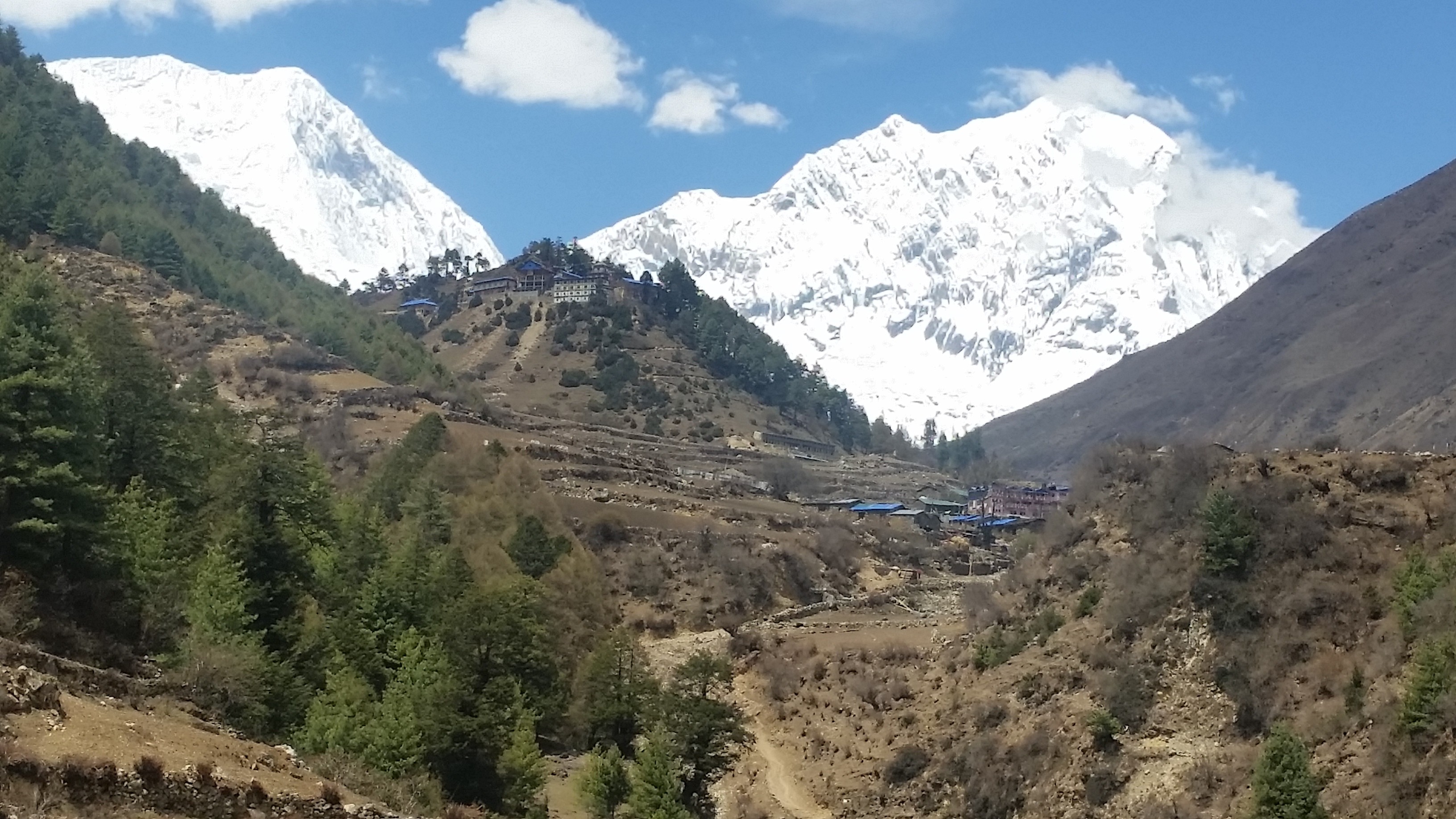
Dumjee Festival

Namche Bazaar holds an annual Buddhist festival called dumjee, which has been a major attraction for tourists in recent days.

It is celebrated also in other Sherpa villages but specifically that of Namche is quite special due to presence of a variety of people.

Dumjee Festival

The first few days are spent sharing visits with the neighboring homes and enjoying delicious typical Sherpa food items.

During the final few days, the entire people of the village gather at the Namche Monastery to mark the celebration of highly respected Sherpa monks’ achievements.

The ceremony, which involves breathtaking lama dances and rounds of traditional Sherpa dance called Shyabru, is led by the incarnate lama of Tengboche Monastery.

Stone and Mud Houses

Even to this day, cemented houses are very rare in Namche Bazaar. Due to the easy availability, people still use stone and mud to build houses.

It is neither a wonder because the transportation of bricks and cement is next to impossible. There is no path even for biking, let alone driving four-wheelers.

However, the stone houses are even more beautiful. Some of the old shelters might look precarious, commercial hotels and lodges are strongly built.

The interior of the hotels are designed with wooden frames. You will, hereby, have a wonderful experience of staying in a countryside hotel.


45 Things to Know Before You Hike to Everest Base Camp

You are suggested to go through the following list of what you should know before going to Everest base camp as a trekker. They are listed in no specific order.

Everest location


Known as the roof of the world for being the tallest mountain on the Earth, Mt. Everest (8848m. / 29029ft.) is in Solukhumbu district of North-Eastern Nepal. It marks the international border between Tibet and Nepal.

Mount Everest is the most outstanding part of Mahalangur range of great Himalayas. After trekking for approximately a week, you will reach the base camp of this mountain.

Best season for Everest base camp trekking

There are two preferable seasons for Everest base camp trekking: Spring and autumn. The spring season starts from mid-February and ends towards the end of May. The period between March and May is the hottest time of year when temperatures might go up to 30°C. 

The autumn season starts from mid-September and lasts until the end of November. It comes with features of dryness, clear blue sky and a mild breeze.

Board a flight to Tenzing-Hillary airport

Tenzing-Hillary airport in Lukla has largely eased the access to Mt. Everest base camp. It takes just 35 minutes’ flight from the Tribhuvan International Airport in Kathmandu to reach Lukla.

Tenzing Hillary Airport of Everest Base Camp

The flight takes you through a sea of cloud and penetrating through it you can view mountainous ranges all around. If you choose to board a flight to Lukla, your trek starts the same day. Otherwise, you have to catch a bus to either Jiri or Salleri and spend some extra days of hiking before reaching Lukla.

Nature of accommodation

Since it is a tourism-flourishing business zone, almost all houses you see in upper Khumbu region are lodges. If you are going to the Mt. Everest base camp or Gokyo, lodging can be the preferable accommodation.

Now, you do not have to worry about finding a lodge for comfortable accommodation in this part of the world. Almost all hotels are quality providers, but even among them, you can choose the standard based on your budget, for there is  a range of options.

However, you need not worry about the basic facilities in any hotel.

Regarding food, you will be provided a menu from where you will get to choose Nepali, Continental, and some Chinese items. The most special thing about those hotels and lodges is that they serve locally produced vegetables and food. Hence, they are healthy and hygienic to eat.

Everest base camp trekking cost coverage

There is no fixed price for hiking up to the Mt. Everest base camp. It differs from company to company. By and large, the cost is determined by nature of accommodation, seasons, your special requirements, etc. At a normal range, you will be charged from US$ 1000 to US$3000 for an average 12 days – 17 days’ trek.  The cost is normally exclusive of a hot shower, battery charging, telephone, internet, beverage and personal shopping.

Trekking route to Mt. Everest base camp

The most often used itinerary for Mt. Everest base camp trek is of 8 days. Sometimes, some trekking companies might offer their clients a quite different trekking route from the traditional one.

Route for Everest Base Camp


The traditional route is: Kathmandu – Lukla – Phakding – Namche  -Tengboche – Dingboche – Lobuche – Gorakshep – Everest base camp. Nonetheless, you are always welcome to review and make changes to the route.

Hire a trekking guide

First of all, the law of Nepal has legalized the necessity of a trekking guide for any foreign trekker in the Himalayas. If you hire a guide, he will manage all the necessary preparations for the trek.

He will give you so much of information about the place and people. Many obstacles might occur during the trek. If you fall sick before the end of your journey, the guide will be of huge help.

Hence, you have to consider hiring a guide who is very much familiar with the route and your destination.

Both group and solo hiking are possible

A trekking agency can deploy staffs for any size of guests’ team. It is all up to the tourists’ choice. If you love traveling alone, you can simply hire a guide and make a move with him.

Trekking itinerary might be more flexible if you love solo trekking. If you feel insecure alone, you are suggested to come with a group. Another advantage of group trekking is that the bigger the group size, the lesser the price.

Necessary trekking gears

Trekking gear list depends upon the season of your travel. The basic gears include lightweight hiking boots, waterproof boots, a pair of sandals, hiking socks, windproof jackets, sunglasses, gloves, quick-dry underwear, day pack, sleeping bag, headlamp, trekking poles, etc.

Required documents and permits

For Everest base camp trek, TIMS (Trekkers Information Management System) card and Sagarmatha National Park entry permit are requirements. If you are on a guided trek, your guide will help you in obtaining the permit and TIMS card. Moreover, you can also obtain them on your own from Nepal Tourism Board or the Sagarmatha National Park entrance. You have to pay US$ 20 for TIMS card whereas Sagarmatha National Park entry fee is US$ 35. For both purposes, you have to bring at least five passport size photos altogether and two copies of your passport.

Is altitude sickness a huge problem up until Base Camp?

There is no age, gender or physical discrimination when it comes to suffering from high altitude sickness. There are, of course, cases where we can see guides carrying their clients on their back to lower region overnight.

Definition of High Altitude

Due to the increased awareness, however, high altitude sickness has been less severe in recent years even in the Mt. Everest region.

Symptoms of high altitude sickness

The symptoms of high altitude sickness include a headache, fatigue, loss of appetite, difficulty in sleeping, vomiting, increase in pulse rate, dizziness, etc.

High altitude sickness can be prevented

What everyone has to understand is that proper acclimatization is the best fight against this disease. It has been customary to spend at least two nights in Namche Bazaar for acclimatization.

Since you frequently go across villages, you should rather comfortably ascend from 300 to 500 meters per day. It is advisable to consult a physician to determine whether you can survive the harsh weather.

You should not go on any medication without a doctor’s prescription.

Everest base camp can become dangerous

Everest base camp trekking nowhere involves dangerous trail. Nevertheless, the nature of mountains is unpredictable. The thing we have to fear most is the weather.

During the rainy season, the path becomes slippery and muddy, and leach might attack you at the same time. Likewise, during the winter, the temperature goes below -30 degree Celsius.

Hence, you are frequently suggested to hire guides who will play remarkable roles in maintaining your safety and comfort.

You need to hire porters


It is customary to hire a porter to carry your bag to your destination when you are heading to the Everest base camp. It is not that you cannot carry your luggage on your own, but the fact is the higher you go, the more burdensome it becomes for you.

If you hire porters, they will carry your whole luggage to your desired destination, and you can carry just a daypack containing your private stuff. Adopting this strategy will pay you off with a comfortable trek.

You can have access to the internet

Most hotels today have wireless fidelity connections. So, you can use wi-fi paying a certain amount. Cyber communications are also being operated everywhere on the way to Mt. Everest.

Before leaving for the trek, you can also buy a Sim card in Kathmandu. Whenever there is a network, you can buy data packs and use the internet for your convenience.

You should carry Nepali currency

It is necessary for you to carry Nepali rupees during the trek. Upon landing in Kathmandu from your respective country, you can exchange currency almost everywhere, including the airport.

It is necessary for personal shopping, tipping, etc. If you do not have a guide, it is better for you to exchange an amount of money which will suffice the whole trek.

Casualties on the way to Everest base camp

So far, there is no officially recorded death during a trek to Everest base camp. Every year, we hear the news of death at Everest, but it is during expeditions that some people, unfortunately, breathe their last.

If you have health issues, you should have constant communication with your guide so that he will take necessary measures.

The truth is life is meant for death. So, if somebody dies en route to Everest base camp, the trek cannot always be the reason for the casualty.

Train yourself for Everest base camp trek

It is not mandatory to have prior experience of trekking. The trek to Everest base camp does not demand any technical skill hence you do not need to have any previous technical climbing experience or even any altitude experience to complete the trek.

Nevertheless, you should be aware of your health. A comfortable trek requires you to be physically fit and to have excellent strength.

To maintain the required fitness, you can personally train yourself by hiking to higher altitudes, running, cycling, etc. for some weeks before coming to Nepal.

You should be mentally prepared

You need to be mentally prepared for life in the mountains depending on your level of comfort with the outdoors.During your trek, aside from joy, you might as well miss whatever you have left behind.

Though Nepalese are very friendly people, you might face difficulties due to cultural differences. Misunderstandings also might occur, and sometimes they might not be able to fulfill your expectations. Hence, you may need to prepare yourself for what is to come.

Poaching in the Sagarmatha National Park is against the law

Poaching is strictly prohibited inside the Sagarmatha National Park. You can observe many species of flora and fauna, but you are allowed to harm none.

Sagarmatha National Park

You should consider being under strict inspection from community police check posts. In case of poaching, the culprit will be condemned to serve long-term jail.

You need insurance

It is essential to have proper insurance while coming to Nepal for trekking to the high Himalayas. Everest base camp trek itinerary involves going as high as to Kalapatthar (5,643 meters).

In spite of having physical fitness and strong health, you might be subject to high altitude sickness. In case of emergency health issues, air evacuation might be necessary. Hence, you are highly suggested to have far-sightedness.

You cannot see the top of Mt. Everest from the base camp

Though your final destination is Everest base camp, you cannot see the top of Mt. Everest from its base. Hence, you are requested to visit Kalapatthar for a close view of Mt. Everest peak.

Best Everest base camp trek agency

No categorization of trekking agencies regarding their quality service has been made so far. Comfort level of trekking mostly depends upon the mutual understanding between the trekking agency and its clients.

The agency’s staffs aim is to make their clients’ journey comfortable, safe and joyous. In spite of the given fact, you are highly suggested to choose an agency with long trekking history.

You should go to Kalapatthar for a sunset view of Mt. Everest peak

Kalapatthar, in Nepali, literally means black stone. After an hour’s hill ascent from Gorakshep, you will reach a place where you will see a massive rock which is black.

Mount Everest from Kala Patthar

The top of this rock rises to an elevation of 5,643 meters, from where you can have a spectacular view of the Mt. Everest. When the weather is clear, the view of Mt. Everest during the sunset gives you a sublime feeling.

The setting sun paints yellowish gray color on what is known as the roof of the world.

Don’t take many showers

The first thing is you will hardly take a bath during the trek, thanks to the coldness. It is almost impossible to even for the local people to take a cold shower. Most lodges offer the facility of the hot shower, but for that, you need to pay a supplementary charge of up to 5 US dollars.

You cannot wash all kinds of clothes

During the acclimatization period, you can wash lightweight t-shirts, socks, underwear, etc. which will be dry within some hours. Washing heavy clothes will only create an additional burden.

You have to be convinced that in spite of being dirty, your clothes will not stink. Wearing them will not cause you any harm, washing them might result in difficult consequences instead.

Use wet wipes instead of cold water

There are water taps and streams throughout the route. However, we recommend you not to wash your hands and face with cold water very often. Instead, a wet wipe is a perfect alternative.

Since everything is cold, you should try to avoid touching cold water so that you will not have to suffer. Using wet wipes has been the most customary practice for any trekker going to the Everest base camp.

You can buy trekking kits in Nepal

Some tourists bother themselves by bringing all necessary gears from their country while some much familiar tourists prefer buying them in Nepal. Thamel area in Kathmandu can be the best place to buy trekking kits.

Trekking Kits

Before doing your shopping, you should consult your hiking company for the required kit list because different seasons require you to have different kits. The North Face Shop, Mountain Hardware Shop, etc. on Tridevi road in Thamel and Redfox, Sherpa, Black Yak, etc. in Durbarmarg area are some of the best places to buy trekking gears.

You can buy them even in places like Namche and Lukla, but the price will be more costly.

Sherpas own the hotels and lodges

Anywhere you reach in Khumbu region; you will mostly see Sherpa people. Since they are born in the Himalayas and grown up there, the Sherpas open hotels and start their career in mountaineering and trekking. Hence, almost all hotels and lodges, on the way to Everest base camp, are owned by Sherpa.

Bring tools of entertainment

While hiking up to Mt. Everest base camp, there are some days when you have to walk only for 2 to 3 hours. There are unquestionably wonderful scenes to view or go to, but sometimes you might love to stay inside the hotel and enjoy there without bothering your feet.

Many tourists can be seen reading, especially when they have to wait for their order. Moreover, if you are in a group, you can play card games, ludo, etc. Hence, you are advised to come with the necessary tools of entertainment.

Electricity is available

Throughout the Everest base camp trek trail, hotels and lodges have electricity. You can charge your electronic devices for a certain amount. It is not an issue to worry about, for the charge is not costly.

You are suggested to bring additional batteries and chargers for your comfort. You do not need to pay for the light, though.

What happens if I go to Mt. Everest base camp during monsoon?

If you love the extreme level of adventure and if you have the endurance, you can go trekking to Mt. Everest base camp during the monsoon. But for most trekkers, it is the least preferable season.

Trek to EBC on Mansoon

During monsoon, you will experience frequent downpours. Since the path is mostly off-road, there will be puddles, and the path will be muddy. The path will be slippery, and there are chances of landslide too. Also, leaches can cling to and bite you anytime without your awareness.

The greatest problem you might face is though you have an umbrella, you will get drenched, and your clothes will be dirty with mud.

Have vegetarian diet

Once you leave Lukla for your journey ahead, you should consider rather having a vegetarian diet. The Sherpas do not murder animals up in the Himalayas.

Hence, if you are offered meat understand that it is imported from lower valleys. Since meat is not refrigerated and because it takes considerably long time for transportation, it might not remain fresh.

In contrast, most vegetables are locally produced, and they are not at all poisoned.

Limit your walking pace

You are advised to walk at a leisurely pace. Since it is not a marathon and nobody is going to judge your speed, you should focus more on your health.

Trying to move faster and reaching the destination earlier than the scheduled day might cause you serious health problems. You need proper acclimatization before reaching Mt. Everest base camp.

You will see changes in your skin

There is a vast difference between the climate of Kathmandu and that of Everest base camp. Leaving Kathmandu suddenly and going to Mt. Everest base camp will certainly have consequences. Due to extreme coldness, you might lose a layer of your skin, and the skin color will be blackened.

Most tourists use sun-cream to avoid direct exposure to coldness and the sun. Fortunately, when you descend to the lower region, your skin will start gaining normalcy.

Be careful from yaks

You will see a lot of yaks commuting to and fro caring loads on their back. Although there is no record of yak attack so far, you should still be careful from them.

Yaks on the way to EBC

It is because you never know when they turn violent. There are several suspension bridges over rivers and streams. They are wide and strong enough to occupy two-way transportation. Despite that, you should be patient and let the yaks cross the bridge first.

Carry first aid kit

Before setting out for your journey make sure that you have carried the first aid kit. Prevention is better than cure, but you cannot prevent some accidents or diseases.

Normally the trekking agency provides their clients with the first aid kit in case of necessity. But still, you have to ask them whether they have carried before your journey begins.

The first aid kit for Everest base camp trek consists of Diamox, handy plus, bandage, etc.

The higher, the more expensive

The higher you go, the more expensive everything becomes. Due to difficulties in the transportation of goods, the upper Khumbu region is more expensive.

Porters, yaks, and mules are employed for supplying goods from the lower valleys. Some of the stuffs are delivered from Kathmandu by helicopter. Hence, it is no wonder that the further you go, the more costly the trek becomes.

You will not spend the night at Everest base camp

There is no human settlement at the Everest base camp. Only the expedition teams set up their tents for extensive training. Therefore, you will be staying at the nearest village, Gorakshep which is the last village of Everest base camp trekking trail.

The most useful toiletries

You have to carry tools like sun cream, lip balm, toilet roll, wet wipes and biodegradable soaps in your daypack because you might need them any time of the day.

Keep your batteries in your sleeping bag overnight

In order not to let your batteries lose their charge put them inside the sleeping bag overnight. Exposure to extreme coldness might cause them to go dysfunctional. Hence, you better be conscious.

You need to carry a water purifier

You should drink a lot of water throughout the trekking duration so that you will have low chances of suffering from altitude sickness and other diseases.


Drinking water from streams and taps is normally healthy in the high Himalayas. In spite of that, you should carry water purifying tablets, for some water sources can be contaminated. In case of boiled water, purification is not necessary.

Do not hang any cloth outside during the night

If you have dried your clothes in the sun, you must collect them by the evening. In case you leave them outside at night, they will be wet with dew and freeze which takes hours on end to dry. It will additionally ruin your clothes.

The trek begins and ends in Kathmandu

Kathmandu is the transition between your home country and Mt. Everest base camp. Since Tribhuvan International Airport in Kathmandu is the only international airport in Nepal, you are bound to land in Kathmandu before the trek, and upon the end of your trek, you must go to Kathmandu again.

Tribhuvan International Airport, Kathmandu

In addition to being the capital city of Nepal, it is a melting pot where people from all over Nepal stay. In Kathmandu valley, you will have a couple of days for sightseeing around the world heritage sites and places of great religious and cultural importance.

Places to visit in Nepal: 26 places you must visit

Nepal is the most beautiful country that has many scenic landscapes with copiousness of both natural and cultural heritage. There are a lot of beautiful places to visit in Nepal. Nepal, the official name of the Federal Democratic Republic of Nepal, is a landlocked country in South Asia.

Nepal is right between two countries bordering China in the north and India in the west, east and south. Nepal is a piece of heaven on Earth.

It is a small country and a home to many Himalayan ranges, various animals, and plants, rich, for the rivers and water which is divided into three regions; Terai region, Hill region, and the mountain region.

Nepal is rich in biodiversity and unique in geography. The highest peak in the world, Mount Everest lies in Nepal. Nepal is one of the best tourism destinations for spending holidays.

The specialty of this country is its multi-ethnic, multi-language, multi-culture. There are many places in Nepal to visit that make your journey memorable and fun.

Kathmandu : Town full of Temples

Kathmandu, the capital city of Nepal, is also known as the Dream City. It is the most crowded city, and most people from outside valley come to fulfill their dream in the Kathmandu.

It is an old city, historically termed as “Nepal Mandala” and has been the home of Newar Culture in the hilly region. It is the center of Nepal’s history, art, culture, and economy and a multi-ethnic population of Hindu and Buddhist religion.

Kathmandu Valley
Kathmandu Valley

In ancient times, Kathmandu valley was a lake before the Goddess Manjushree cut Chovar hill with her sword and drained all the water away.

Kathmandu city is a gate to tourism in Nepal and is famous for its cultural heritage such as The Kathmandu Durbar Square, The Royal Palaces, Hanuman Dhoka, Asan, Kritipur, the Buddhist stupas of Swayambhu and Boudhanath.

The earliest is the Licchavi dynasty of Durbar Square. It had 50 temples and distributed in two quadrangles of Durbar Square.

The outer Quadrangles has Kasthamandap temple, Kumari Ghar and Shiva-Parvati Temple; the inner quadrangles have the Hanuman Dhoka Palace. The royal family lived till 1886, and later they moved to The Royal Palace (Narayanhiti Palace).

Patan: Years old Cultural Heritage 

Patan is located in the southern part of the valley, 5 km drive from the Kathmandu bus park. It is the oldest city also known as Lalitpur and by its Newari name, Yala. It is a city of Newari people and is also rich for cultural heritage, arts, and crafts; Patan Durbar Square, Ashoka stupa, Patan Museum, Statues, Godavari Botanical Garden, Patan zoo and many others.

Patan Durbar Square
Patan Durbar Square

The places are buzzing all the time with the locals and the tourist. The Patan Durbar Square served as the residence of the Malla rulers of the Patan states. It is divided into different chowks.

The Museum is in Keshab Narayan Chowk. Opposite to Patan Durbar Square, there is the stone temple of ‘Lord Krishna’ (Krishna Mandir) with its 21 spires and bas-relief art depicting scenes from the Mahabharat epics.
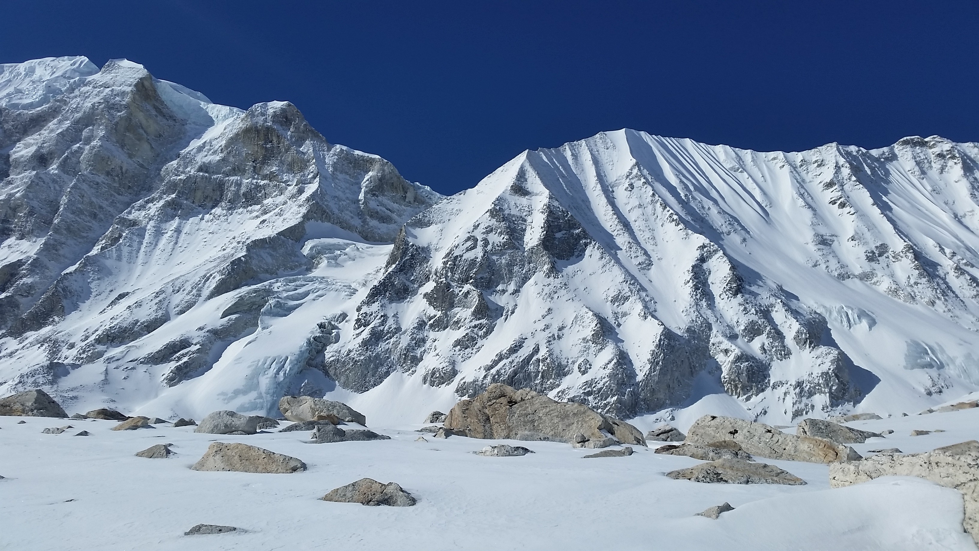
Also, the Ashoka Stupa lies in the east of the Patan. Patan is famous for the Rato Machchhindranath festival which is celebrated for a long time for almost one month.

Bhaktapur: Newari Culture

Bhaktapur, the smaller city of the valley located in the east corner, is approximately 13 km away from the Kathmandu. It is a city of devotees, Newar people and full of religious place. Bhaktapur was named as ‘Bhadgon’ or ‘Khwopa’ in the ancient time.

Bhaktapur Durbar Square

It preserved the historical monuments, palaces, courtyards, temple, a hand-crafted peacock that reflect the Hinduism. Bhaktapur is also famous for the marvelous crafts including pottery, weaver, thanka, and masks.

Bhaktapur Durbar Square (‘Layaku’ in Newari Language) is the royal palace of the old Bhaktapur Kingdom.

The area is full of historical monuments such as the fifty-five Windows which is a masterpiece of wood carvings, Golden Gate, The Big Bell, Pashupatinath Temple, Kedarnath Temple, Statue of Bhupatindra Malla, Siddi Laxmi Temple and Vatshala Temple is a stone temple.

The next place is Taumadi, famous for the Nyatapola Temple. One of the oldest temples with a five-story pagoda style temple of the Goddess Siddhi Laxmi built by King Bhupatindra Malla.

The temple didn’t get destroyed during the earthquake in 1990 and 2015.

Dattatraya Temple is built in the pagoda style in three-level of Lord Shiva built by the Yaksha Malla. Also, there is a Pottery Square where people make the various designs of pots out of clay.

Another is the Siddha Pokhari (Ta Pukhu: Newar language) where the next day of the Indra Jatra devotees worship the Goddess Indrayani in the west of the pond.

The city is famous for the special curd called “Ju Ju Dhau.” JuJu means King and Dhau means curd. Whoever visits Bhaktapur they never forget to taste the curd prepared by the local people.

It is known as the city of festivals such as Bisket Jatra, Gai Jatra (Saparu), Pulu Kisi (Indra Jatra), Yomari Purnima and many more.

Pokhara: A gift of Nature to Humanity

Pokhara is one of the places with most beautiful scenery and natural lakes. It needs 5-6 hours drive from Kathmandu to Pokhara where you can explore the natural beauty. Pokhara includes various lakes and temples, such as Phewa Lake, Begnas Lake, Rupa Lake, Gude Lake, Neutani Lake and Maidi Lake, Barahi temple, Bindbyabasini Temple and many others.

Few Lake in Pokhara
Few Lake in Pokhara

The beautiful closer view of the Dhaulagiri, Annapurna, Manaslu, and Machhapuchre Mountain can be seen from the Pokhara. The Mahendra Cave, Bat Cave, and Gupteshwor are the known cave.

Sarankot is famous for the paragliding over the Phewa lake and land at the bottom of the city.

David’s Fall is an awesome and deepest waterfall located in the south-west of Pokhara. Close to the lakeside, there are many lodges and restaurants are available, and along with it, you can enjoy the stunning view from there.

Rara Lake: Peace and Beauty at a place

Rara lake is the biggest and deepest lake of Nepal located in Jumla and Mugu districts which lie at an altitude of 2990 meters and covers an area of 10.8 square kilometers.

Rara Lake
Rara Lake

Rara lake is the main feature of the Rara National Park. Rara lake has much unique flora and fauna importance of rare and vulnerable species. The lake is a popular destination with a rough route in Western Nepal for trekkers.

Lumbini: Buddha’s Birth Place

Lord Buddha, Siddhartha Gautam was born in 623 B.C. Lumbini is a Buddhist pilgrimage site in the Rupandehi District. The temple of Maya Devi is one of the most important sites in the Lumbini Garden where Queen Maya Devi gave birth to the Gautam Buddha.

Lumbini
Lumbini

The Ashoka Pillar is a stone pillar along with the four stupas and a pillar. Monks in saffron-robed clothing can also be seen there.

Gosainkunda: Awesome trek to go for

Gosaikunda lake is one of the most famous religious and pilgrimage sites of Nepal. It is located at an altitude of 4,380 m(14370 ft.), and surrounded by peaks in Langtang National Park in Rasuwa District with a surface of 13.8 ha (34 acres).

Gosaikunda
Gosaikunda

It is also surrounded by the mountain ranges, amazing scenario, and a delightful forest.

Every year in Janai Purnima, August full moon day thousands of pilgrims visit Gosaikunda, take a bath in the lake and worship Lord Shiva. Gosainkunda is one of the best places for trekking destination.

Panch Pokhari: Five lakes, one sight

Panch Pokhari is a group of five holy lakes, located in the Sindhupalchowk district in Nepal.

Panch Pokhari
Panch Pokhari

Panch Pokhari offers pristine mountain views, rich culture, and stunning natural beauty and features different biological diversity. Every year in the Janai Purnima, many Hindus and Buddhist pilgrims visit Panch Pokhari.

Tilocho Lake: Lake sky use to see itself

Tilicho Lake is one of the most popular sites, located in the Manang district of Nepal. Tilicho Lake lies at an altitude of 4,919 meters in the Annapurna range of the Himalayas.

Tilicho Lake
Tilicho Lake

The trekking route combines Annapurna circuit trekking.Tilicho Lake is surrounded by mountains of Tilicho, Nilgiri, Khangsar and the Muktinath Peak that make the lake more delightful.

Everest Base Camp: Once is not Enough

Everest Base camp is the first and famous trekking destination on the entire earth. It is Situated in beautiful Khumbu region, Solukhumbu district of Nepal.

Everest Base camp

The Everest Base Camp is the most popular breathtaking, exciting and challenging trekking route to the Himalayas range. You need to take a flight to Lukla and move towards Namche Bazaar.

Namche Bazaar is the gate to Everest where the journey starts to the many mountains. Also, you can explore Sherpa villages and ancient Thami and Tengboche. Kalapathar is the most visited point to have a view of Mount Everest.

Chitwan National Park: Jungle Safari

The Chitwan National Park is the first national park in Nepal and stated as World Heritage Property. It is located in the subtropical southern part of the Terai region, also rich in natural beauty.

A total of 68 species of mammals, 544 species of birds, 56 species of herpetofauna and 126 species of fish have been recorded in the park. The best part of the park is a jungle safari where you can see different animals, and it is especially renowned for its protection of One Horn Rhinoceros, Bengal Tiger, and crocodile.

Janakpur: Where Lord Ram and Sita got married

Janakpur

Janakpur is popular for the pilgrims and the birthplace of King Janak’s daughter Sita. The city is also known as Janakpur Dham, and it is the capital of the Dhanusa district. Nepal Railways, which is the only railway in Nepal, connects Janakpur to Siraha at the Nepal-India border. The local people of Janakpur speak the Maithali language as it is the city of old Maithili culture. Every year, the festival ‘Ram Navami’ celebrates beautifully.

Annapurna Base Camp: Quaint Gurung Village

The Annapurna Base Camp is the second popular trekking journey in the Annapurna area after Everest Base Camp. The trek explores amazing views of the mountains and the rich culture, local communities and the traditional way of life.

Annapurna Base Camp
Annapurna Base Camp

The Annapurna Base Camp route begins from Ghandruk trail to Chomorong, and Deurali to reach Annapurna Base Camp and along this route, you can find splendid views of Dhaulagiri, Himchuli, Mount Fishtail, and Annapurna.

Lukla: Doorway to Majestic Mt. Everest, Divine Scenery 

Lukla is located in the Khumbu area of the Solukhumbu District in the Sagarmatha-Zone of north-east Nepal.

Lukla
Lukla

Although Lukla is well-known for the most dangerous airport in the world, it is also popular for mountaineering, trekking and visiting the amazing scenario of the Himalayas ranges. It is the most visited trekking route to Everest Base Camp, Namche Bazaar, Gokyo valley trek, and the Sherpa cuisine is the specialty of that place.

Nagarkot: A picnic Spot

Nagarkot is the best place to see the spectacular sunrise view and the Himalayas ranges when the weather is clear.

Nagarkot
Nagarkot

Many visitors prefer to visit in the Spring season, and also locals go for the picnic. Nagarkot can be easily accessed by hiking, cycling, bus or other means of transportation.

Bhote Koshi: Rafting or Bungee Jump?

Bungee Jumping is one of the adventurous sports in Bhote Koshi, Nepal.

Bhote Koshi
Bhote Koshi

In Nepal, there are two places where you can go for the Bungee jumping; Bhote Koshi River and Pokhara. The jump takes place at 160 meters above the Bhote Koshi River.

Mustang: Let’s get lost

Mustang is rich in natural beauty, cultural heritage, and a historical place and situated in the Dhaulagiri zone in Nepal. This beautiful land is divided into two parts; the Upper Mustang and the Lower Mustang. The Lower Mustang is full of natural scenery, and Upper Mustang is popular for the adventurous trekking.

Mustang
Mustang

Snowfall mostly occurs in the winter season and visitors enjoy playing with snow during this season. In Mustang, There are different beautiful places such as Jomsom, Kagbeni, Lo Manthang and many others. Muktinath Temple is a holy place for both Hindus and Buddhists.

Within, Hinduism it is called Mukti Kshetra which means the ‘place of liberation or moksha’ and had 108 water taps.

Khapdak National Park: Green everywhere

Khapdak National Park is in Seti Zone and is stretched over four districts of Nepal: Bajhang, Bajura, Accham, and Doti and covers an area of 225 square kilometers.

Khaptad National Park

It has many different species of animals, birds and medicinal herbs and the landscapes consist of steep slopes, streams, and moorland.

Langtang: Monasteries

Langtang is nestled on the northern side of Kathmandu. Langtang National Park is home to the Langtang region.

Langtang
Langtang

Langtang is popular for trekking, extensive views, old monasteries, traditional Tamang villages and beautiful mountain scenery with rhododendron forests that bloom during the spring season. The religious Gosainkunda Lake and Briddim villages lie in the Langtang.

Swayambhunath: Guardian with two eyes

Swayambhunath is the second most holy place after the Boudhanath, located on the top of a hill in Kathmandu, Nepal.

Swayambhunath

The temple is also known as ‘Monkey Temple’ due to a big tribe of roaming monkeys are found there. The temple constructed in the fifth century. Both Hindu and Buddhist people are the pilgrims of the Swayambhu.

Boudhanath: World Heritage

Boudhanath is the biggest stupa in Kathmandu, Nepal. Boudha stupa is also called Khasti (Newari tongue).

Boudhanath Stupa

During Losar in February or March, there is the largest celebration of Buddhist people. There are 50 Gompas around the Boudhanath. Buddha stupa is a UNESCO World Heritage Site. It is most popular tourist site in the Kathmandu.

Ilam: Try tea of Ilam 

Ilam, famous for tea production, is a beautiful hill area located in the eastern part of Nepal.

Ilam

Ilam offers a brisk walk in the tea garden, picnic, sightseeing spots, and a gentle slopes into the nearby woods. Some of the popular places to visit in Ilam are Antu Danda, Mai Pokhari, Sadakpur, Gajur Mukhi and Mai Beni. The time to visit Ilam is from October to December and from April to February.

Pashupatinath Temple: Lord Shiva temple

The Pashupatinath Temple is a famous and sacred Hindu Temple located at the bank of the Bagmati River.

Pashupatinath Temple

Pashupatinath Temple is considered as the most important and holiest temple of Lord Shiva of Nepal. Every year on Maha Shivaratri in March there is a huge crowd of pilgrims. Near the Pashupati temple, there is another temple known as Gujheswori Temple. Many other temples are visited by people from all over Nepal and India.

Dhulikhel: Spectacular view

Dhulikhel is the administrative center of Kavrepalanchwok district, Nepal.

Dhulikhel
Dhulikhel

Dhulikhel is a popular destination to observe the view of mountains peak and hills side after some minutes of some walk, the arch of 1000 steps. At the top of the 1000 steps, there is the small temple of Kali where you can have the spectacular view.

Changunarayan Temple: 4th Century Temple

Changu Narayan, the oldest temple perched on the hill, built in the 4th Century during the Licchavi period is located in the north site of Bhaktapur.

Changunarayan Temple
Changunarayan temple

The temple is decorated with ten incarnations of the Narayan and stone lion guard all around the temple. Garuda, half-man and half-bird knees in front of the temple. The local people are mostly Newar, Gurung, and Tamangs.

Phoksundo Lake: Not to miss Lake

Phoksundo Lake is a fresh alpine water lake, located at an elevation of 3,611.5 meters (11,849 ft.) above the Sea Level in the Dolpa District.

Phoksundo Lake
Phoksundo Lake

The snow-capped mountains surround Phoksundo Lake. There are more than 20 stupas and a gompa in the eastern side of the lake.

Mardi Himal Trek: Weather, Cost, Route

The Mardi Himal is a newly opened route in the Annapurna region and is also known as the hidden treasure trek too. The Mardi Himal Trekking is short and easy with well-managed camping and tea house trek offering a beautiful view of the Annapurna area.
Mardi Himal is the least visited trekking peak, and this trek is the best destination to avoid the crowd.

Mardi Himal Trekking

Though the availability of food and accommodation on the route is minimum, Mardi Himal Trekking is still an enjoyable trekking route that requires minimum effort.
Mardi Himal Trek is about a week-long in the Himalayas with stunning views of snowy peaks through small Nepali Villages. It is an interesting trek compared to other popular treks in the Annapurna region.
Mardi Himal is located to the east of the Annapurna Base Camp. It offers a spectacular view of Annapurna, Dhaulagiri, Machhapuchre (Fishtail) and Manaslu Himalayas ranges.
Also, its natural beauty allows you to view the Nepal national bird-Pheasant, national flowers- Rhododendron, Musk deer, Snow Leopard, Himalayan Thar, and many more wild animals and several plants which are used to make medicine.

Mardi Himal Trekking

Mardi Himal is 4,500 meters above sea level. The Mardi Himal Trekking trail starts from Kathmandu to the beautiful city Pokhara. Traveling from Kathmandu to Pokhara has two options, either a flight which takes only half an hour or a drive for about 6-7 hours drive.
Drive from Pokhara to Phedi (1600 m) drive 30 minutes. Walking along the trail, you will go slowly up and then trek from Pothana to Deurali (2100 m) take 4-5 hours.
Also, you can start your journey to Mardi Himal from Kande after 1 Hour of driving from Pokhara Balung Highway. The first walk is easy, and you will have to walk for about 1 and a half hours to the ridge (2060 m), then slowly walk towards Australian Camp.
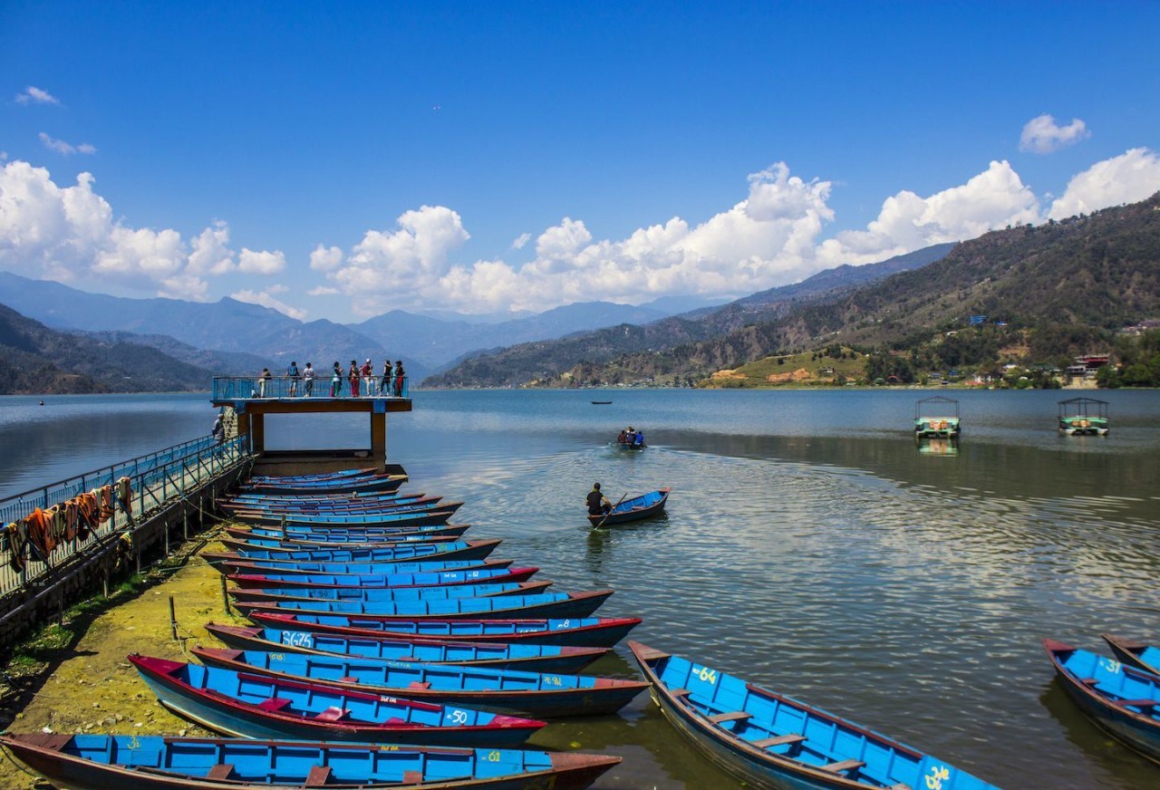
The place is full of amazing views of the Annapurna range and Pokhara valley. Then the trek continues from Australian Camp to Pothana and then again up to Deurali.
From Deurali, the trek continues to Forest Camp (2900 m)-walk for 6-7 hours. Then you will pass through the Rhododendron forest, which makes the whole forest more beautiful with a gradual uphill. There is no tea house along the way, so you must carry lunch and water yourselves.
The trail gradually extends up to the Low Camp almost 3000 meters which takes 5-6 hours. There is a couple of tea houses where trekkers can take a rest and enjoy the scenario of Mt. Fishtail.

View of Machapuchre from low camp
View of Machhapuchhre from low camp

The Low Camp provides you with the best view of Machhapuchhre anywhere in Nepal along with accommodation for the sunrise and sunset views.
The further walk to Badal Danda (Cloud Hill) almost 1 hour above the tree line and trek to high camp from there you will see better view than before.
Now, you need a short walk to High Camp, 6-7 hours continuously, and then you will see the snow-capped peak of Annapurna South, Huinchuli, and Fishtails that are closer to Snowcapped.
After a steep climb and a longer walk, you will finally reach to Mardi Himal Base Camp (4500 m) from where you can view Mardi Himal.
After exploring the Mardi Himal Base Camp, the returning trail is different; you will go through Siding village through the pine and Rhododendron Forest.
Then trek to Ghalel to Lwang to Khoramukh and back to Pokhara. Take a flight or drive heading back from Pokhara to Kathmandu.

Mardi Himal Trek Route

SN Route Time Duration(walk and drive) Highest Altitude
1 Pokhara to Phedi 1-hour drive 1650 m
2 trek to Deurali 4-5 hours 2100 m
3 Duerali to Forest Champ 6-7 hours 2900 m
4 Forest to Low Camp 5-6 hours 3050 m
5 Low Camp to High Camp 6-7 hours 3500 m
6 High Camp to Base Camp  6-7 Hours 4500 m
7 High Camp to Sidhing 5-6 hours 1,700 m
8 Sidhing to Lwang 5-6 hours 1460 m
9 Lwang to Pokhara 1-2 hours, 2.30 hrs drive 827 m

Mardi Himal Trek Cost

The trek cost is USD 20 including a 13% Vat that is paid to an Annapurna Conservation Area Project, and Trekkers Information Management System (TIMS). The individual trekkers must pay USD 20 for TIMS, and the trekkers who travel via Trekking Companies costs USD 10 only (if you are with a group).
For those who can’t afford the expensive tours, the package tours are also available. The package tours depend on the days. Following package tours such as six days, 5-7 days, and 10-12 days can be booked online. The charge of the guide is also included.

Mardi Himal Weather

The best season to go to Mardi Himal is Autumn and Spring for trekking and Mountaineering the weather is clear, and the temperature is moderate from September to November.

Mardi Himal
Mardi Himal

Thus, you can see a clear and beautiful view without any hindrance. March to May which is the season of flowers, plants, and animals walking also can be seen. At the end of the dry season and the best time for trekking.
Summer and Winter are the risky seasons to visit. June to August is the month of heavy rainfall. December to February is the coolest weather, at that time temperature fall to zero degrees or even below.
Mardi Himal Trekking Difficulties
Trekking to Mardi Himal is not that difficult. You don’t need ropes, and ice picks because there is no vertical climbing. But if it rains, it will be difficult to trek as the way becomes quite steep and slippery.
The only difficult section is the last non-stop six hours hike from High Camp to Base Camp because of the steep and rocky path. People of different ages from all around the world can easily experience the glory od trekking and Climb the Mardi Himal.

Things you need

You must know some important things before going for a trek. Firstly, you must take the permits from Annapurna Conservation Area Project (ACAP) and Tourism Information Management System (TIMS) with the help of agents or through the official Nepal Tourism Board offices in Kathmandu and Pokhara.
Then the duration of trekking depends upon you. According to the duration of the trek, you need to arrange your luggage containing warm clothes, Down jacket, Trousers, Long sleeve T-shirt, a pair of hiking boots, Shorts, Socks, Rubber sandals, water bottles, Sunglasses, walking steak, Headlight, Sleeping bag, warm winter hat, etc. And the most important thing is a map.

Restaurant on the way to Mardi Himal

The restaurants and café are available from one stop to another stop with different cuisine, so you don’t have to worry about food. While you are traveling to Mardi Himal, the one thing you should care about is to carry food.

Facts about Mardi Himal

  1. Mardi Himal Base Camp is at 4500 meters and marks the highest point of the Mardi Himal Trek.
  2. The highest sleeping point on Mardi Himal Trek is at High Camp.
  3. Mardi Himal Trek is popular in Annapurna Range where you can see amazing views of Machhapuchre (also known as Fishtail, 6,993 m), Annapurna South (7,010 m), and Mount Hiunchuli (3,441 m).
  4. Mardi Himal Trek route has been popular over the past five years, and Tea house (guest house) has been established there for visitors.

Mardi Himal Map

Mardi Himal map

Affiliations & Recommendations